I’ve been creating interferograms with Sentinel-1 data through SNAP application for the past few months, and now I’m trying to broaden my horizons with ERS 1/2 data. I’ve downloaded images in the SAR_IMS_IP format from ESA’s online dissemination site, but I do not know where to go from here. Can someone provide insight on how to proceed?
as ERS was acquired in stripmap mode, no splitting/debursting/back geocoding ist needed.
The processing is easier:
- Apply Orbit File (for both)
- Coregister
- Interferogram
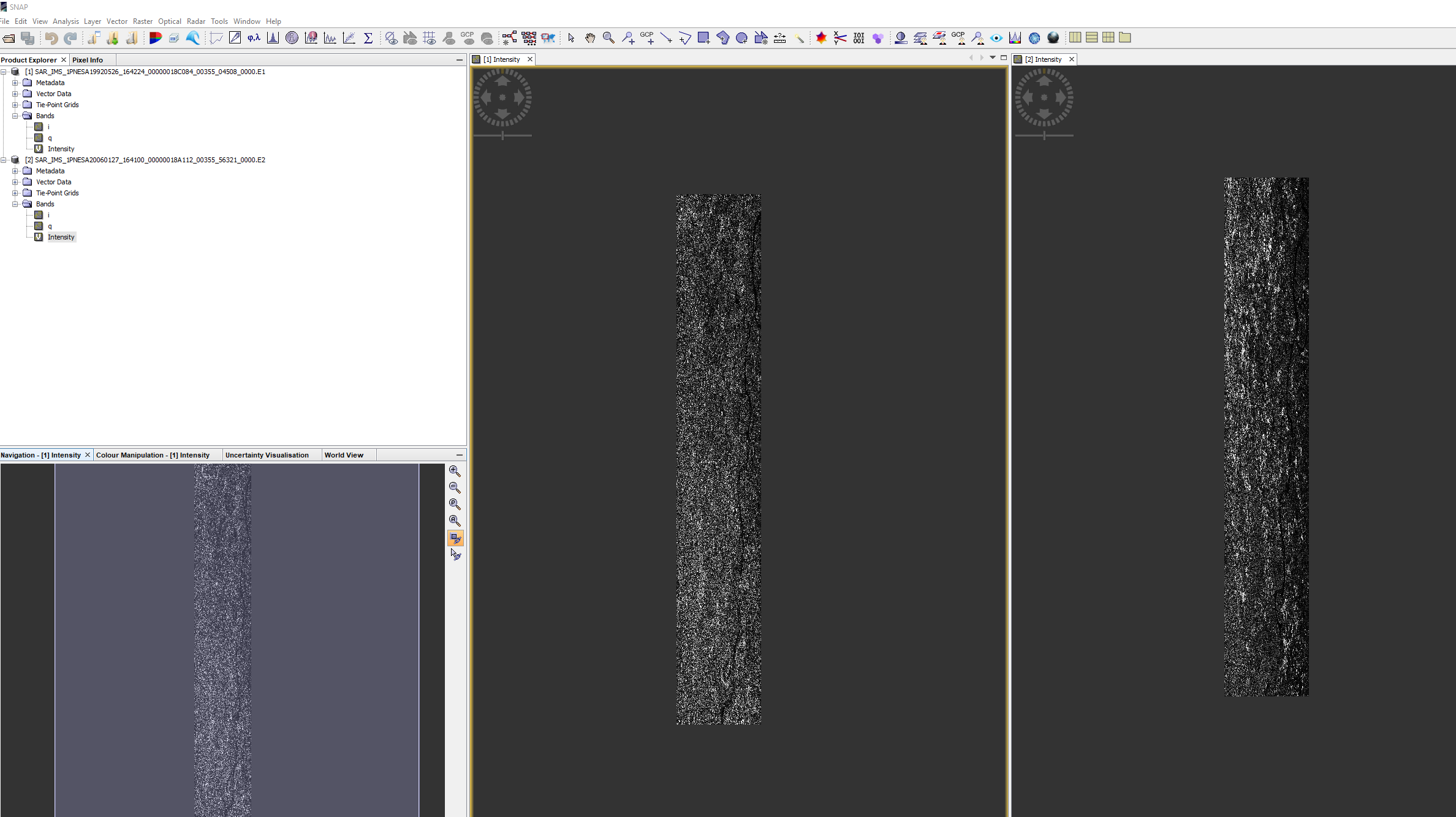
I use ERS data for land subsidence monitoring. after coregistration, I have 9 ground control
points 0.87 root mean square. According to the following document http://step.esa.int/docs/tutorials/S1TBX%20Stripmap%20Interferometry%20with%20ERS%20Tutorial.pdf (page 11), the required tolerance is 130 GCPs. Can you please evaluate my coregistration if it it accurate or not.
The required accuracy for InSAR is 0.01 pixels or better to keep cohrence degradation to a minimum. You have a more difficult case than average since half of the scene is water where valid GCPs cannot be found. You should tweak co-registration parameters accordingly to increase the number of valid GCPs.
ps. you can always try to generate interferogram and coherence - if the co-registration failed the end-result will be noise or mostly noise.
Thank you for your explanation. Please can you explain more what do you mean by “You should tweak co-registration parameters”. which parameters do you think can be changed to get more GCPs.
I was thinking of subset firstly the scene to remove the water covered area but according to the same document referenced (page 10), it is recommended to coregister before subset
![]()
I haven’t used the co-registration operator for a very long time but I see a couple of parameters under " “Cross-Correlation” that should help:
- “Test GCPs are on land” -> set this on
If that fails you can simply increase the “Number of GCPs” (trials) from 2000 to, say, 20000. It will take longer but will increase the number of GCP trials over the whole image and therefore also over land.
BTW you should study the operator help and figure out if you need to “Apply Fine Registration” or not. @ABraun has more current info.
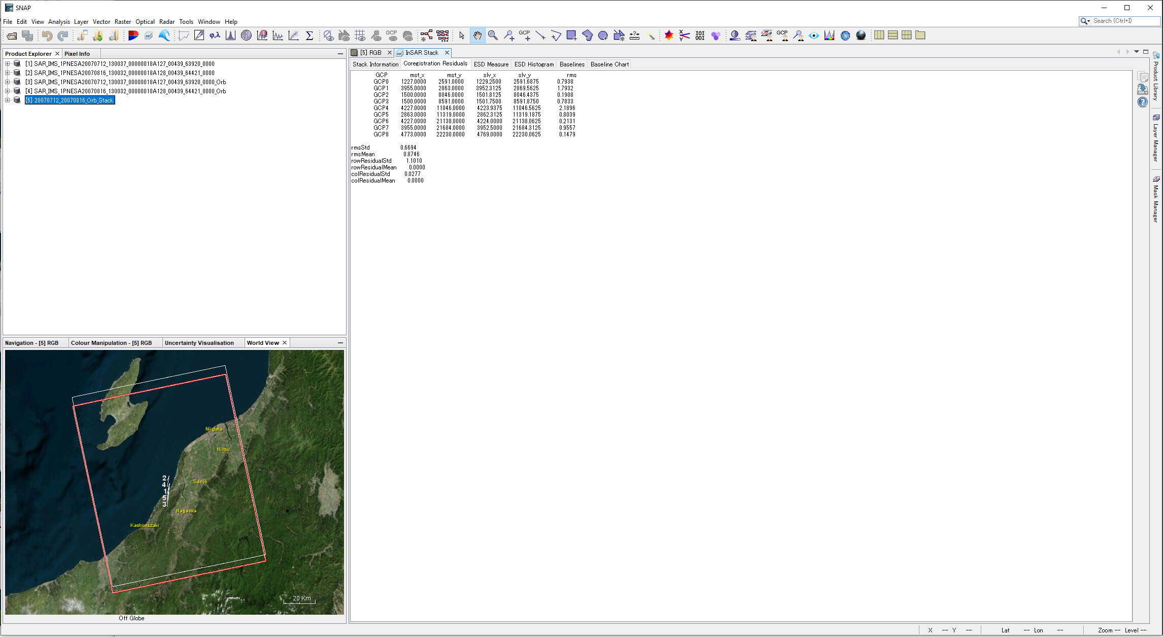
I agree - 9 GCPs could be a random result with a strong distortion of the second product. You can check by creating an RGB image if both images are alinged. If this is the case create the interefrogram and check if it has nois or ramps (indicates bad coregistration), especially over highly coherent areas, such as urban areas or open land (free of vegetation).
to find more usable GCPs you can test the following:
- increase the number of GCPs to 5000 for a test
- check “Test GPCs are on land”
If this does not improve the coregistration, you can additionally check
- Estimate initial coarse offset
If nothing works, you can test the DEM-assisted coregistration based on SRTM 1Sec HGT data.
thank you for you explanation, after following your advice by increasing the number of GCPs to 5000 for a test and check “Test GPCs are on land” and even estimate initial coarse offset, all the value CGPs become and rmsmean become 0. when I tried the second solution using DEM-assisted coregistration, there is no information regarding CGPs at Insar > Coregistration residual module.
How to check the accuracy of the coregistered product from DEM-assisted coregistration?
I even try to subset product before coregistration without increase the number of GCPs to 5000 for a test and check “Test GPCs are on land, the maximum CGPs was 89.
When I use the subset product and proceed to coregistration with increase the number of GCPs to 5000 for a test and check “Test GPCs, GCP and rms become 0.
Please do you have other hint
You can play around with the options, for example increasing the GCP candidates to 10000 or more. The ultimate test of successful coregistration is coherence -> play around and generate interferograms and coherence images to check what is going on.
thank you very much for your kind support. I think I finally good result that make sense. I initially subset the product to get small area of interest. In the AOI, I avoid as much as possible water area and vegetation and after coregistration (without increase the number of GCPs to 5000 for a test and check “Test GPCs are on land), I got GCPs 156. My final displacement also is in the range of my expectation.
Thank you very much. Thank also to @ABraun. I use his document as support for my study
very good - well done!
You are welcome. After proceeding to DInSAR of many pairs of image to find out the displacement in the LOS, I have two questions:
how to determine the average displacement combining many InSAR pair ?
how to find out the evolution of the displacement with the time in a specific area?
An example is given at the end of this tutorial: Sentinel-1 TOPS interferometry
Please check the last part of these slides (free registration required): Subsidence monitoring (NEST) – EO College
well. thank you very much
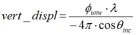
I want to calculate the vertical displacement from the unwrapped phase using the following formula
therefore when I consult the metadata of my ERS data to find out the incidence angle. there is no value.
Shall I consider 23 deg or is there any another method to find out the incidence angle?
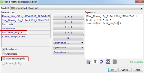
the best cohice is to apply this equation in the band maths using the tie-point grid of incidence angle
thank you, I got it