dear community,
I’m very new to GIS/RS and doing it for my own purpose, I’ve discovered several tools as well as SNAP but I’m very confused about several things, hope you could give me some help:
-
the most of the tutorial I’ve seen uses OpenHUB to download tiles and granules and the load in SNAP to process. I thought that SNAP could be used to dowload and process tiles without using an external website, am I wrong? In case I’m right, why they still use external websites to download products?
-
I need to do a TimeLapse: I guess I should download each image and then create an image sequence in my video editing software. The problem is that with SNAP I’m not able to download anything (obvisously I’ve created my Sci-Hub account, logged in etc…).
Thank you so much and sorry for my probably banal questions,
Best
You should mention the products you want to use. For many applications, engagement with the data producers is important to understand operational issues and sensor status. Optical sensors, for example, degrade over time and may require adjustments to calibration coefficients. Tracking sensor performance is a big part of the human work required to produce quantitative time-series – once you understand the data, producing a time-series product can be automated using batch processing. Quality control generally requires inspecting the data to guard against download errors and flag any unusual “events” that require investigation.
In general, remote sensing workflows are built around a primary product of interest but also require “ancillary data” such as digital elevation “models” (DEM’s), spacecraft location and orientation, or atmospheric properties (moisture, gases, dust, etc.). Many workflows use primary data that has been downloaded from an archive site using the tools on that site to specify a region-of-interest and time-period, but will automatically download ancillary data. Perhaps this explains your confusion.
Many of the data archive sites provide tools to download images useful for quality control. Some scientists have published papers based on analysis of unusual features detected in these images.
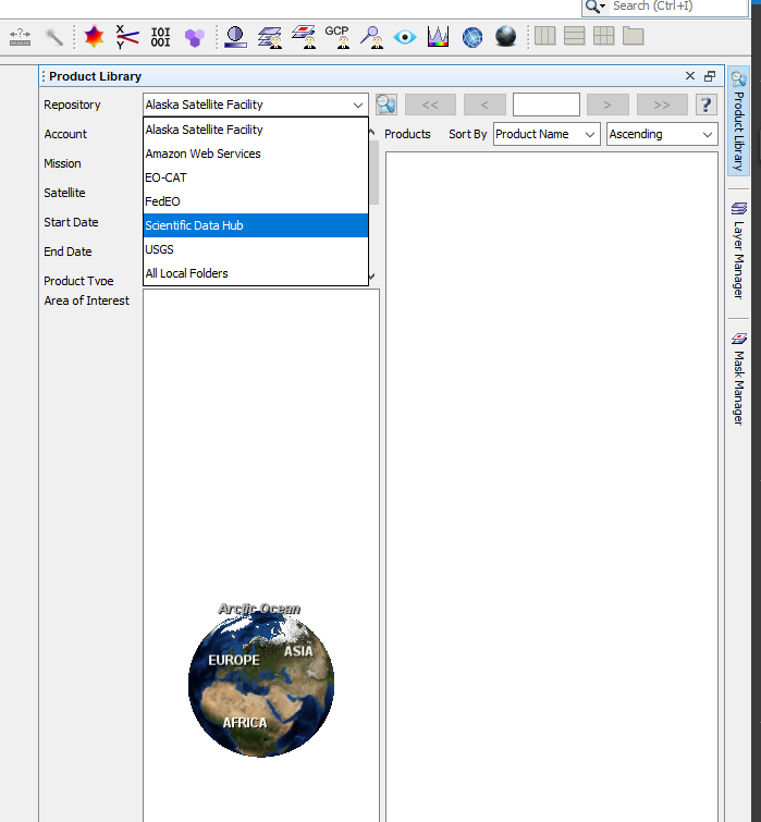
For downloading data, you can use the Product Library in SNAP.
Several data sources are supported.
You need to provide the credentials for e.g., SciHub and then you can search for data and download it.
Automatic download while processing is not yet possible.
For creating images in batch mode, you can use pconvert from the command line.
Thank you so much @gnwiii,
your reply is very specific and deep, I need to study a bit to properly understand everything you mentioned.
At the moment my only aim is just to download batch raster images and raster images obtained by combining spectral features.
@marpet this is exactly what I’m doing but my downloads are stuck or pending unfortunately.
What I’m also really missing is the difference between SNAP, GIS or ArcGIS for example, or they just do the same thing in different ways?
Best
SNAP, QGIS, ENVI and ArcGIS do more or less the same.
But the focus is different.
SNAP is focussing on the raster data and the certain pixel values and processing the data. Creating maps is not in the focus of SNAP but possible.
Why the downloads get stuck I have no idea. Maybe a problem with the service.
Any error message shown in SNAP?
You could try using the API provided by SciHub.
There are several ways explained: Open Access Hub (copernicus.eu)
Also, sentinelsat might be an option: Python API — Sentinelsat 1.1.1 documentation
Thanks so much for all the replies, very helpful links and resources!