Hi,
As part of terrain correction we have been using the option but it appears to be aligning on the pixel centre, not the coverage. This is inconsistent with the Sentinel-2 products where the coverage aligns with the pixel edges and the pixel geolocation is reported (as per the pixel is area convention) as half a pixel width and height from the coverage edge.
For example, this subset of a 60m resampled Sentinel 2 tile has the GeoTIFF coverage with a 411600m easting ![]() whilst the corner pixel (centre) is correctly located at 411630m
whilst the corner pixel (centre) is correctly located at 411630m 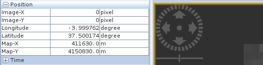
Conversely a Sentinel-1 terrain corrected/geocoded product, subset to -1.0 degrees longitude to 0.0 degrees longitude has GeoTIFF coverage metadata half a (1x10⁻⁴ degree) pixel of set west (and north) ![]() . Again, the pixel centre geolocation is half a pixel off
. Again, the pixel centre geolocation is half a pixel off
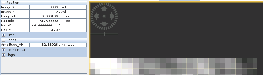
In other words, the is applied to the pixel centre when is should be applied to align the pixel edges to the grid, as per the Sentinel 2 products and as requested in the coverage subset parameters (-1.0 to 0.0 degrees longitude not -1.00005 to -0.00005 degrees longitude delivered).