These were the steps I undertook to geocode it.
- Extract the S1 zip file
- Set the folder as working environment
- Select Sentinel-1 unzipped in the Import menu
- Extract the data (I used 4x4 multi-looking to save time for testing)
- Convert S2 to C2
- Run the Geocoding of the C2 matrix
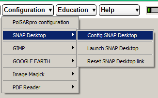
It is important that the connection between PolSARpro and SNAP is correctly configured.
Please see the instructions here: Help installing PolSARpro software step by step on detailed on the windows 7 system