Hi everybody,
I want to georeference canopy height model of TanDEM-X data in ASF map software but it does not read TanDEM-X format. I did georeference in snap software but it has a shift when i compare with canopy height model of laser.
What do you mean by georeference the heigt model?
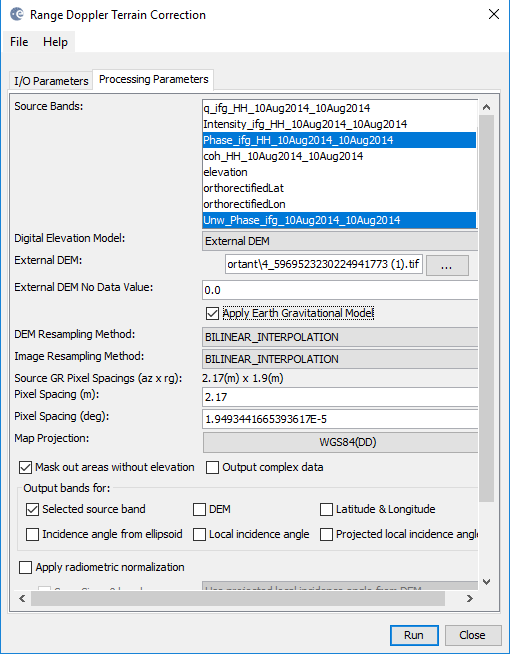
TanDEM-X is based on EGM96 ellipsoid while SRTM or other elevation data is based on the WGS84 ellipsoid. This often has an altitude difference of dozens of meters:

you can select TanDEM-X in here as “External DEM” but you have to check “Apply Earth Gravitational Model” (EGM96)
what kind of shift? Vertical, horizontal… How large?
Please be a bit more explicit.
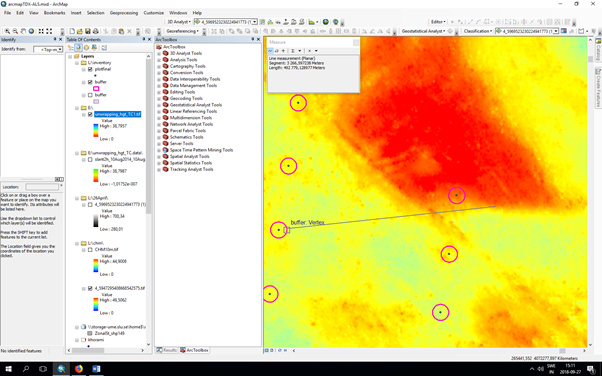
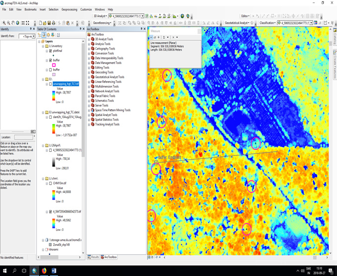
horizontal shift, about 17 meters
if you use your laser DEM you might not use “Apply Earth Gravitational Model”, depends on its reference.
Is the shift also there with SRTM or TanDEM-X?
I have used TanDEM-X data, not SRTM. I Georefrenced canopy height model of TanDEM-X data using laser DTM but I saw horizontal shift in canopy height model of TanDEM-X.
you mean the geolocation of the data is not correct?
Now I understand. Did you try georeferencing with “Apply Earth Gravitational Model” and without and compare?
yes, I tried both of them but it did not effect on georeferenced. I wanted to do with ASF map software but it does not support TanDEM-X format. this shift is horizontal shift?
Why isn’t it possible in ASF MapReady?
just several format is supported with ASF map. TanDEM-X and ALOS-2 are not read with its. I do not know exactly what is problem?
you are right, sorry. You can use TanDEM-X as a DEM to terrain correct other SAR data but it is not possible to import it as the data to be processed.
What is the main input data format of your TDX data? A bistatic SLC data product or an already processed DSM?
I still have trouble undestanding what you mean with “canopy height model”.
using interferometric technic, I extracted canopy height model, (DSM-DTM : CHM) DSM using TanDEM-X and DTM using laser data with format ( COSSC).
and it worked to retrieve surface heights of vegetation with TanDEM-X data? Not bad.
Try SRTM 1ArcSecond for terrain correction instead. This should be sufficient for a correct geolocation and we could exclude that the laser data causes the problem.