This is my first attempt at this analysis, I followed the SNAP tutorial and have produced a file that I would now like to use in ArcGIS.
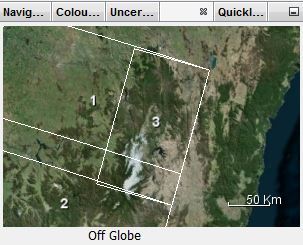
However the exported coordinates appear to be wrong.
In the toolbox I have this:
In arc the image shows as being out over the sea to the east of Australia. (I am only allowed to post one image)
Where can I find the correct coordinates? I would appreciate any help.
Hi, try to process the whole bursts and export it later, to export some bursted gives this error, I don’t know why, please take a look at this, while trying to create KMZ
Did you use Sentinel-1 TOPS or Stripmap data?
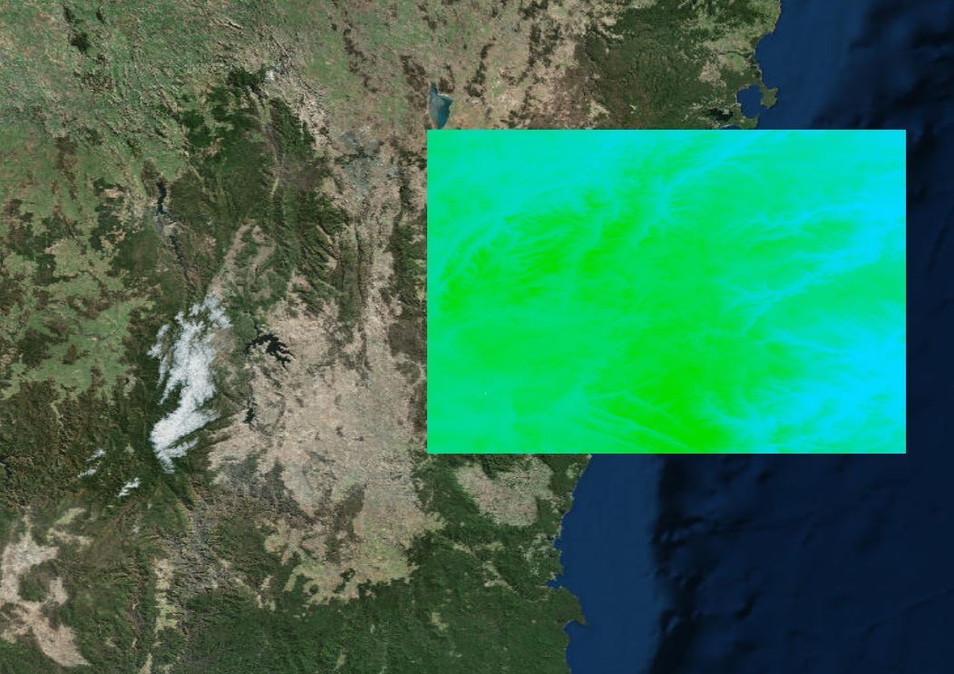
Did you apply RangeDoppler Terrain correction? Because the TOPS tutorial leaves out this step. Before your data is usable in GIS you need to project it using a DEM and a coordinate reference system. Radar > Geometric > Terrain Correction > Range Doppler Terrain Correction.
Exports to GeoTiff in SAR geometry may not have accurate georeferencing. As ABraun has said, apply terrain correction before exporting to GeoTiff for use in GIS.
Hi @falahfakhri I want to export the interference stack obtained after snap processing to a more common image format, in other words to export the previous step of exporting to StaMPS format, so that I can read it programmatically and use it for other processing, how do I go about doing that?