Georeferencing by means of polynomial adjustements

Hi everyone,
For teaching purposes, I would like to georeference an image to another image by means of polynomial adjustment using control points. I can’t find this option in SNAP. I have reviewed the forum (there are many posts!), But I also cannot find a similar query.
I would appreciate some help.
Thank you

Hi,

you can set Ground Control Points (GCP) and based on those points you can create polynomial based GeoCoding.
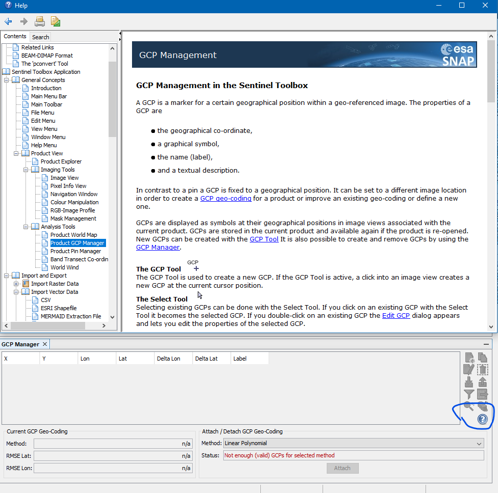
Open the GCP Management window (View -> Tool Windows -> GCP Manager).
There you can click on the white question mark with the blue background and you will get the help page.

Dear Marpet,
Thank you for your fast answer.
I’ve finally got it.
I have used an image without georeferencing and taking the coordinates of another source I have managed to generate the georeferencing.
However, I have doubts.
I don’t know where to see the residuals of the adjustment but point by point.

Thank you