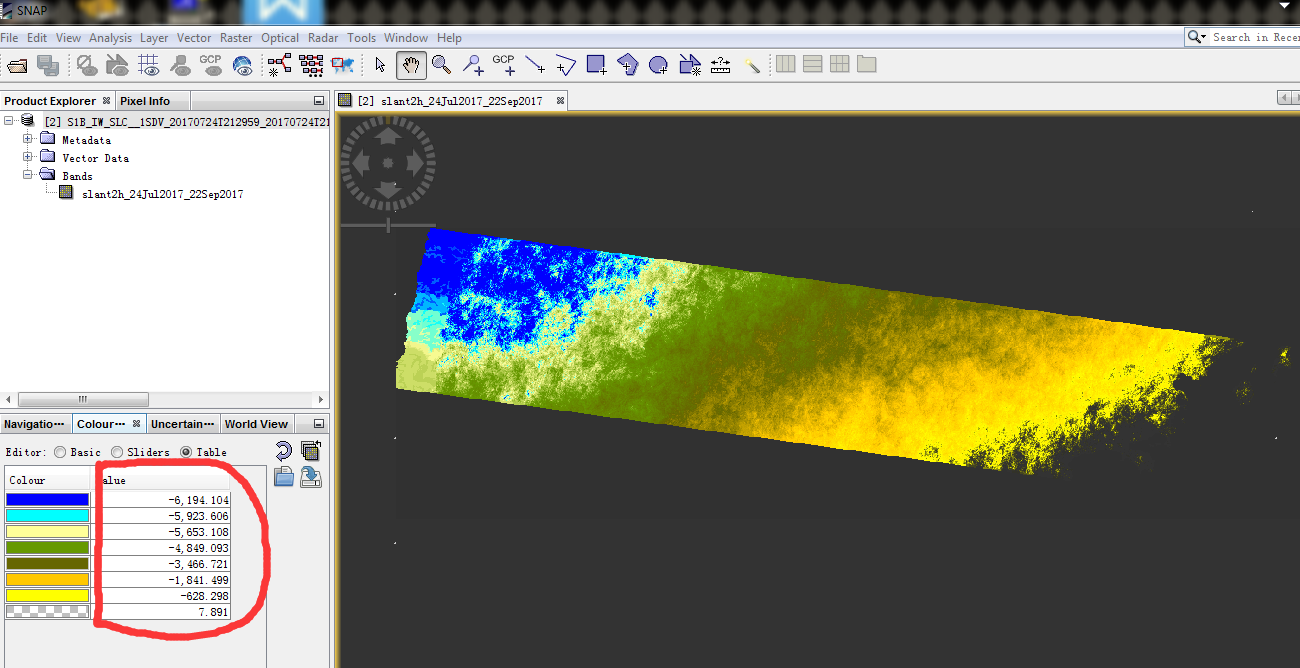
. My values of height are generally below to zero. Where are mistakes about my process? How can I get the result as DSM, digital surface model?
1/ S-1 Level-1 SLC products: Split and Apply_Orbit_File.
2/ Create stack using Backgeocoding.
3/ Apply Interferogram formation.
4/ Deburst the result.
5/ Apply TopoPhaseRemoval.
6/ Snaphu Export.
7/ Conduct snaphu to get unwrapped phase.
8/ Snaphu Input with the result of 5 and result of 7
9/ Apply topographic correction.
10/ Apply phase to height.
phase to height converts the unwrapped phase to metric units but without vertical reference. If you use phase to elevation a DEM is used to put these values into a reasonable range.
It is also always worth to check for coherence to see where the phase information is usable.
Thanks for your kind reply. But how can I get DSM rather than DEM? If I get GPCs (elevation + tree height),can I transfer metric units without vertical reference from resluts of ‘phase to height’ to the real height of the surface?
You are using Sentinel-1 which operates at C-band. The wavelengths will stop at the canopies of most trees, but that depends on your area of study. But in highly vegetated areas your InSAR information will not be very precise anyways, because of rapid temporal decorrelation and the comparably low resolution of Sentinel-1.
Where is your image located?
Thanks a lot. My study area is the highly vegetated are. Dose “The wavelengths will stop at the canopies of most trees” mean that results from ‘phase to elevation’ is the real height (elevation plus tree height)?
yes, but it is highly unreliable due to decorrelation. Plus, the large pixels will probably contain mixtures of both ground and canopy backscatter. Vegetation height from SAR is probably one of the hardest tasks of radar analyses.
Because you are using repeat-pass interferometry (data acquired on two different days) with the Sentinel-1 data, you will also have errors in the DSM due to variations in the atmosphere between the two dates. This is in addition to the decorrelation or loss of coherence. I agree with @ABraun that getting vegetation height from Sentinel-1 interferometry is difficult and full of errors.
I want to get DSM rather than vegetation height. My study area is the highyly vegetated area, can I use one SLC product (only one Sentinel-1B SLC image acquired each day of my study area ) get the correct DSM?
I want to get DSM rather than vegetation height. My study area is the highyly vegetated area, can I use one SLC product (only one Sentinel-1B SLC image acquired each day of my study area ) get the correct DSM?
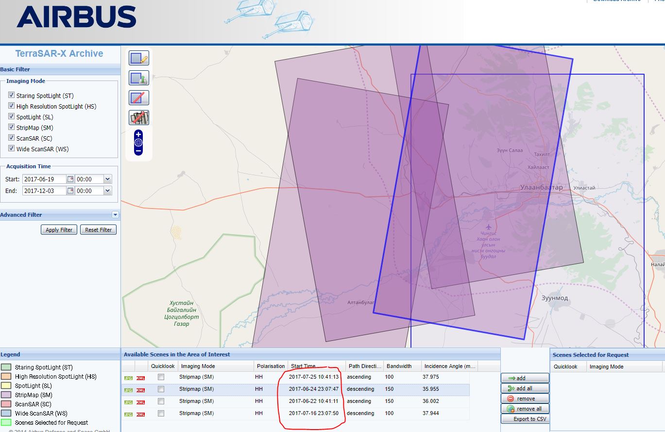
Sorry, there is no way to do interferometry with one SLC product. You need two SAR images. You should look at the possibility of getting data from the DLR TerraSAR-X and TanDEM-X bistatic pairs. They operate the two satellites close together so they can acquire two SAR images at the same time. When you have two SLC images acquired at the same time, there is no change in the atmosphere, and there is no loss of coherence. In addition, they use the X-band radar wavelength that is more likely to measure the tops of the trees than C-band. This is the best way to get a Digital Surface Model.
You can make a DSM from the Sentinel-1 repeat-pass interferometry as you had started to do earlier, but it will have errors due to the atmospheric changes. One way to reduce those errors would be to make a number of DSMs from different Sentinel-1 pairs and average them.
TerraSAR-X / TanDEM-X is a commercial mission. If you work at a university you can apply for a quota here: https://tandemx-science.dlr.de/ but this requires a detailed project proposal and the confirmation of external funding.
Which session (spring, autumn) is suitable for DEM generation from Sentinel-1 data?
I found some information from NASA insar data processing training. There, radar data is sensitive for dry and weather condition, vegetation cover so on…