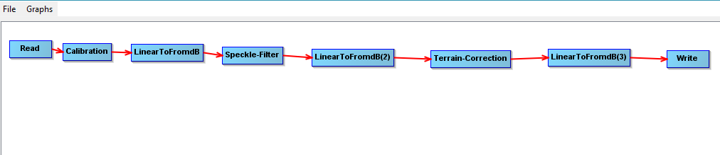
Is this preprocessing graph a correct one? I am extracting the water spread area of a reservoir from standard sentinel images.
1 Like
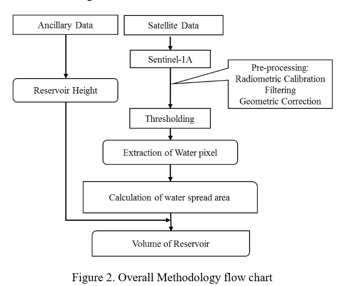
I think the following processing flowchart could be good start for water spread area
The following work also could be good assistance for water body destinations,
A Method for Automatic and Rapid Mapping of Water Surfaces from Sentinel-1 Imagery
1 Like