Greetings to all.
I have been working with a couple of GRDH 1SDV images
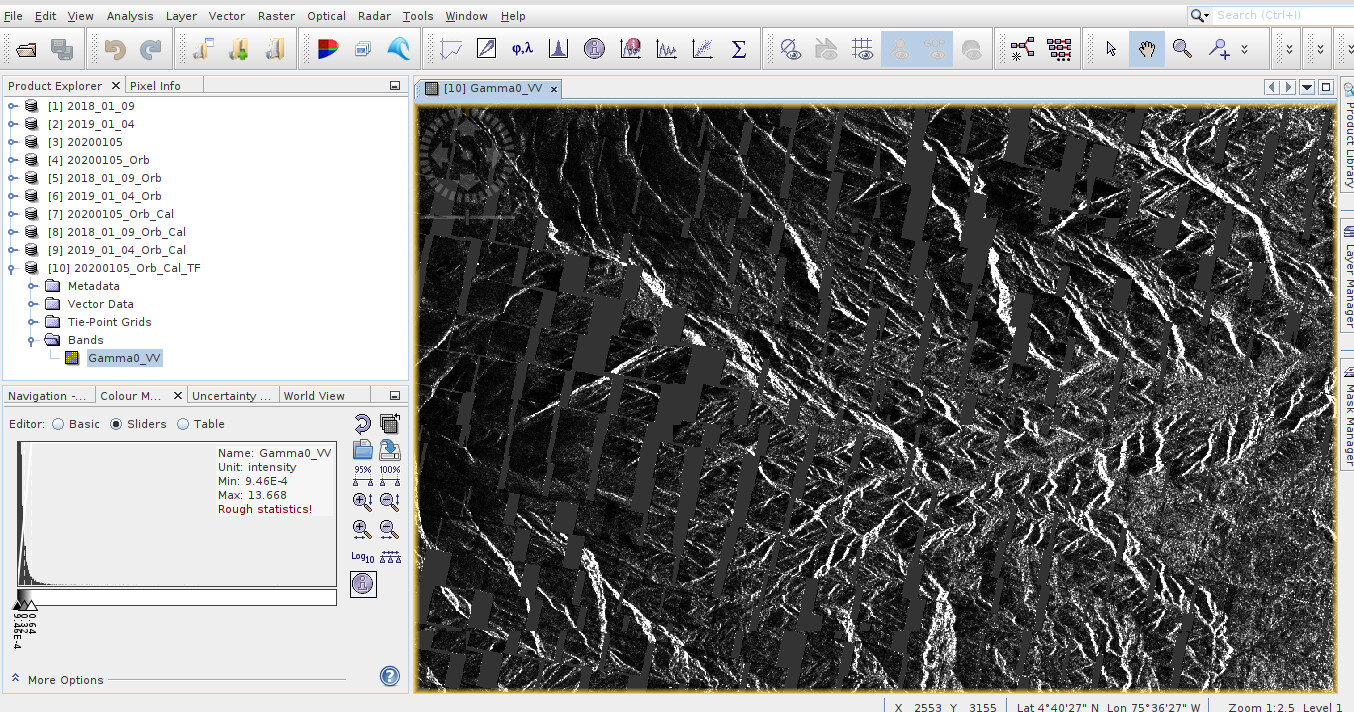
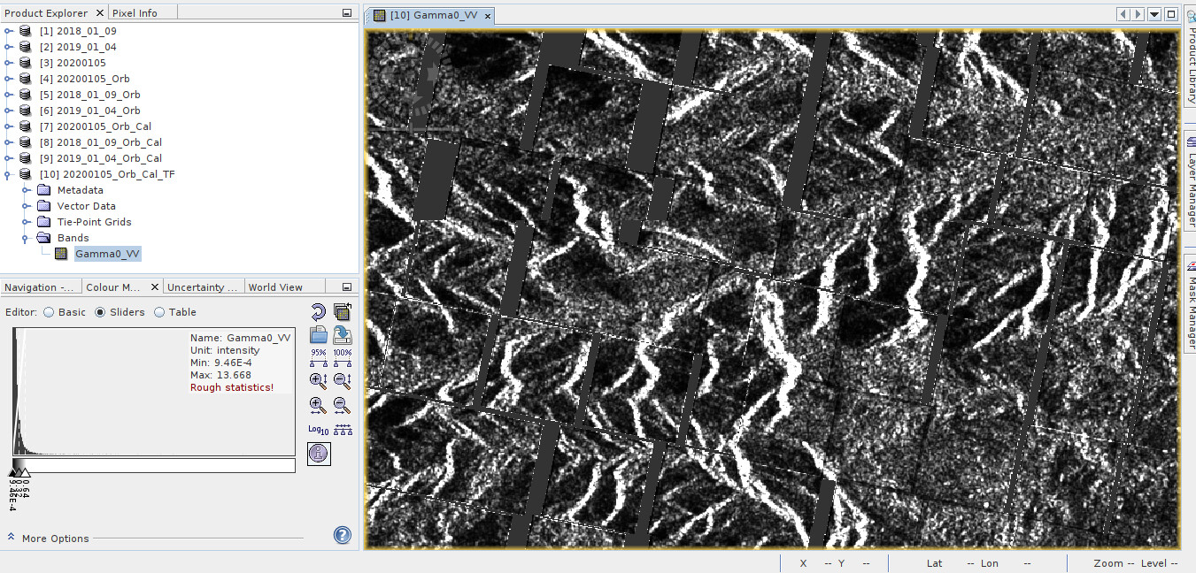
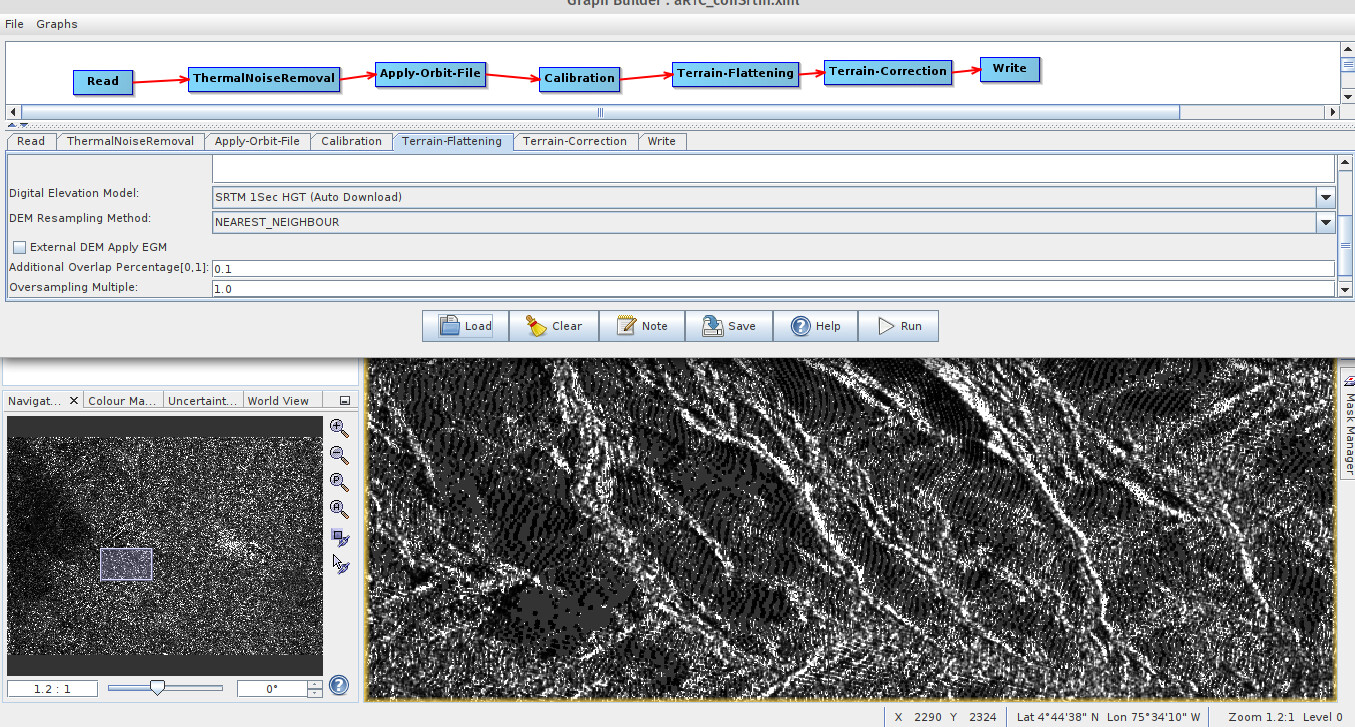
After applying orbit, thermal noise and border noise removal, calibrate (beta), and radiometric terrain flattening and geometric terrain correction. These squares appeared, all over the image and areas with nodata. I have repeated the process and they always start to appear after performing the calibration, either in sigma or beta.
Snap version 8.0.2
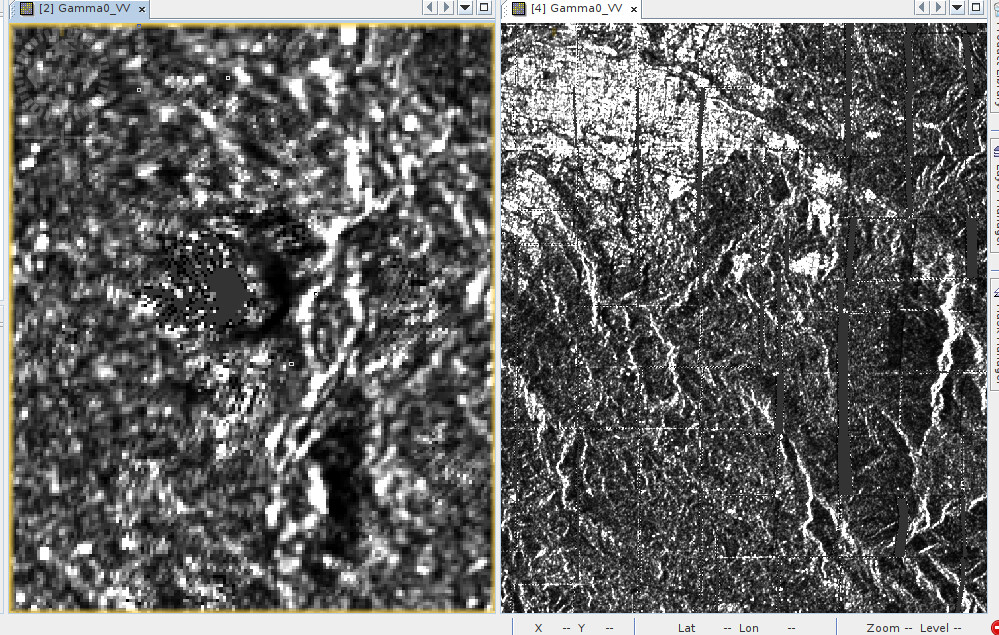
I tried it several times with different DEMs, first with SRTM 1Sec HGT, and SRTM 3sec, also with GETASSE. Whereas with the primers there are gray areas and some “rings” like fingerprints (left image), with Getasse the image appears with large discontinuous squares and larger gray areas (right image)