Hello,
I am relativity new to working with SAR data, especially InSAR, so bear with me. I am trying to create coherence maps to detect changes associated with open-pit mining over a large area. I am using two images 12 days apart.
I think my maps are doing a reasonable job of showing some areas of change (Below is an example). However, it is very hard to identify amongst all the noisy low-coherence areas where there is vegetation and pasture. I understand this is due to volumetric scattering in vegetated areas and maybe differences in moisture between images?
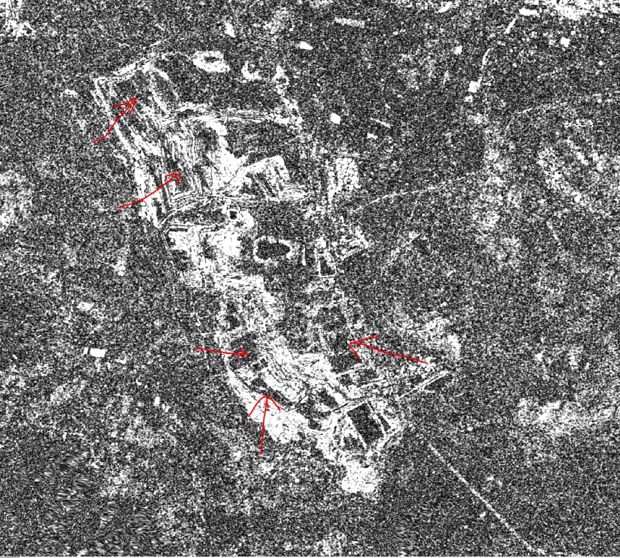
What I am looking for is a way to make the changes in mining areas more obvious and reduce the noise from vegetation.
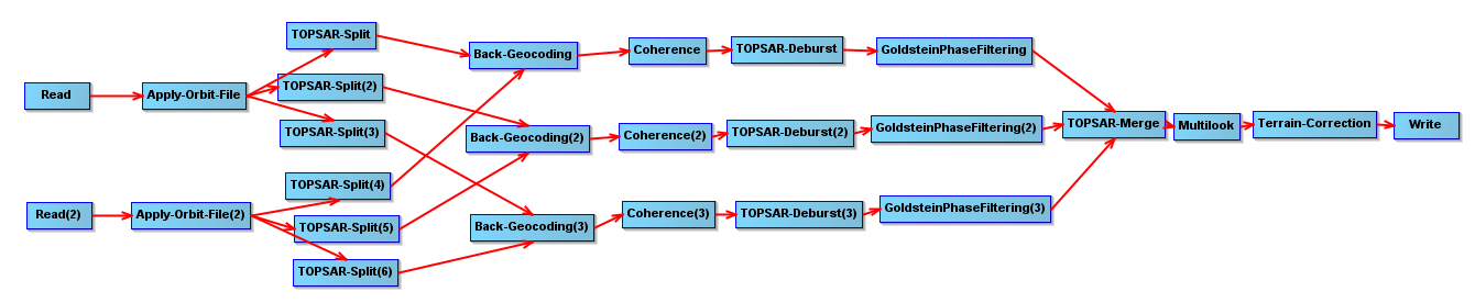
I am mostly using default settings, except in the coherence tool I have checked “Subtract flat-earth phase” and “Subtract topographic phase”
Below is screen shot of my process
Any pointers on parameters I could play with, further processing would be greatly appreciated