What is the meaning with ´´high coherence ´´ and ´´ low coherence´´? How ´´high coherence ´´ and ´´ low coherence´´ can be connected to interferogram and fringes?
If we have ´´high coherence ´´, it means we have more deformation and displacement (unstable area) between two IW data?
If we have ´´poor coherence ´´, it means we have less deformation and displacement (stable area) between two IW data?
Cheers,
Marjan
Hello,
I need some explanation regarding this concept of InSAR coherence too. @falahfakhri The provided link contains only the abstracts of the papers.
Could you please provide give us more explanation about this subject or provide the full text of the paper “Quantitative and Qualitative Analysis of Coherence in Multi-temporal SAR Inferometry”.
Thank you very much.
hi ,
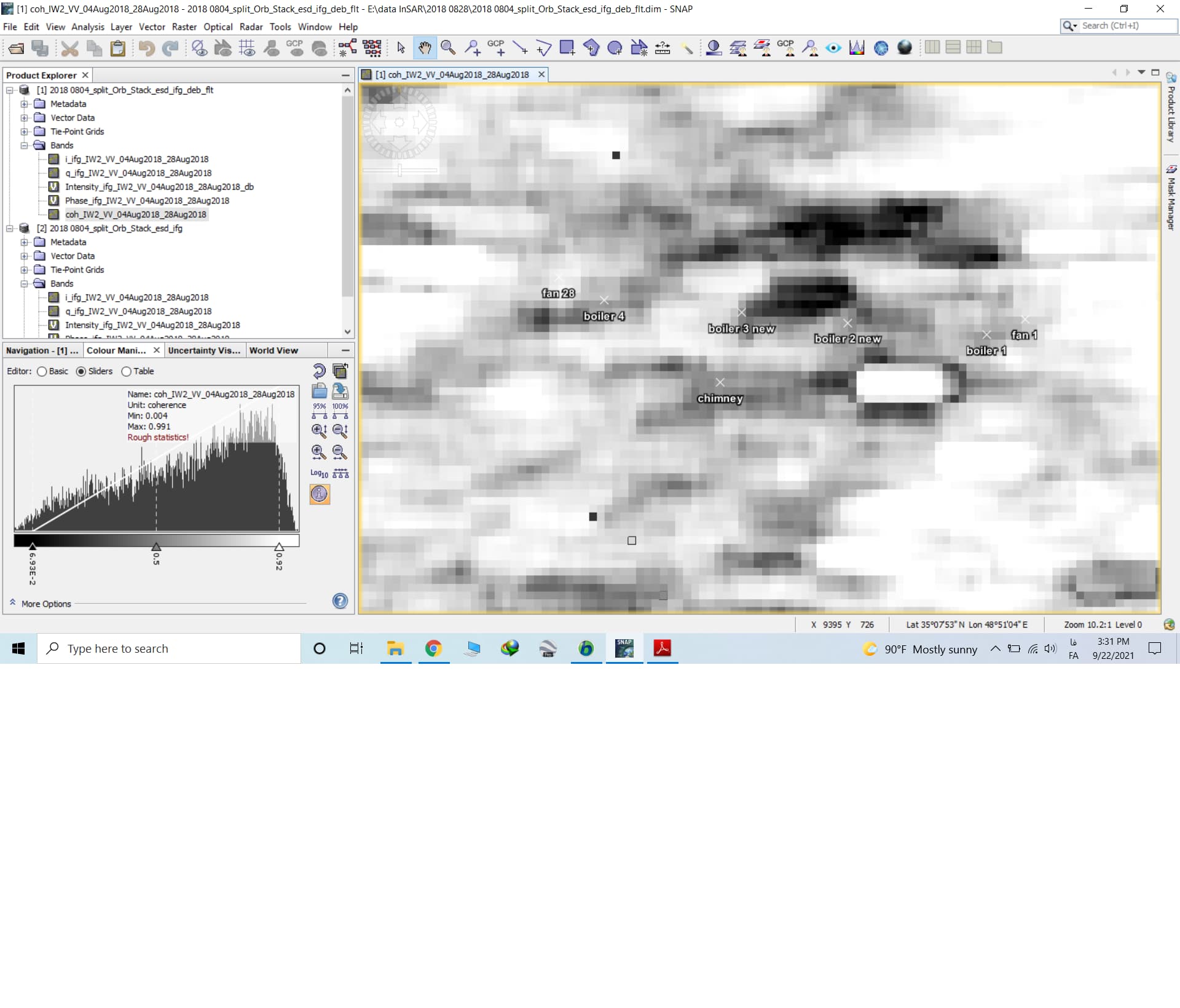
What is the approximate amount of good coherence suitable for extracting the amount of subsidence? In other words, can the height difference values obtained from pixels with coherence, for examp
le 0.4, be trusted? Do you have a reference in this regard? Thank you
I don’t think there is an universally valid threshold for coherence. You can judge by looking at the interferogram: Does it look alright in the area you are interested in?
Also the pattern of coherence: A patch of low coherence (e.g. from a small lake) does little harm your analysis, but if these become dominant in the image, you will struggle to unwrap it correctly.
In fact, I want to extract the amount of subsidence of a large building.
And only a few pixels are important to me, and the areas around the building are not important.
What should be the coherence of the pixels under these conditions?
Traditional DInSAR was made for the detection of displacement of areas, such as volcanoes, urban areas, mining areas… The detection of few pixels cannot reliably be measured, because of how their neighbourhood impacts their phase value during the displacement. If you search literature on building subsidence from radar you will most likely end up with persistent scatterer interferometry approaches.
They are based on time-series of the phase signal and can be applied to objects.
Here are some points on how to start: StaMPS - Detailed instructions - #50 by kraezir