I decompose the UAVSAR into intensity and phase images, but they are all slant, are there methods that I can get the geocoded phase image?
I would like to use the phase image to training model with deep learning method. The ground truth (label )data are all ortho. So if I want to match them I have to geocode the phase image. But I failed after trying many methods.
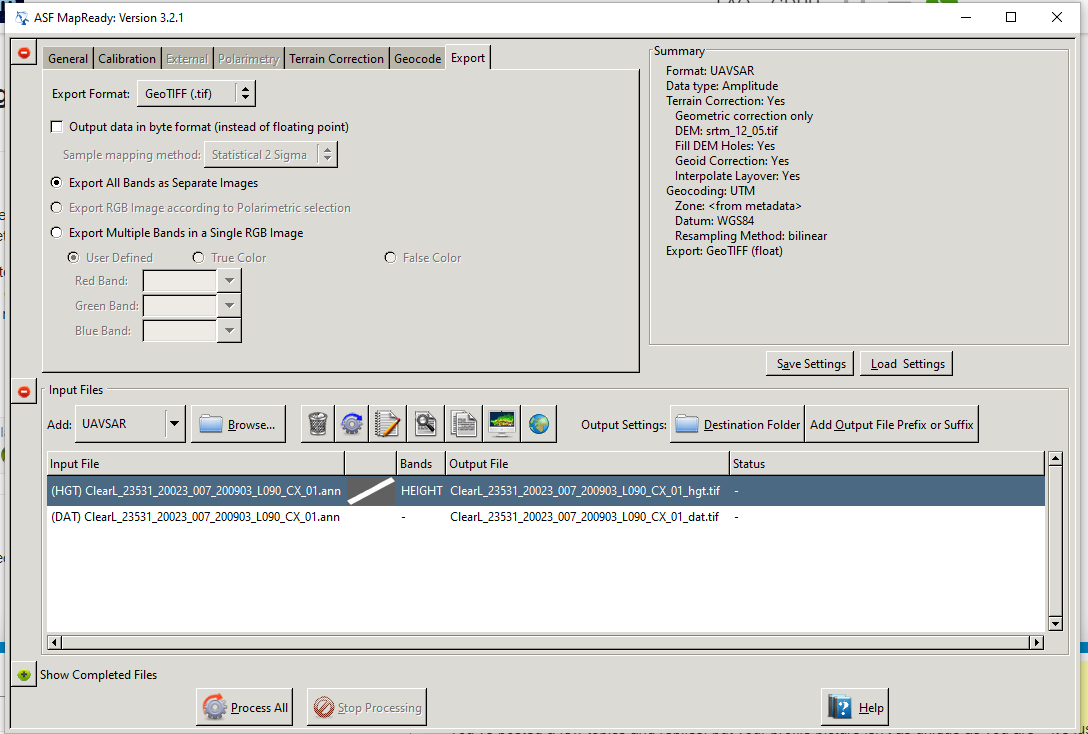
Thank you ABraun! I have tried the method. Btu I failed without notice what the problem is. I have got the .ann,.dat and srtm data. Is there any other operation I should do first?
The phase is not always noise-like. Some part of the phase contains information. There are some researches on this topic. It can improve the accuracy of classification.
Hi @shen, the UAVSAR .grd files are ground-range geocoded and terrain-corrected. You don’t need to do additional processing on them to work with them in a GIS or other image processing system. Are you trying to look at the polarimetric UAVSAR products or the interferograms? The file listing you sent is for the PolSAR or polarimetric SAR image. There are Repeat-Pass Interferometry (RPI) and Interferometric SLC stack products if you want to do something with interferograms.
Hi @EJFielding, Thank you so much for your help. I’m focusing on polarimetric SAR image for classifying. Some researches shows that" The phase between different polarimetric channels has physical meaning and hence contributes to the classification process" In my opinion, .grd may lose the phase information. I would like to decompose the polarimetric SAR image to phase image in order to explore the information. If possible, could you please give me some advice on phase image terrain correction or some other methods? Thank you so much.
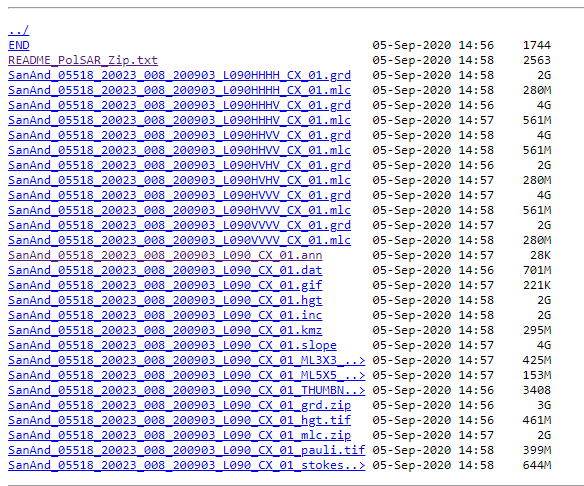
Hi @shen, the set of six UAVSAR polarimetric .grd files include all the cross-channel and co-polarization polarimetric information in geocoded and terrain-corrected images. I am not an expert on polarimetric analysis, so I can’t explain how to extract the phase, but it is in the products. These are the six products for one scene: