I’m using the MOD09GA product (mainly using band 6). I want to work only with the data from the Terra satellite; how can I know if the image is Terra or Aqua?
I looked in the MODIS Surface Reflectance User’s Guide. In the user’s guide, they wrote “The “MOD” prefix should be taken as referring to the dataset in general, not to Terra-derived data in particular. All programs discussed in this document process either Terra- or Aqua-derived data.”
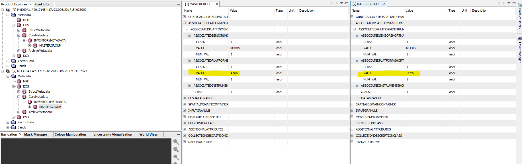
I also looked in the meta-data using the SNAP Information tool and didn’t find the satellite reference. Where can I see it?
There is an attribute in the metadata which you can check.
As Ana said, the guys on the Earthdata forum can probably explain better how to distinguish the two.
I think you should read that line as “whenever we mention ‘MOD’ in this document as the prefix for a dataset, it doesn’t mean we are speaking about Terra data only. The statements should be equally valid for Aqua (=MYD) datasets.”
For as far as I know, whenever a dataset starts with MOD, it does mean that it’s Terra. MYD means Aqua.
It’s just that they want to avoid that the document gets too complex by everytime saying “MOD or MYD”. Like the "whenever we say “he”, we also mean “she”.