good evening friends
I am New to S3 data i tried to export file to Geotiff but it does not work anybody know the right format to convert S3 data it will be helpful for my further process
thank you
good evening friends
I am New to S3 data i tried to export file to Geotiff but it does not work anybody know the right format to convert S3 data it will be helpful for my further process
thank you
What went wrong? What kind of error message do you get? With which tool are you trying to open the GeoTiff file?
You need to provide some more information before we can help.
Thank you sir
<img src="/uploads/default/original/2X/4/459fe9c4ebbe2b9d668c8e0f62071d79a8390eae.jpg" width="690" height="388">
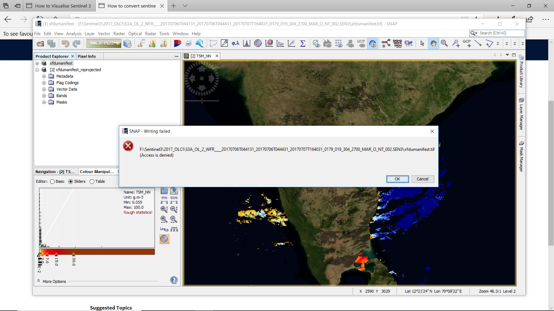
I tried to export S3_WFR product which is in XML file I need to convert Geotiff format
i Did file-export-Geotiff when i select geotiff format it show some error *Access Denied *
and The grid not show the lat and long ,if it shows possible to get grid properties ?
The error message indicates that you don’t have the write permission in the directory. Maybe you have already stored a tif there and have it open in SNAP?
Also it is not good practice to store the tif into the original Sentinel-3 directory. In addition you better do not name the changed products xfdumanifest, because then all your product will have this name. For your example it would be better to name the product in your example S3A_OL_2_WFR_20170706.tif or something more readable. Maybe include the name of the region. The name suggested by default is, unfortunately not well usable for Sentinel-3 products.
Thank you very much its working fine after changing file name and path …but still I need to open grid property for good visual because it graticule overlay is fine but I need visual lat and long in bold.
Thanks you
The graticule is not good customisable. We have this on the development roadmap.
For the time being I would suggest that you add the grid overlay in e.g. QGIS.
Thank you for your kind reply I will try my best