@falahfakhri I think this topic is not related to the question. The problem here is that the output of C2RCC is not written into a permanent raster in the first place.
The v means this product is virutal only
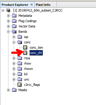
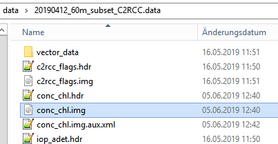
To open it in QGIS, right-click the band and select “Convert band”, then Menu > File > Save product. The raster is then physically written on your hard drive. You find it in the .data folder of your working directory as “conc_chl.img”.
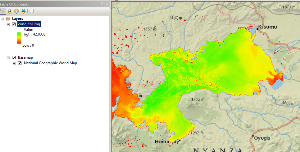
You can directly open it in ArcGIS.