If you open the img file, the values are the same. It’s just the color legend
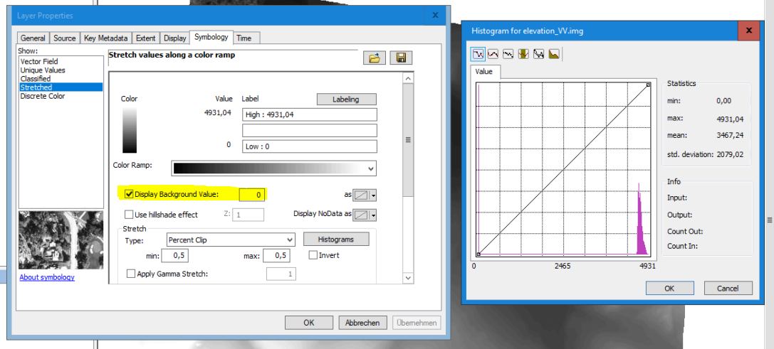
ArcMap does not know that 0 is your “NoData” value. It was applied in SNAP, but you have to define it for ArcMap as well.
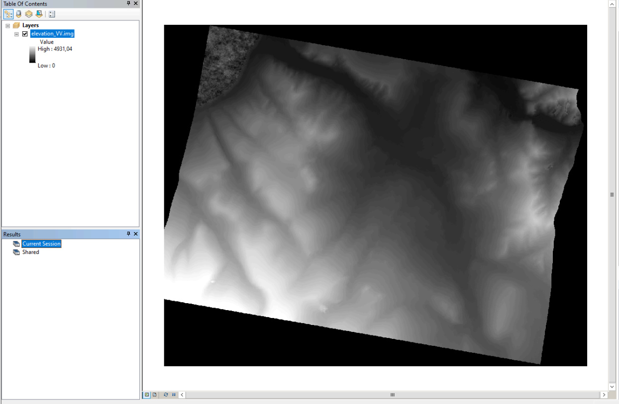
As you see, the value range is not different, it’s just the legend of ArcMap which thinks 0 is part of the product:
Close the product in ArcMap, go to the ArcCatalogue and define 0 as NoData value:
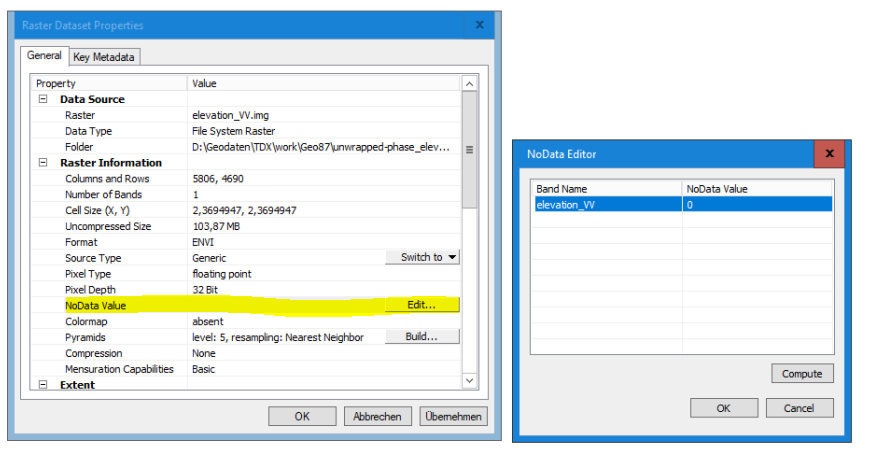
Once you open it againt, the scale is adjusted
