I need to export the cloudmask of sentinel to a format that can be read in QGIS orARCGIS or envi. I have tried to export it, but the option it appears is .xml and I cannot open the file on the programs just mentioned. Does anybody can tell me how to use the mask outside snap, please?
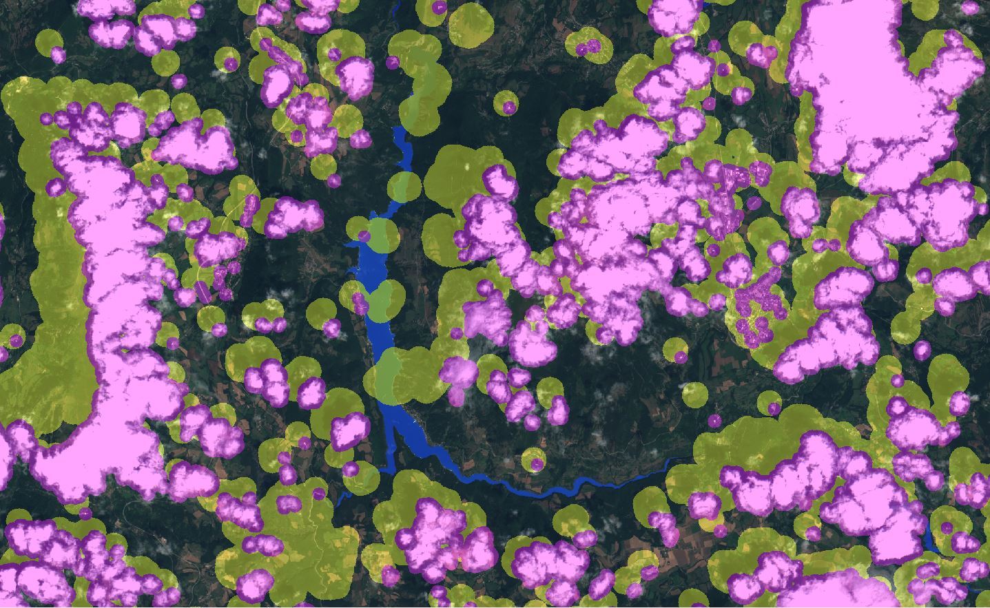
This second image is the result of the FMASK. It classifies the cloud (purple), cloud shadow (yellow), water (blue) and snow (not on the printscreen). In this case the clouds are detected almost perfectly. But I recoginized that FMASK has a tendency to overestimate the number of clouds. Sometimes it classifies Buildings and Lake/River coast as clouds.
I experienced quite the underestimation with sen2cor. thanks for the hint with FMASK, I didn’t know it was available for S2 already, I’ll give it a try.
Concerning Sen2Cor, a binary cloud mask is not directly available but a Scene Classification Map with 12 classes is available at 20 m and 60 m resolution. It is possible to construct a simple binary cloud mask by aggregating the three following classes of the Scene Classification Map: (Cloud Medium Probability (8) + Cloud High Probability (9) + Cirrus (10)).
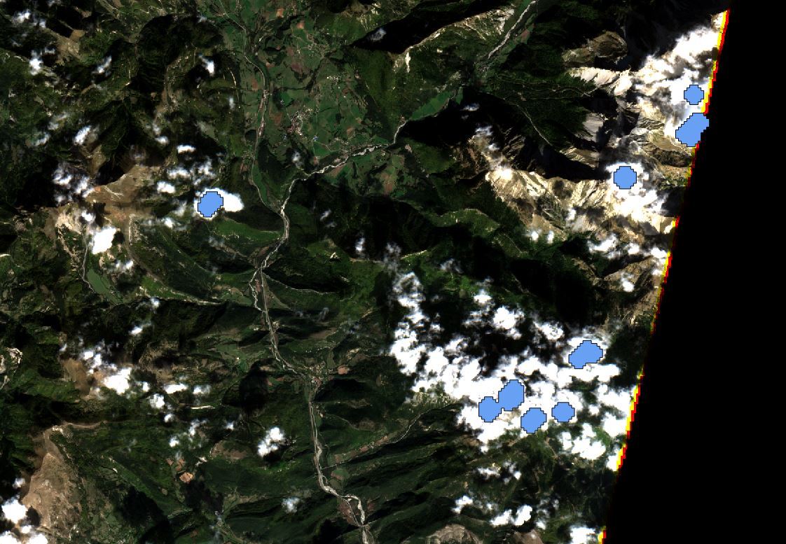
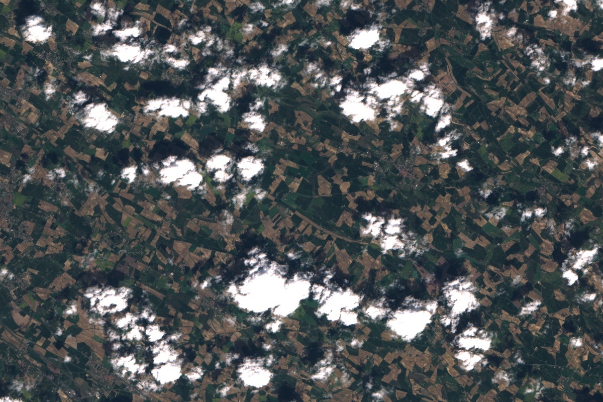
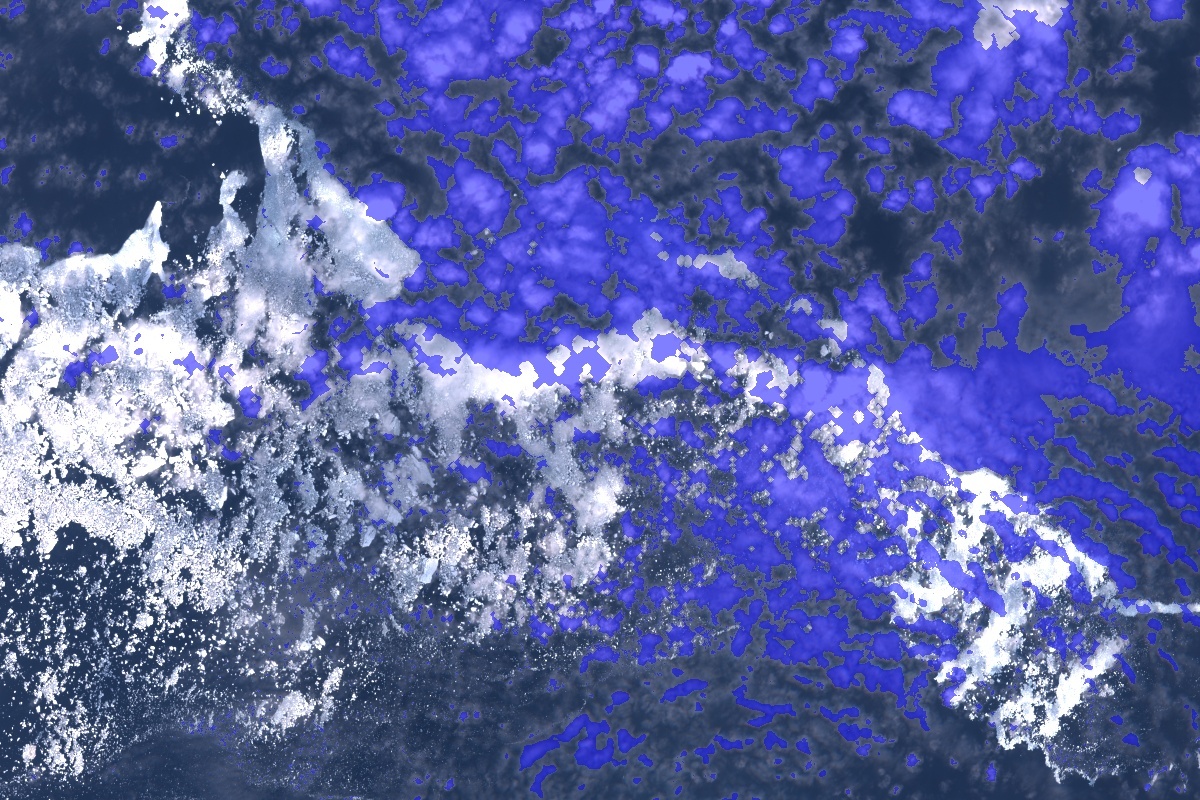
Some examples are given hereafter showing first a L1C TOA colour composition and after the Sen2Cor cloud mask coloured in blue over the L1C TOA image:
Please keep in mind that Sen2Cor cloud mask can be considered as a "raw"pixel-based cloud mask that can be further processed by users depending on their particular application. Users who privilege very clean pixels would need a more conservative cloud mask and can dilate Sen2Cor cloud mask. One reason why Sen2Cor cloud mask is not provided already dilated is because the dilatation process of the cloud mask is not reversible and in some cases, users may be interested in getting as much information as possible from their data. They can then use the original Sen2Cor cloud mask for their processing.
Sen2Cor Scene Classification Map provides information on Cloud shadow, Water and Snow, like FMASK.
Please note that an improved version of the cloud screening algorithm of Sen2Cor is expected for Spring 2017.
I am facing a task to generate binary cloud mask from sen2Cor cloud classification map to feed as input to IOTA2 using Python.
You have mentioned that by aggregating the three following classes of the Scene Classification Map: (Cloud Medium Probability (8) + Cloud High Probability (9) + Cirrus (10)), it is possible to construct a simple binary cloud mask.
Could you please offer some detailed information for this aggregation, ie packages, tools or even Github repos can be used in this task? I have searched for a long time. It seems that your answer is the best what I am looking for.
SNAP with snappy is well suited for your use case. You can create a new band (BandMath) which combines the three cloud values and write this as a new file.
I’m working on a processing chain to process data from Sentinel2. I’m not familiar with SNAP. The only thing I know for SNAP is that it is GUI platform for satellite data processing . Is it possible to embed snappy in Python code or shell code?
However, if you are not yet familiar with processing with SNAP/snappy the overhead might to much for you and some simple python package is better suited for you. But for this I donÄt have a suggestion.
Thank you for the detail information you provide. They are awesome. I will talk with my supervisor to see if we should get SNAP involved in this processing chain.