Excuse me, I have one problem in reading the elevation data that auto-downloaded by SNAP.
There are 1 data file (.dim) and 1 data directory (.data) after I completed the radar data workflow.
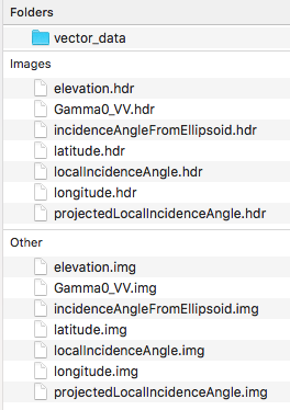
In the *.data directory, there are 1 ASCII file (elevation.hdr) and 1 data file (elevation.img) about elevation.
How to use/read the elevation data (elevation.img) by myself using C/C++ or MATLAB?
Thank you.
these data are ENVI rasters. You can import them with the corresponding reader: https://www.mathworks.com/matlabcentral/fileexchange/27172-envi-file-reader-writer
Thank you. BTW, MATLAB function: “multibandread()” is also a useful method.
Thank you so much.