Hi everyone. How can I find a pixel with known coordinate in SNAP software?
You can find certain pixels by using a pin.
Select from the menu View -> Tool Windows -> Pin Manager or enable the toolbar for tool windows by choosing View -> Toolbars -> Tool Windows and selecting the Pin Manager ![]() .
.
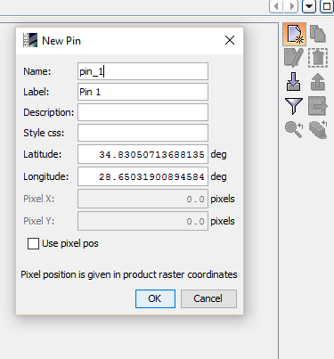
There you have the option to create new pins by coordinates.
Thank you for reply.
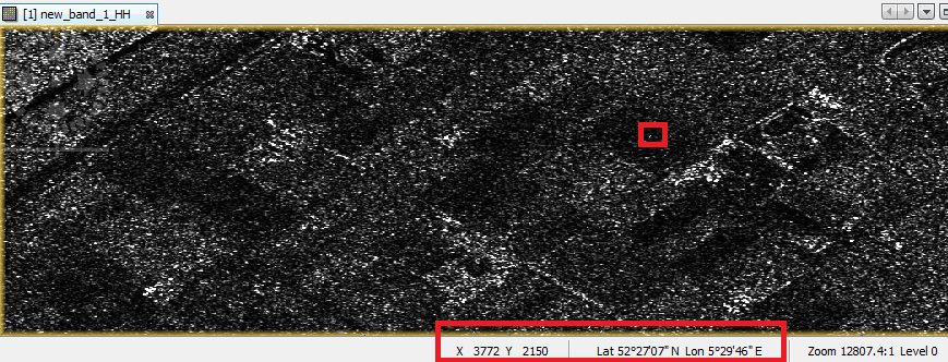
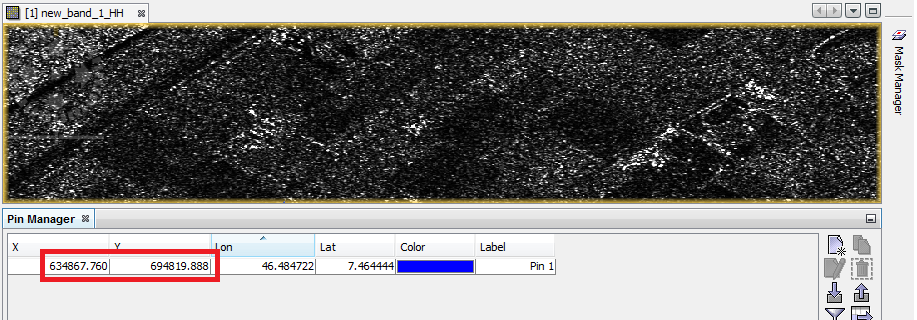
In this figure, snap displays the correct latitude and longitude for the selected pixel but when I find the pixel with the same coordinate via pin manager, image coordinate is false.
How can I access to the information that SNAP displays in bottom toolbar? I don’t have the true metadata for the image and when I geocode data, the output has error.
What kind of product is it? Some radar data of course, but what exactly.
It seems that the geo-coding is not correct. It can find the lat/lon for a pixel coordinate but not the correct pixel coordinates for lat/lon (which is more difficult).
You sad
Maybe this needs to be fixed first. But I’m not an Radar expert
So maybe someone else can help.
How is the geocoding [quote=“rosers90, post:5, topic:3480”]
I don’t have the true metadata for the image and when I geocode data, the output has error.
[/quote]
how is the geocoding performed?
I have a GTC image with metadata but I want to geocode my SLC image. I replaced SLC metadata with GTC metadata. As my GTC data has one pixel less than SLC data , I resized data and then replaced metadata. When I geocoded SLC data with this new metadata, the result is not correct and has error