I am pre-processing Sentinel-1 SAR GRD imagery with IW swath. The pre-processing step includes terrain correction where a DEM needs to be selected. Since my ROI is in Greenland, I use ACE30.
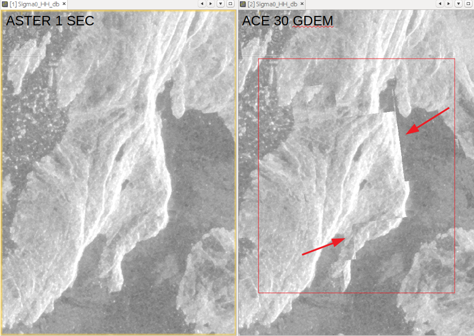
I recently noticed irregular stitched spots in certain regions of the SAR imagery after preprocessing is complete. When I switch to ASTER 1 sec GDEM, this issue does not show up.
I also want to add that ASTER is not automatically downloaded, so if you have not manually done it and placed the file in the correct folder (or entered it as an external DEM) probably not terrain correction will be applied and the data is only ellipsoid corrected.
SNAP looks in the DEM folder for correct tiles. If none are found, a flat surface is assumed.
Only the DEMs flagged with “AutoDownload” are automatically retrieved.
Hi @mengdahl,
Thank you for the information. How to overcome these artefacts in the image then? Do you have any suggestions for the DEM in terrain correction. It cannot be SRTM since I am working in region > 60 deg north.
Oh okay, thanks @ABraun. So then Is there a work around for the large artefacts as shown above in the image 1? Are there any other DEMs I can use suited for this problem?
Thanks @ABraun! The reason I am looking for an automatic download DEM as a solution is because I have a large number of tiles spread across different regions that would otherwise require a manual download of DEM.
If I use External DEM download, are there any processing steps that I need to keep in mind for the DEM that are specific to SNAP toolbox. In other words, is there anything to keep in mind when using external DEM in SNAP toolbox for e.g: naming convention, file format constrains?
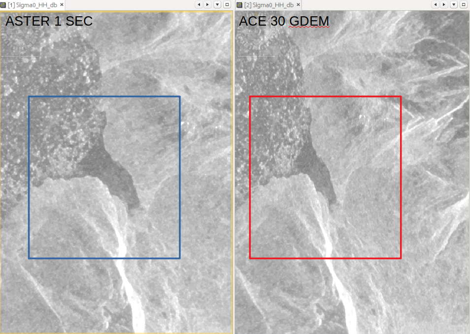
Also why is the warping seen in above in image 2? Is it dependent on the fact that ACE 30 DEM was applied and in the non-warped image there was no DEM used (as ASTER is not auto downloaded)?
if you have many distributed areas, you can try GETASSE or CDEM (both AutoDownload) and compare if they produce less artefacts than ACE30. But they are also of low resolution compared to SRTM or ASTER.
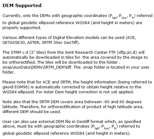
If you decide to manually dowonload DEMs for terrain correction, you just have to make sure that these are projected in WGS84 and stored as GeoTiff. Please have a look at the help pages regarding this point