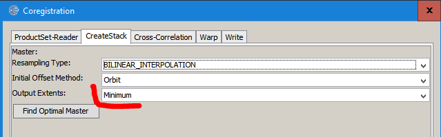
you can do this easier by coregistration of all images. If you select a master image, its resolution and extent is used for all salve images. You can define the resampling technique and what should be done with areas which aren’t covered by all images (minimum extent, master extent, maximum extent).
Thanks for the help @ABraun
I have some more questions, please look at them:
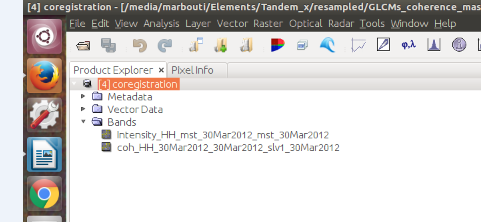
As you told me, I used co-registration and I put three images (1. backscatter, 2. coherence 3.phase) but I do not know why in the result, I do not have phase image?
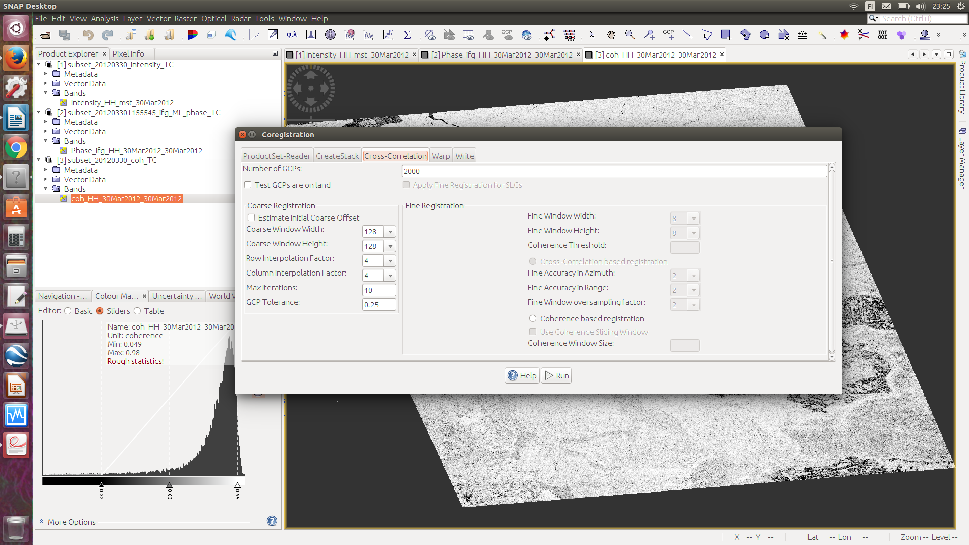
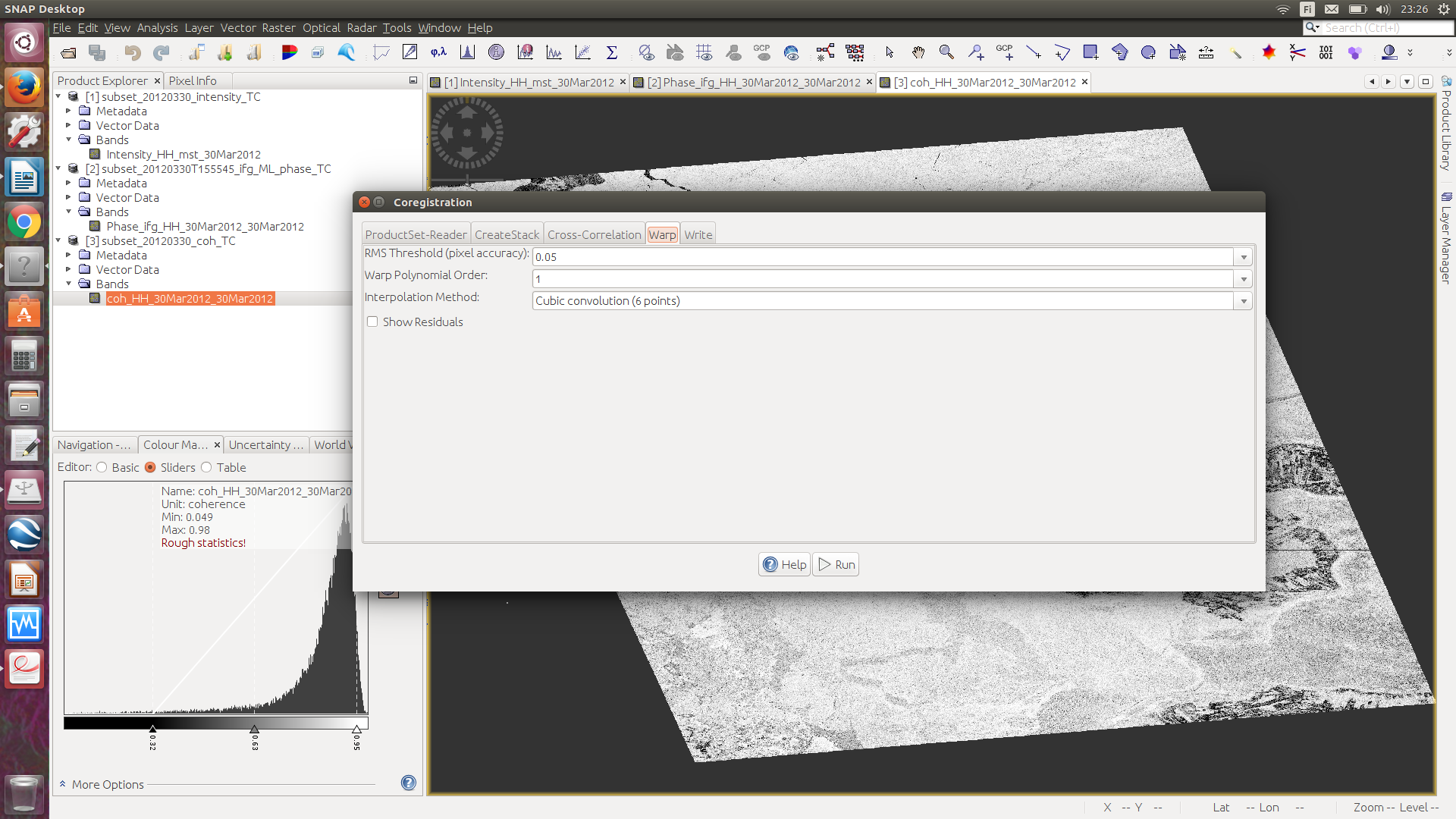
You can see my steps in below:
Productset reader; I put three images here but type, acquition, track and orbit are empty. I used these data before for classification and I had same issue ( I mean type, acquition, track and orbit were empty) but the classification worked and I thought it was not important, so I do not think so this is a problem.
Another important thing;
5. How can I see what is the resolution of my original data? As I mentioned that before when I went to re-sampling part, the resolution part was zero. Why?
I have one question regarding this answer that you (@ABraun ) gave. Sorry if I misunderstand.
As I look at SNAP software, there are several ways for changing resolution;
Using multi look option in SNAP
using re-sampling option in SNAP
using Range Doppler terrain correction option in SNAP
So why you mentioned that we should use first, multi looking and then the RD Terrain Correction???!!
Each of these steps changes the resolution but they still perform different tasks:
Multi-looking generates square pixels out of slant range geometries in the first place, no resampling technique applied.
Re-sampling only changes the resolution to a given pixel-size.
Terrain Correction adjusts the image to local topographic conditions, thereby using resampling as well.
It totally depends on what you want to do with your data. There is no “standard” way of perparing SAR data for analyses. Sometimes multi-looking simply helps to see the image undistorted.
I know this topic is closed for over 2 years now, but I need to ask you this:
When I give the pixel size of 30 m in RD terrain correction for my SAR image, spatial resolution is set to 30 m. However, when I subset (Clip) my image in Arcmap according to the shapefile, if I want to make the same rows and columns as my Landsat image (Subset from same shapefile), pixel size changes to 30.5 and 30.9. Pixel size of Landsat is 30 m. Can someone please tell me why this happens and how can I prevent it?
I’d say this depends on how ArcMap treats pixels which partly lie outside the shapefile. You can check in the processing environments if you find some setting which indicate that resampling is involved.
If you want to adjust Sentinel-1 and Landsat-8 to have the same pixel sizes and numbers, you can use the collocation tool with the one of smaller coverage as the master and the other as the slave.