Good evening,
I have this Sentinel-1’s product :
S1A_IW_GRDH_1SDV_20170210T051855_20170210T051920_015217_018EB5_1497
How could I get an image with a resolution of 20x20 m using SNAP?
Thank you very much in advance.
Good evening,
I have this Sentinel-1’s product :
S1A_IW_GRDH_1SDV_20170210T051855_20170210T051920_015217_018EB5_1497
How could I get an image with a resolution of 20x20 m using SNAP?
Thank you very much in advance.
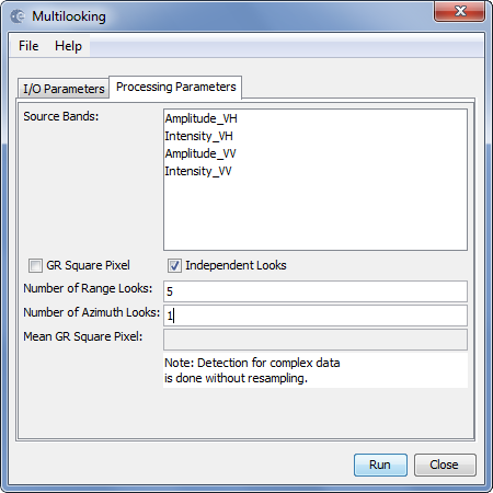
use multi-looking fist and change the number of looks according to your required target resolution.
Then run the RangeDoppler Terrain correction module.
Please, for example, according this page https://sentinel.esa.int/web/sentinel/user-guides/sentinel-1-sar/resolutions/level-1-ground-range-detected
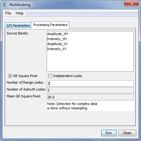
and my screenshoot I get image with resolution 20x22 m, is it correct?

Thanks.
yes, the value in “Mean GR Square Pixel” should change according to your entered value. I’d try 2 Range looks at first.
You can then, in the RD Terrain Correction module define the final resolution (resampled).
Thanks, you’re really helping me.
I understand that pixel spacing represents how much area each pixel covers, while resolution indicates the smallest object you could pick out in an image.
Change the Map projection to UTM (automatic) and you will get meters as map units (pixel spacing) intstead of degrees.
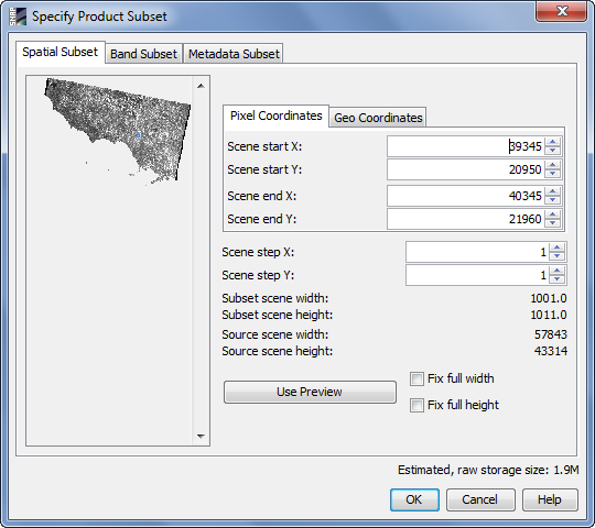
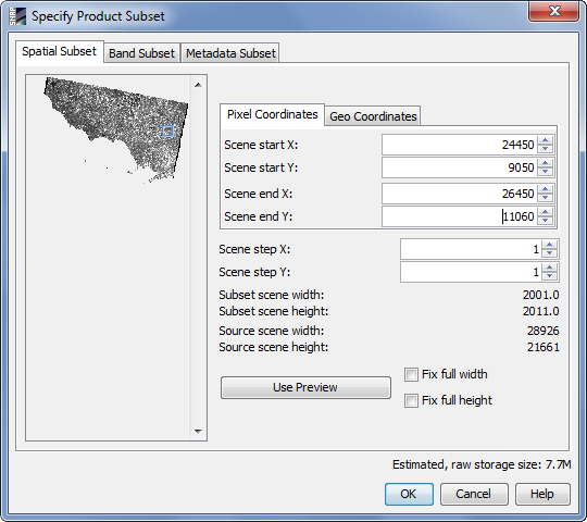
Using the subset operator. Right click on your image > export subset from view. You can define the dimensions of your output.
Dear Braun,
with these steps I get picture with a resolution of 5 m of 1000x1000 pixels, is it right?


I’m sorry if I have wrong to understand your aid.
I see nothing wrong in it.
But why does it have to be exactly 1000 Pixels?
No no, also 2000x2000 pixels or other is ok.
Is correct the second photo?
you first make it 20m in the multi-looking and then select 5m as an output in the Terrain Correction, that doesn’t make sense. If you want 5m leave out the multi-looking.
About the error: You need to enter the number 5 in the “Pixel spacing (m)” not in the field for degrees.
Looks like you’ve chosen pixel spacing of 554731 metres, which is obviously incorrect.
Yes, I was wrong because pixel spacing represents how much area each pixel covers, while resolution indicates the smallest object you could pick out in an image.
My problem is that I don’t understand how to obtain resolution of 5-10 m.
I don’t use the multilook but imposed the value directly as in the screenshot, now is it right?
At the end I would like to get a picture similar to this
In rough terms you are correct.
Short answer: you cannot. The resolution of the data is what it is (depends on sensor properties) and changing the pixel size cannot improve it. You can set the pixel size to 1m if you want to, but that does not increase the resolution to that level.
Please, could you explain to me how to get photos from the Sentinel-1’s GRD product?
Multillook or Terrain Correction?
Now I’m really confused.
Multilooking reduces both the resolution and pixel-size. Do terrain correction to the map projection of your liking and select a pixel-spacing of 10m (for example) and see if that works for you.
both are correct. One is based on degrees, the other on meters.
Excuse me for my many questions, I’m learning thanks to you.
I took this photo
with two steps in the screenshoots:

What is exactly the resolution of my image?
I know the pixel spacing of 10 m but I realized that resolution and pixel spacing are different, in fact this topic confirms it
I have some Tandem-x images that they have different dimensions. You can see the dimension of one of them in below:
dimension: 9659*6081