I am using SNAP to view Sentinel-2 L2A band images and I’d like to overlay vectors from externally generated kml files that show the boundaries of one or two small fields.
How do I import kml data and then overlay it’s vectors?
I am using SNAP to view Sentinel-2 L2A band images and I’d like to overlay vectors from externally generated kml files that show the boundaries of one or two small fields.
How do I import kml data and then overlay it’s vectors?
Import of KML is not supported.
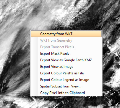
But you can convert KML to WKT and define the geometry by the WKT. Use the context menu of the image.
Or you can convert the KML to a shapefile and then import it into the product (File / Import /Vector Data / ESRI Shapefile)