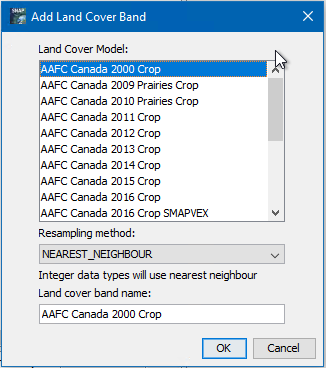
You are referring to the ‘Add Landcover Band’ function, right?
The add new data maps here, the source code needs to be changed, there is now public extension point available.
But in general you can use any landcover map and collocate it with your data in SNAP.