I plotted an histogram of the persistent scattering hgt file from StaMPS and realized that the majority of the PS heights were -28, -27, and -26. I did the same, but using the SRTM dem that was used in the ISCE2 stack processing (clipping it using each PS location to get the WGSS84 elevation). The SRTM dem seems like a more realistic distribution of height in my study area. Is there a way to fix this problem? I’m confused as to why my PS heights are mainly -28, -27, and -26. I’ll also be posting this on the StaMPS github. (see attached figures)
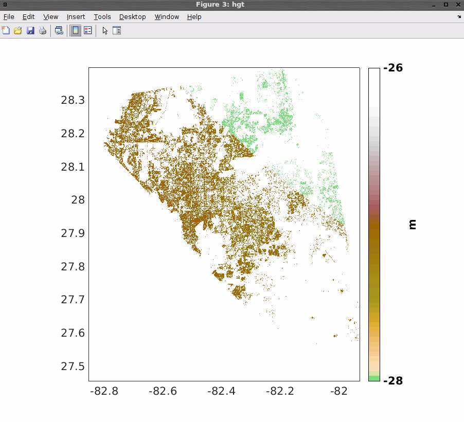
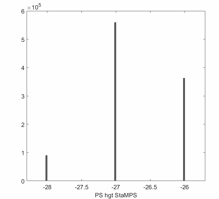
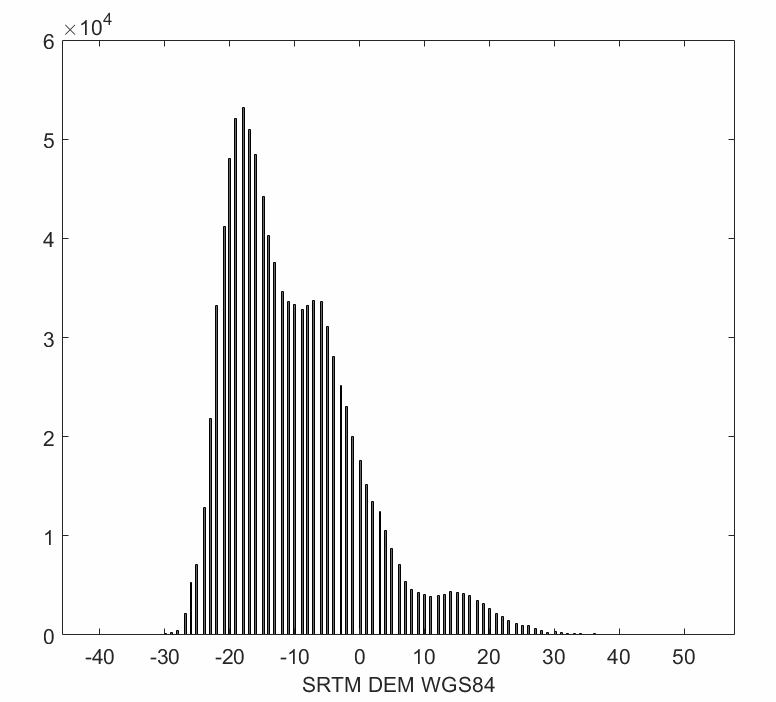
Solved this by reprocessing from ISCE2; it turns out the DEM I downloaded was corrupt. ISCE2 updated the files necessary for DEM download and stitching!
1 Like