hi, i need some help about the explanation/description of those symbol functions.
what is Bn, s, R, Ro, and so on. please and thank you 
ESA provides nice explanations on interferometry:
Here you will find three documents:
Part A is for readers with a good knowledge of optical and microwave remote sensing, to acquaint them with interferometric SAR image processing and interpretation.
Part B provides a practical approach and the technical background for beginners with InSAR processing.
Part C contains a more mathematical approach, for a deeper understanding of the interferometric process. It includes themes such as super resolution and ERS/Envisat interferometry.
1 Like
thnks for the answer 
can i ask again?
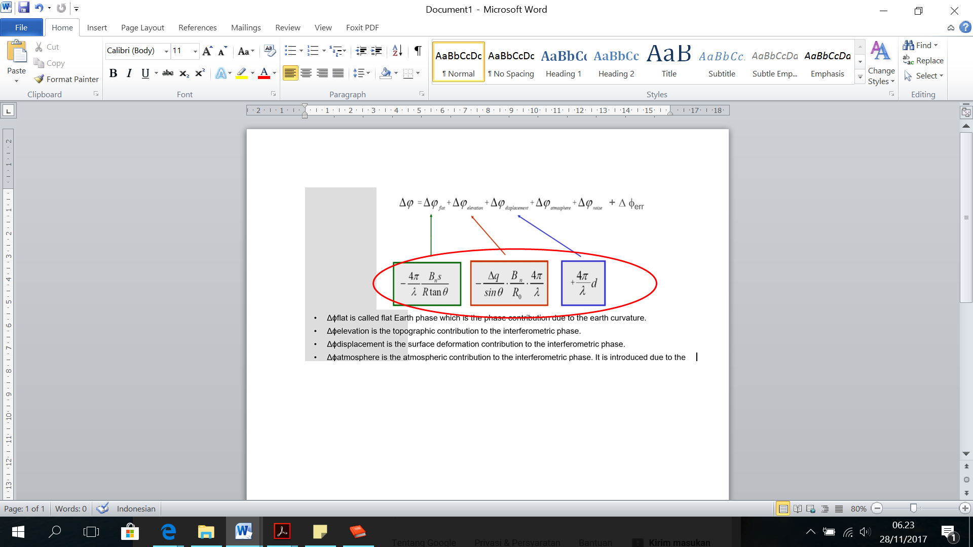
i already read it, and i thank i got the answer, but once more, what the meaning of negative (-) value in the functions there?
thnk you
which function do you mean?
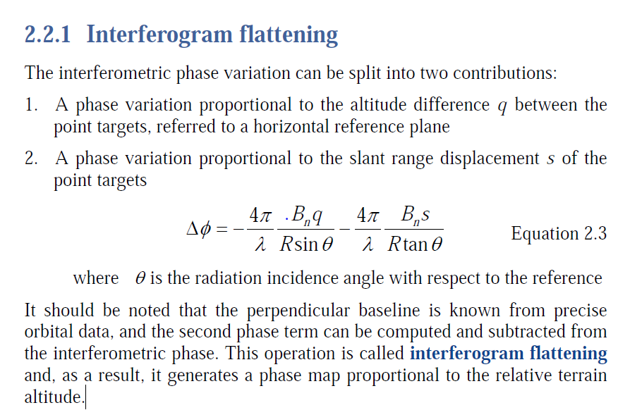
i am not sure but I suppose it is the correction of the interferometric phase for the topography of the earth so only fringes related to differences in elevations remain.
I’m sorry, I didn’t get the last words of your answer.
please see here, slide 10: http://www.its.caltech.edu/~ee157/lecture_note/Interferometry.pdf
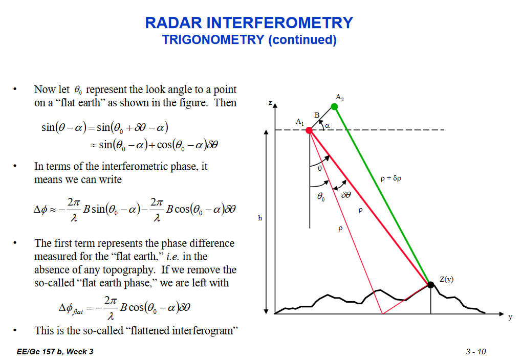
Thank you for your best answer.
Just to make me sure, “flat earth” here means homogeneous earth such as geoid?
Then to make it like the ‘real’ topography again, the flat earth function removed?
Why don’t you just have a look at in the sources I provided? I am not here to read manuals to you guys.
Yes, I had. 
I just want to confirm by the way I understood it.
Well, thank you very much and sorry to interrupt  ️
️
1 Like