Insar difference by using SRTM3sec / SRTM1sec

Hey everyone,

I’m currently using SAR images to study the displacement of the ground in the Jakarta Area. Usually I did the job with SRTM3sec but in some tutorial I saw 1sec was using so I decided to try with kind of combination :

  • FullSRTM3sec for traitement and for the Range doppler correction
  • FullSRTM1sec for traitement and for the Range doppler correction
  • FullSRTM1sec for traitement and SRTM3sec for the the Range doppler correction
  • FullSRTM3sec for traitement and SRTM1sec for the the Range doppler correction

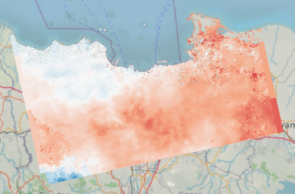
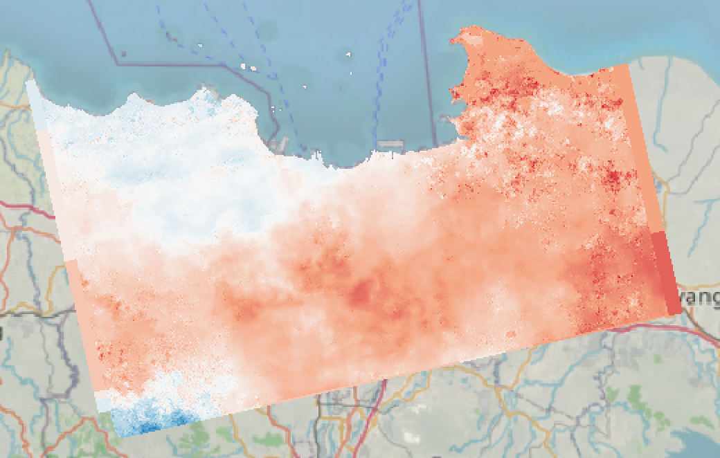
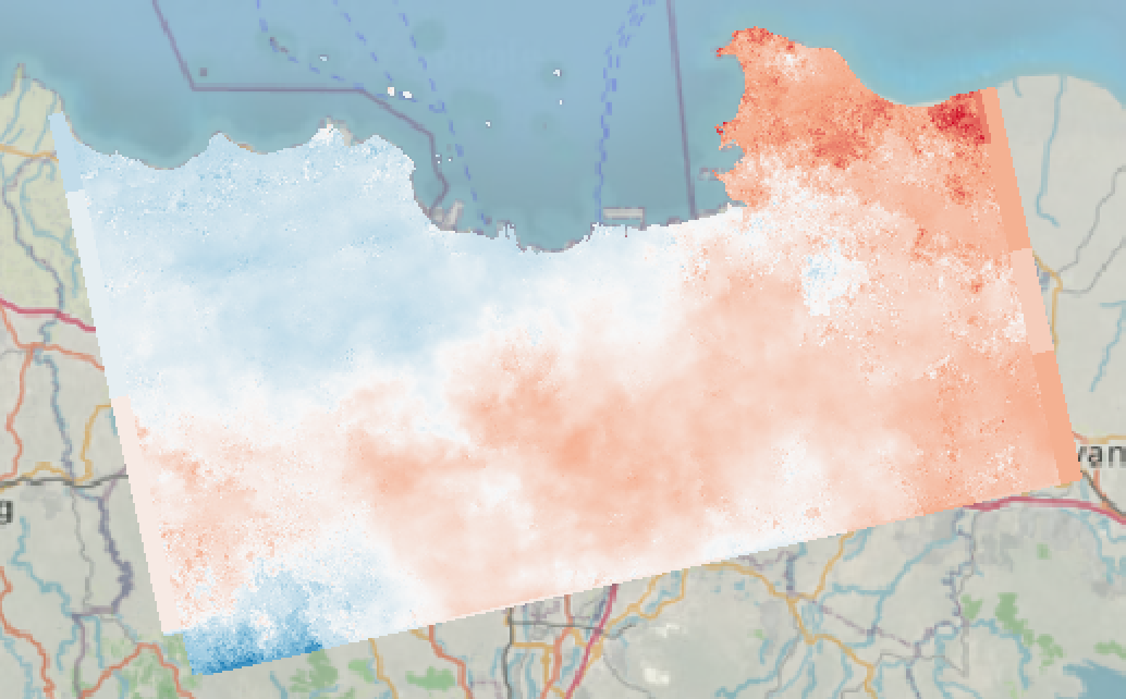
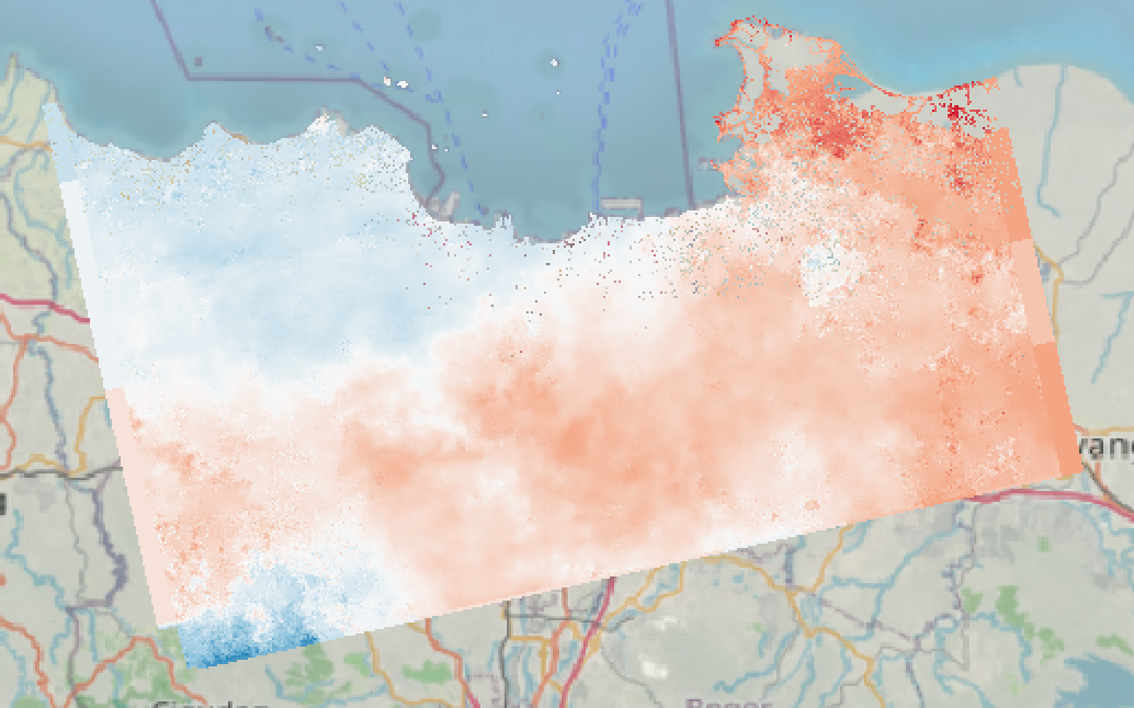
I saw some different pattern and also the SRTM1 sec seems to have some lack of data in water / deltas zones. But the most important is the data generally. I read here it’s not gonna big change and sometimes better SRTM can putting more noise than taking a “normal” or less accurate DEM.

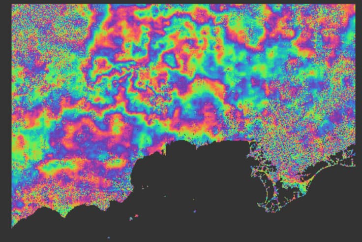
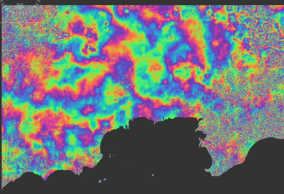
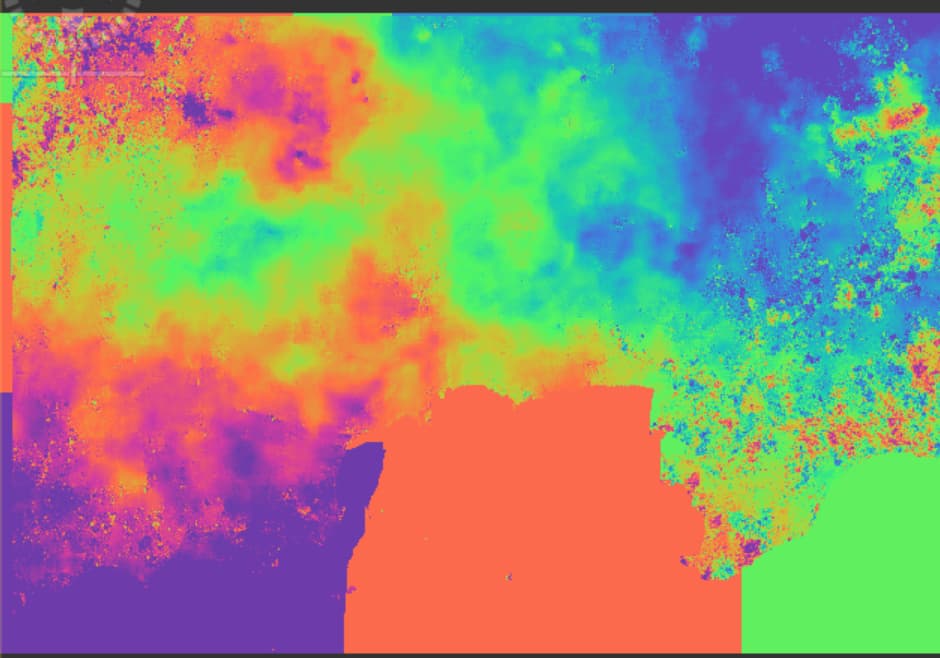
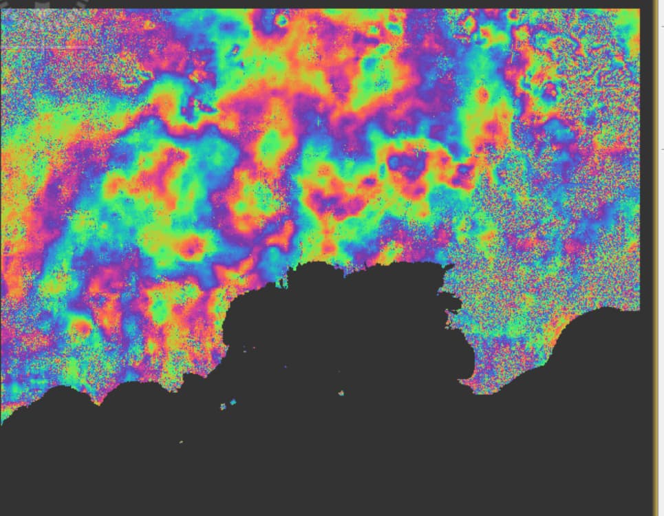
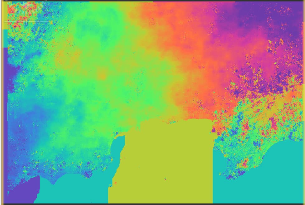
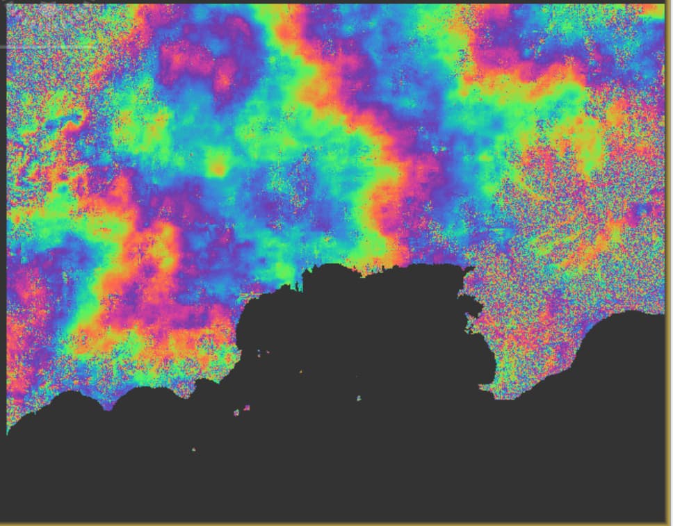
Here the picture, red indicate uplifting and blue indicate subsidence even if we don’t have this time (values are took by the maximum of subsidence in south-west)

FullSRTM1sec

FullSRTM1sec for traitement and SRTM3sec for the the Range doppler correction

FullSRTM3sec

When I doing the subtract of values for 30 controlled points located in high confidence ( > .6) the standard deviation look like this :

That seems no impact but I want to be sure I don’t make any mistake :slight_smile:

Best regards,
Clément

Does the interferogram look alright? The DEM used as an auxilliary file has a smaller impact compared to phase quality and unwrapping errors.

Yes I think so, here the interferogram / phase and unwrapping phase.

I did on 3 burst on IW2 in Jakarta

here another with SRTM3sec

The big color pattern in the unwrapping represent water, when I doing phase displacement and export in tiff I have 0 as value.

Cheers,
Clément

I’d suggest:

  1. try with Copernicus DEM
  2. make mask for the water areas

Concerning mask for the water areas do you doing before interferogram or before unwrapping ?

after unwrapping and convert to displacement, before geocoding

As you suggest after unwrapping I apply the land sea mask and then phase displacement but the values are the same between mask and no mask area

Sharing this link about the influence of DEM in DInSAR. Hope it helps/contributes to this topic.

Also nice work by the way.

you can already remove water bodies before unwrapping: Filter out low coherence pixels before phase unwrapping

But your interferograms seem strongly affected by atmosphere which might have a bigger impact than sea surface decorrelation.

Thanks Pedro, I will definitly read it !

When i put a mask of water it seems not affected very well the unwrapping and the map of displacement

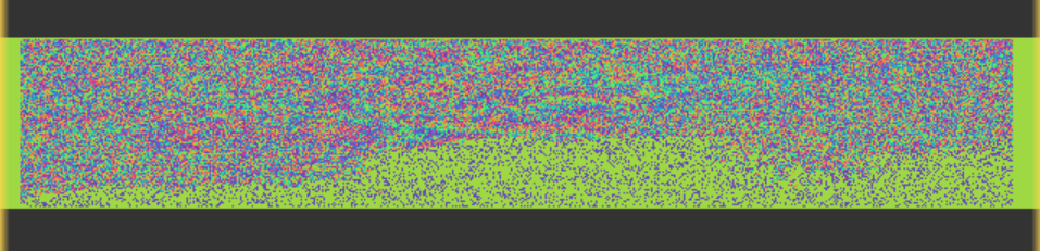
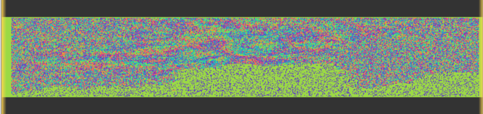
yes, this is what I was thinking as well. The water is not the problem, because it is at the edge of your area of interest. Also, the DEM has no greater impact. But the interferogram contains many patterns which are not related to displacement (and some decorrelated areas at the right bottom).
Are these images from the rainy season?

What is the temporal baseline?

The one I give come from 11 oct to 4 nov looking the precipitation in indonesia the rainy season start oct / november to end of march i can show you different interferogram with timeline.

Here some picture of interferogram and unw by different month

April from May


June to July


Jul to August

I just wanted to precise the area with kind of noise bottom of the “peninsula” are swamp / farm which are sometime under water

Area in top left are mostly forest and a bit of mining in the very very corner I think

hm, I see little correspondence within the different interferograms. Only a small fraction will be attributed to actual deformation. Would Persistent Scatterer Interferometry be the better choice here?

I think yes, I follow most of tutorial for insar Time-series and I only look subsidence. The problem is I doing only with step by step so it take time to generates stuff.