I am new to SAR and SNAP, so I have been reading up and going through some tutorials on how to create an inteferogram and output a product that will display small level changes in ground elevation between two SAR datasets. I’m working with Cosmo-Skymed CSG and CSKS2 Single Look Complex data.
My processing steps are:
Coregister
Create subset
Create inteferogram
Goldstein Phase Filtering
Snaphu Export-Unwrap-Import
Phase to Displacement
Geometric Terrain Correction.
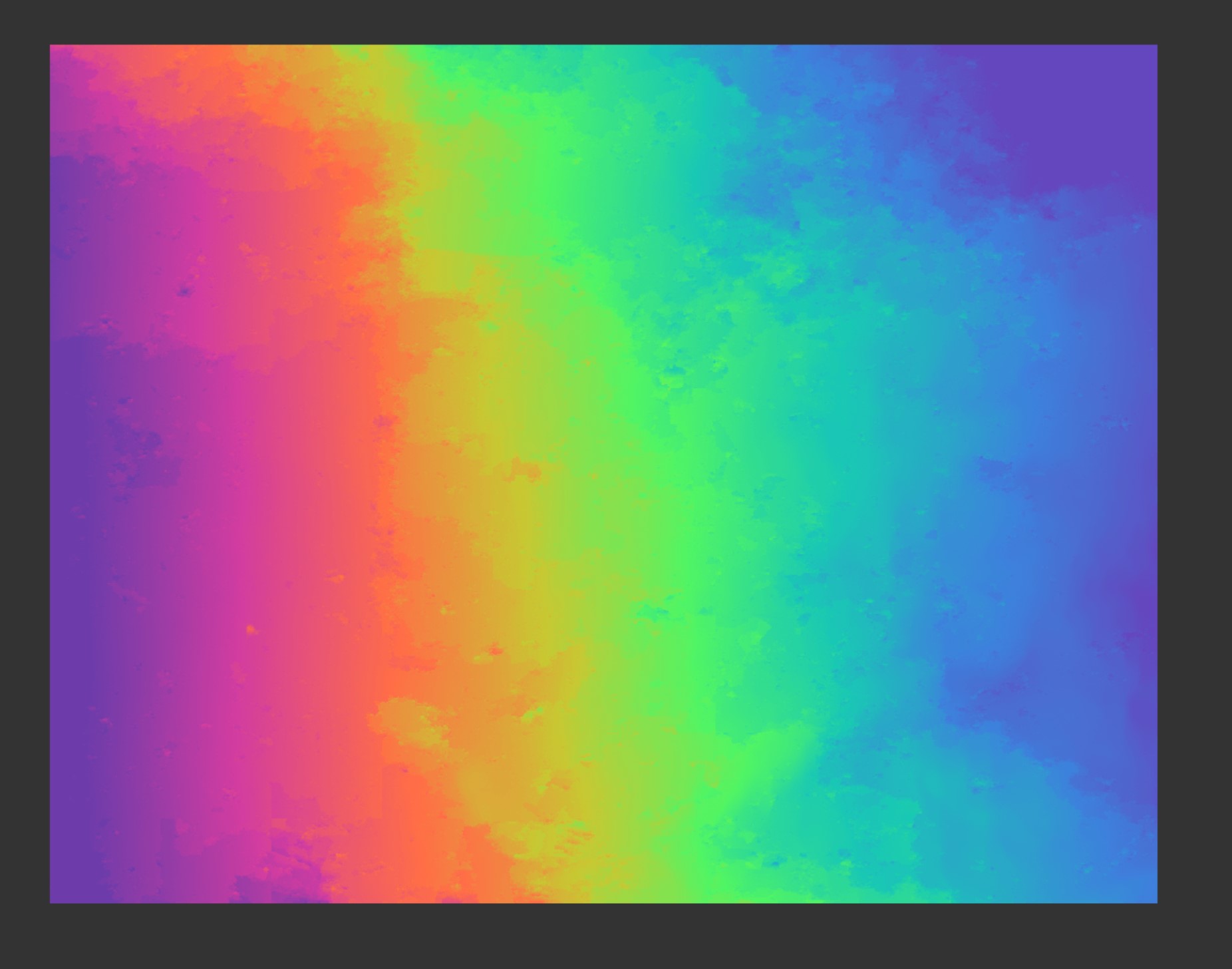
The resulting unwrapped inteferogram looks like the image below. This looks like gently sloping terrain DEM. There should be almost no change in the deformation map. I think the issue is that the terrain correction isn’t right. Do you need to apply orbit data to SkyMed SLC? What is my mistake here? Any help would be appreciated.
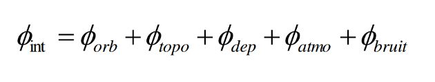
The topographic phase (same as the flat earth phase) should be removed before the unwrapping of the interferogram.
The interferogram’s phase (ie: phase difference between two SAR acquisitions) is the sum of different contributing factors. (see equation below)
Therefore in order to get just the displacement phase it’s necessary to subtract the other contributions. If you’re using the latest SNAP version there should be an option to do that when generating your interferogram.
It is the displacement phase that when unwrapped gives you the measured displacement in LOS.
Thanks for your suggestion. I’m still not getting good results. The images were acquired one day apart. Is that an appropriate time difference? Should they be from the same orbit, or taken further apart?
For InSAR, the images used should always be acquired with the same orbit (e.g., you can’t use a descending master and an ascending slave). I personally also wouldn’t recommend working with different orbits in general because the geometric distortions in SAR images (layover, shadows, foreshortening) depend on the looking direction. Having different orbits in the stack means that these distortions won’t match from one image to another, and unless you have a good understanding of the terrain topography, these could also be attributed to actual changes between the acquisitions.
When it comes to the time difference (temporal baseline), theoretically, there is no minimum. It all depends on what you’re studying. A one-day baseline might not be enough for a slow creeping landslide, but it is sufficient in the case of an earthquake.
Thanks again for your reply. I verified the images have the same orbit characteristics (antenna positioning, pass, acquisition mode). They were taken a few days apart, so obviously not from the same orbital pass. My guess is that the position of the cosmo-skymed images isn’t being calculated to the necessary accuracy. There is something slightly off. I’ve used the same methods on Sentinel data, I am guessing I’m missing a step or there is a compatibility issue between SNAP and the vendor products, either the data or metadata used to position it.