I have a stack of 5 PALSAR 2 SAR images. I made the stack, using radar>coregistration. Then I did radar>interferometric>products>interferogram formation. I left everything default. I tried again but adding “subtract topographic phase” and those defaults.
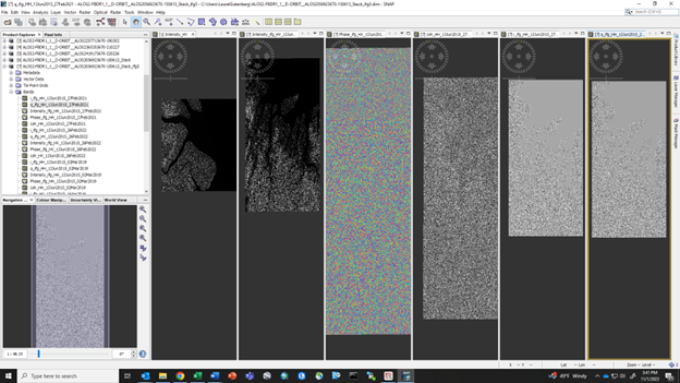
The phase image looks like nothing. It is a vegetated area, but shouldn’t at least the shoreline/water be visible?
The resulting intensity, i, and q look better as in I can see the water vs land.
Not sure where to go or what to fix from here. I had asked the vendor about finding pairs/a stack that would work well together since I couldn’t find a baseline tool on my own like with ASF. But even with bad pairs, it seems like zero info/pattern in the phase would be unlikely. Or am I looking at these products wrong?
What is the baseline according to SNAP? If the image pair is not suitable for InSAR (baseline above critical for example), the coherence is zero and there is no useful information in the phase.
The ALOS satellite had a large variation in baseline during the mission, up to 6000 meters. Baselines greater than about 1000 meters will have little or no coherence.
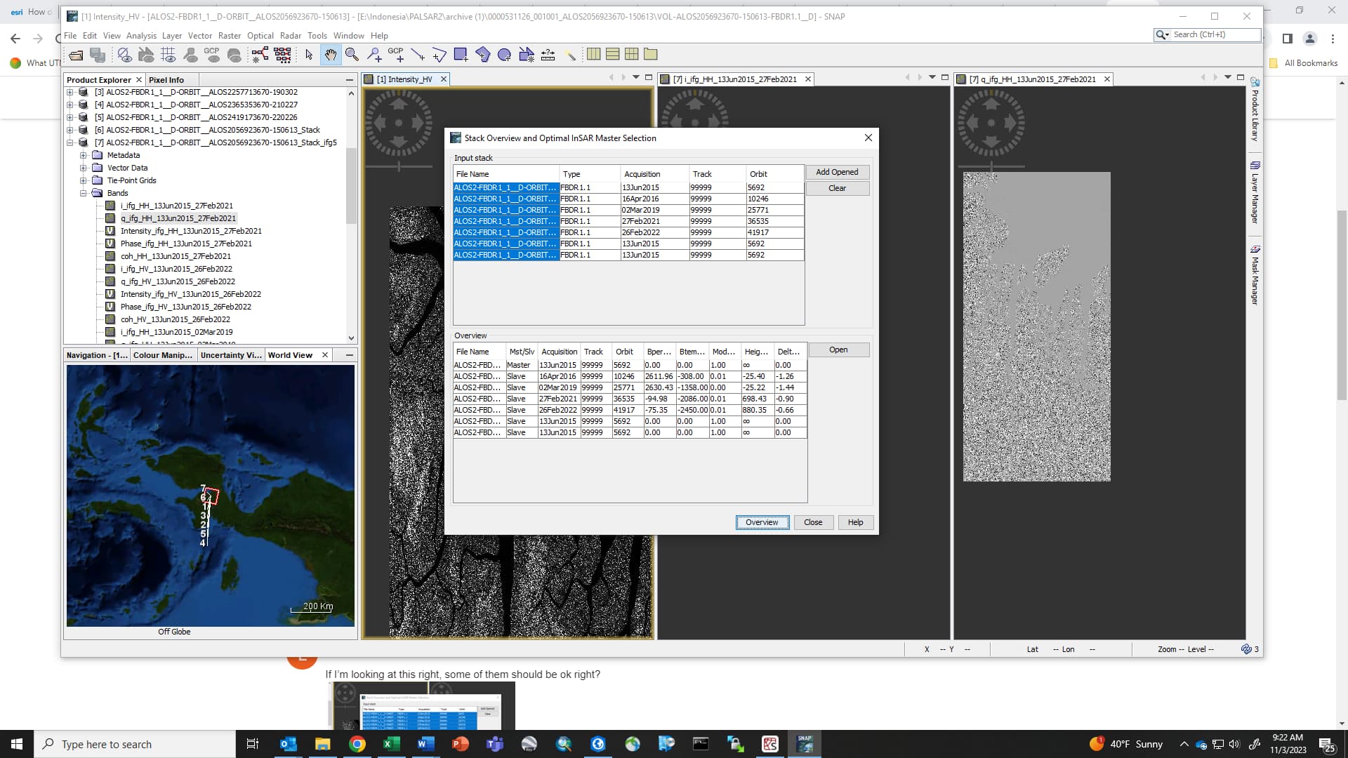
If I’m looking at this right, some of them should be ok right?
It looks like some are under 1000m and some are over, although the two that are way over look like they should be close together, am I looking at this right? Thanks!
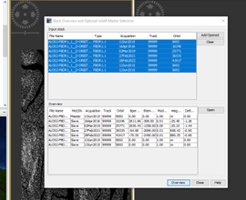
The screenshots are much too small & overcompressed to be readable. Please attach larger ones.
I see now that you are using ALOS-2 data, not data from the first ALOS satellite. I missed where you said “PALSAR 2” that is the radar on ALOS-2. The ALOS-2 satellite has much less variation in baseline than the ALOS satellite had. The ALOS-2 baselines are normally less than about 400 meters, so I am surprised to see the 2600 meter baselines.
I also see that you are working on tropical islands that are probably covered with rainforest. Even with L-band radar wavelength and short spatial baselines, the vegetation in rainforests will cause a nearly complete loss of coherence after about 6-12 months. Are there any cities or substantial towns in the area? Those should have some coherence if the interferogram is correctly coregistered.
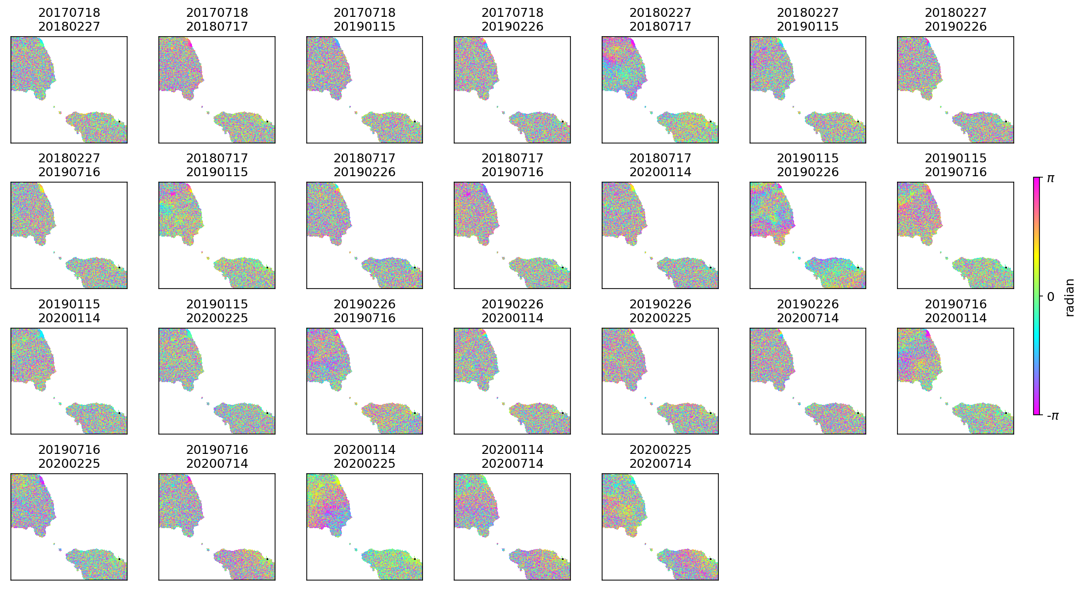
Here is an example of ALOS-2 interferograms from the stripmap (SM3) mode over parts of the islands of Samoa. The shorter intervals have some coherence everywhere, but the longer intervals are only coherent in the city of Apia (too small to see at this scale) and an area of unvegetated rocks. I used the ISCE2 workflow “alosStack” and then MintPy to make this plot.
This is the baseline plot for the ALOS-2 data used above. All of the baselines are less than 200 meters.
network.pdf (17.8 KB)