Hello everyone.
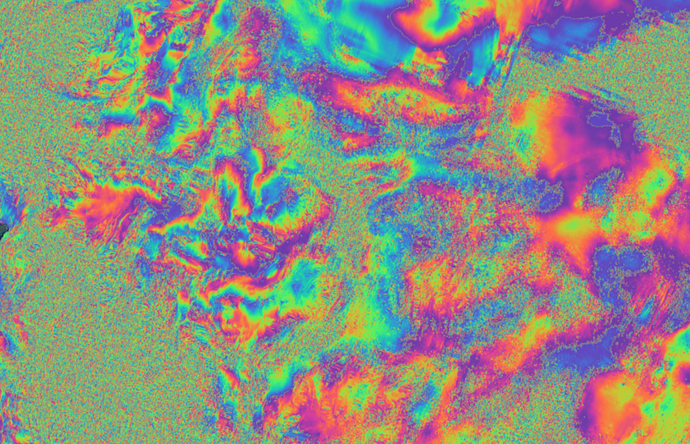
I am fairly new to SNAP and interferogram creation, and have been rather confused by a problem. I have checked through a number of threads on this forum before writing this, but I cannot find any answers. I am trying to generate interferograms over the South Patagonian Icefield (Argentina/Chile) with the objective of determining floating portions of ice outlets. I am familiar with the method for interpreting such interferograms and have seen it done in Antarctica, Greenland and elsewhere. However I am getting stuck at the interferogram formation and processing stage. I cannot get the interferogram to form any fringes whatsoever over ice, it always comes out simply as ‘noise’ (see figure below, specked area is ice). I am able to generate decent interferograms over land alone with the same tiles.
Is anyone here familiar with making interferograms over ice, and able to help me understand what is missing?
For info I have tried with several tiles ( and in other glaciated areas) and cannot get ice to resolve in any case.
Tiles used:
S1B_IW_SLC__1SDV_20190526T094342_20190526T094410_016413_01EE5F_6688
S1B_IW_SLC__1SDV_20190607T094342_20190607T094410_016588_01F39B_E4EC
Processing steps:
Coregistration with ESD > Interferogram formation > Debursting > Topographic phase removal > Multilooking > Goldstein Phase Filtering > Range Doppler Terrain Correction
As far as I can tell the problem arises within the first two steps. Could the issue be with ice losing coherence too rapidly for the 12 day image spacing to be usable? If this is the case does anyone have an idea which satellite data is generally used for glaciated areas?
Many Thanks-
Max


