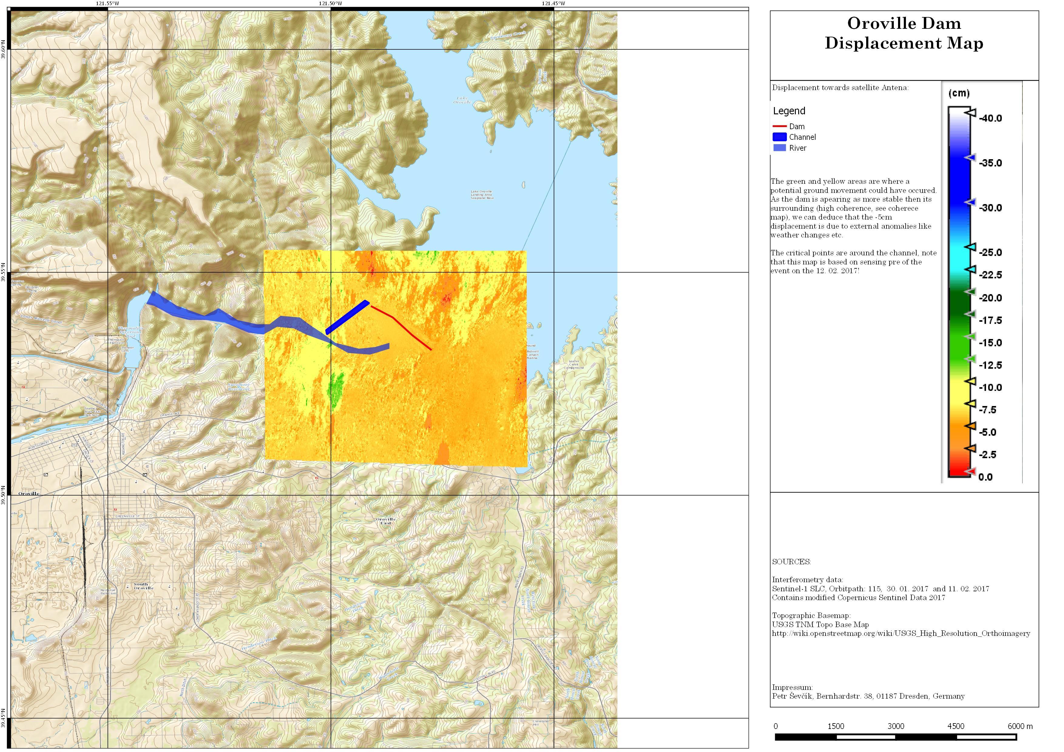
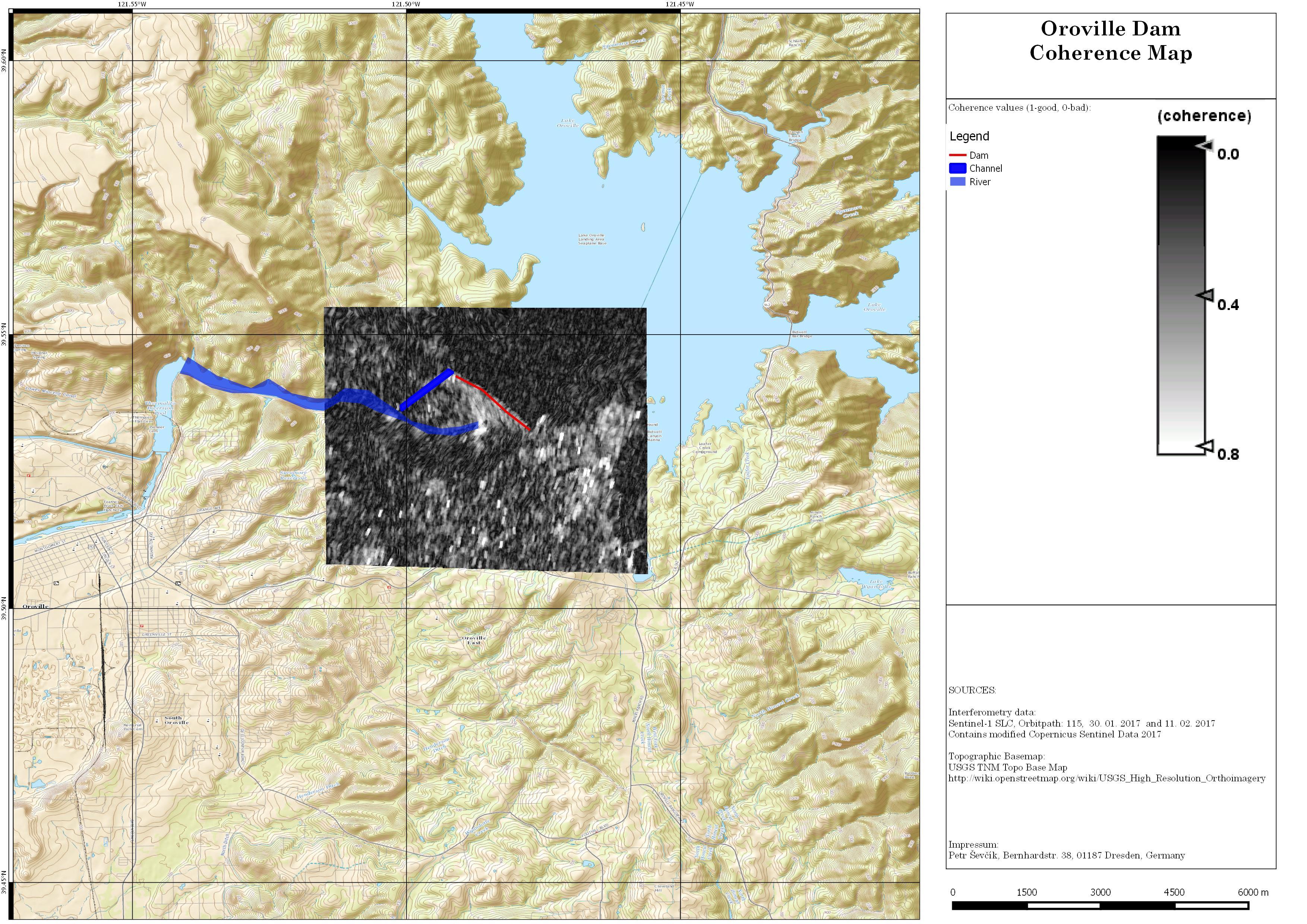
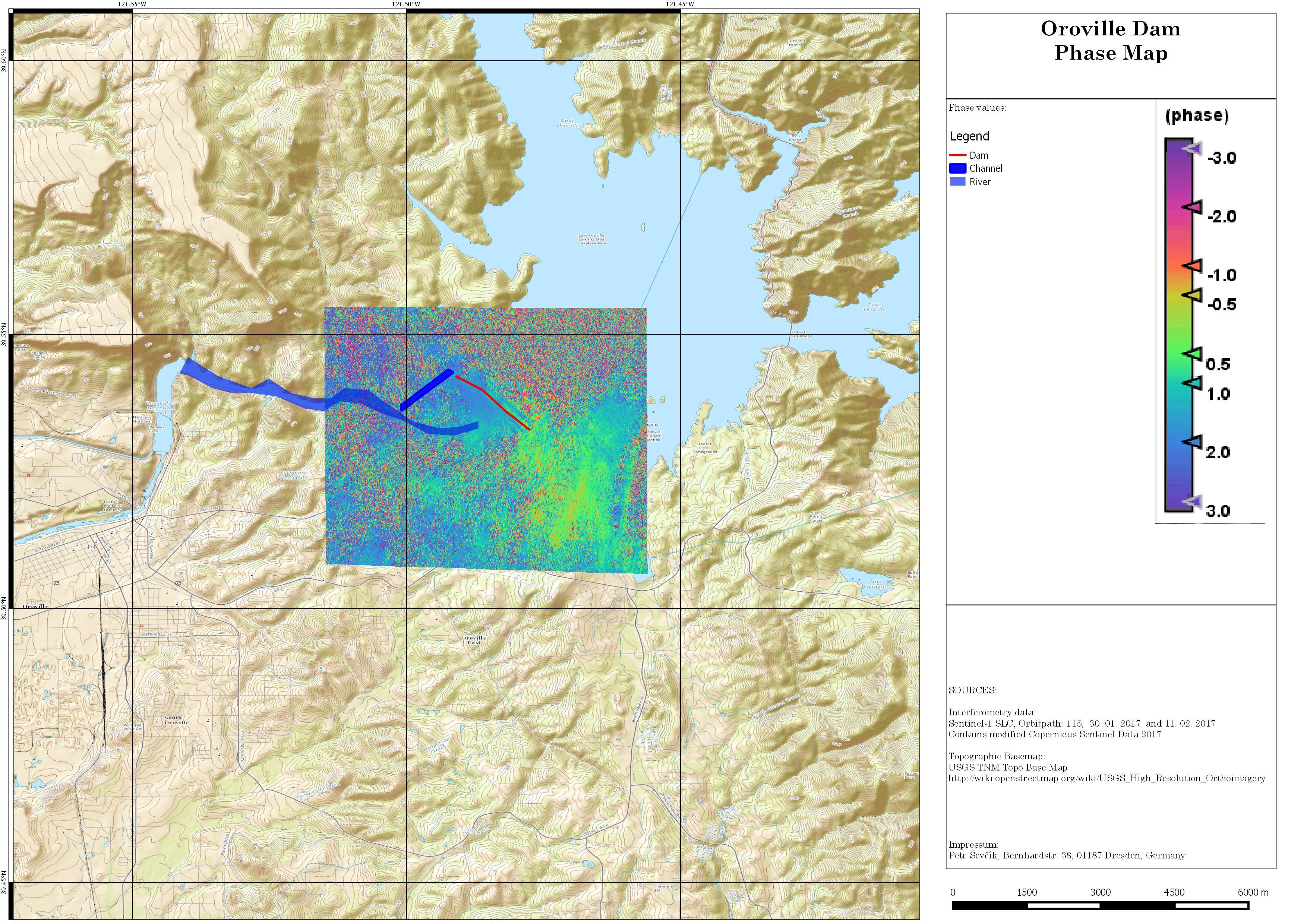
I was looking for a long time to apply TOPS on landslides or similar events, rather to predict them. Here is my processing result of Oreville event where there are 2 SLC products available, 1 day before the incident and 14 days back.
I call upon Interferometry gurus and would like you to share opinions if something like this is possible and if the measurements procured by the satellite could be interpreted as to connect them to the events that followed. And so if such a prediction is possible or not.
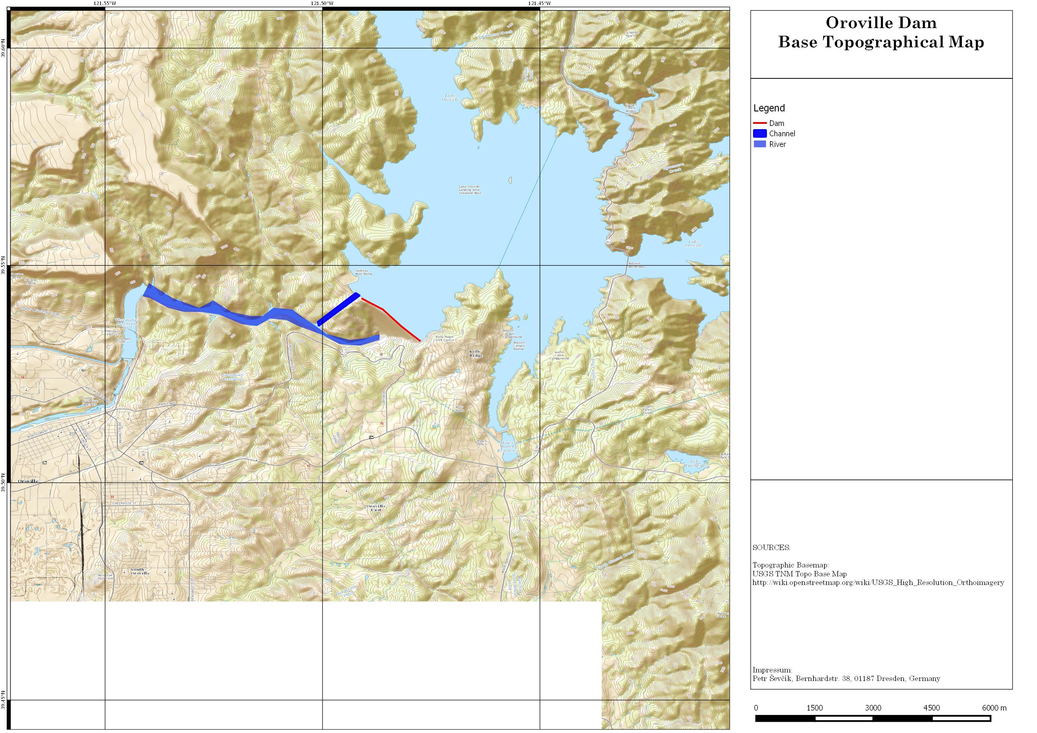
Default map:
Here are my results:
>
P.S.: Also would like to know if I am doing anything wrong.