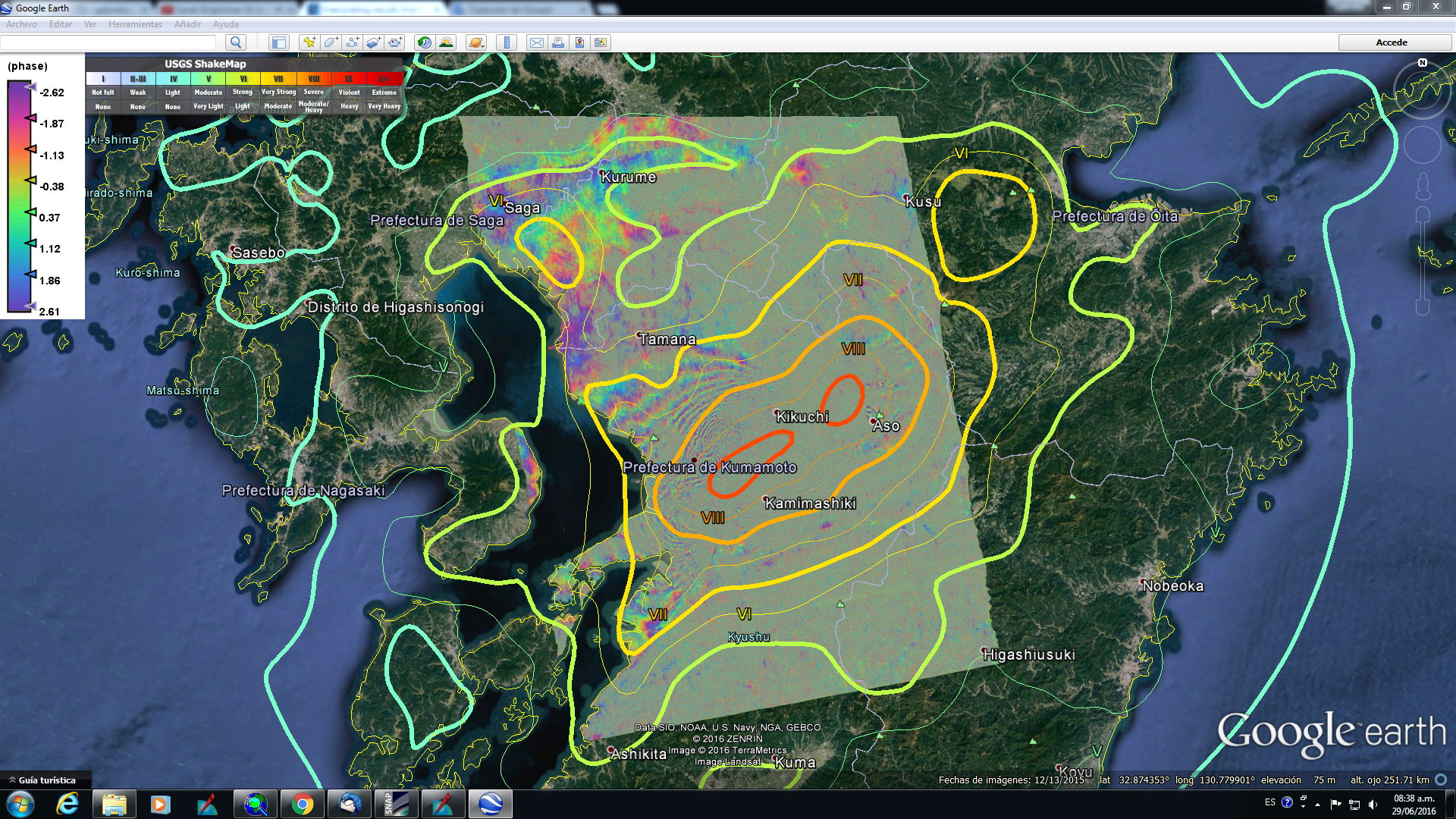
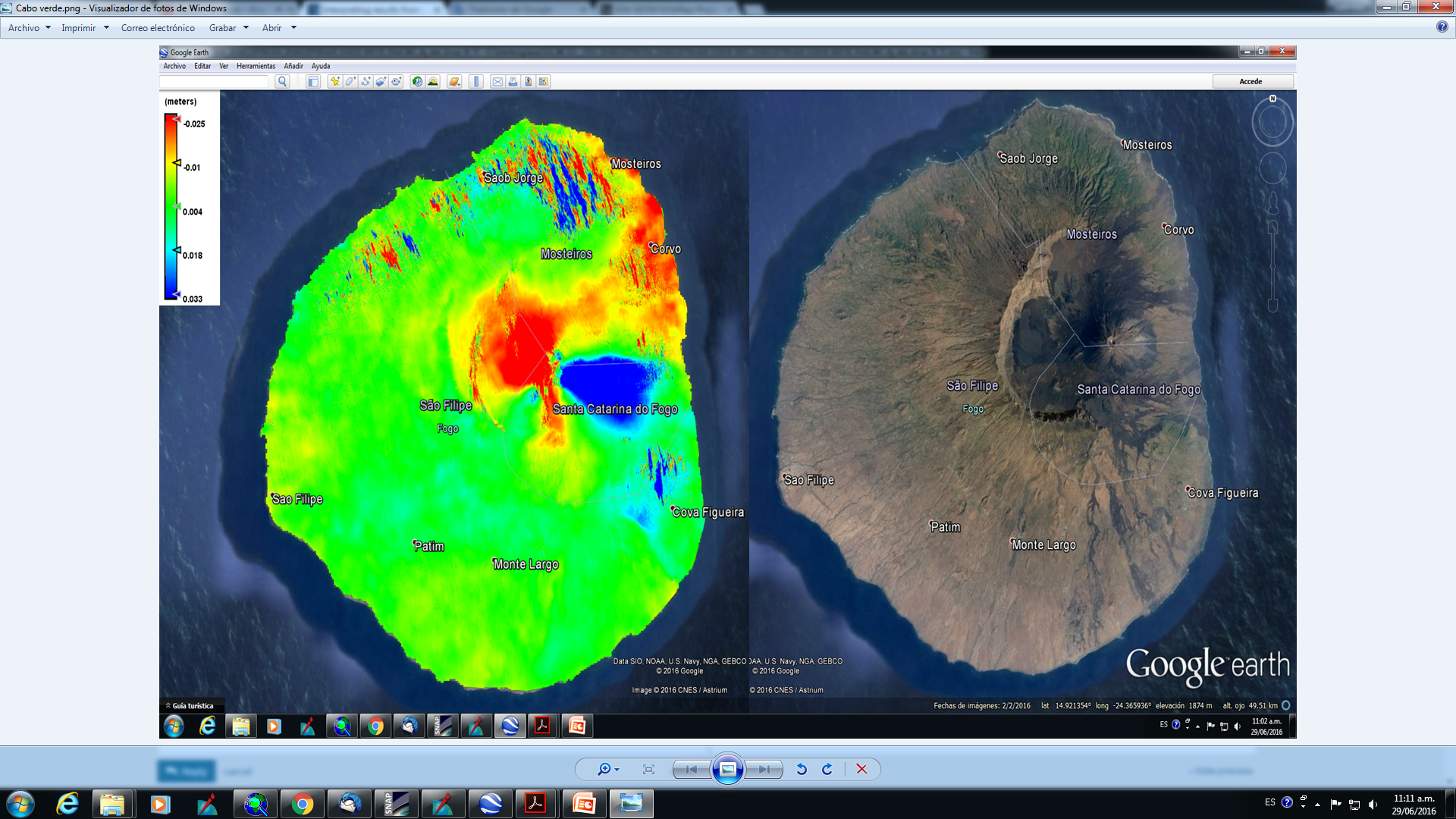
I have generated displacements from S1/A repeat pass (~ 2 weeks interval) using 2 pass method. Using the phase to displacement tool, it yields LOS displacements which can be converted to vertical displacements using incidence angle.
From the resulting displacement map, it appears that the values are large (cm level deformations). Previous literature observed mm-level deformations per year. So it seems my results are unreasonably large.
From this, I have a few questions
Is it wrong to using incidence angle to convert to vertical displacement? Considering that the incidence angle are about 41 to 45 degrees for S1/A, they might be less sensitive to vertical displacements
For displacement maps, am I supposed to use a pair of images with Bperp that is <5 m?
I have read that the displacements are ‘relative’. In this, I am not sure what it means. I understand displacements are relative based on the MASTER image, is that what this mean?
Am I supposed to rely on GPS measurements to correct my insar results? (in order to obtain the mm-level results reported in literature)
How can I combine results from ascending and descending to get a true vertical motion?
I couldn’t get my head around the values of displacement that I’m getting. Would greatly appreciate any help here.
You are probably seeing the effect of the atmosphere, i.e. atmospheric artifacts. It is unrealistic to think that you can detect a deformation that is 1/25th of “millimeters” in a two week interval. For small signals you would need to do Persistent Scatterer Interferometry (PSI) - in the future you can use the S1TBX to do the pre-processing for PSI.
Is it wrong to using incidence angle to convert to vertical displacement? Considering that the incidence angle are about 41 to 45 degrees for S1/A, they might be less sensitive to vertical displacements To obtain the vertical motion/displacement you need to combine ascending and descending SAR measurements.
For displacement maps, am I supposed to use a pair of images with Bperp that is <5 m? In principal, Smaller Bpepr reduce sensitivity to topography and so less residual topo phases and more accurate displacement estimates.
I have read that the displacements are ‘relative’. In this, I am
not sure what it means. I understand displacements are relative based on
the MASTER image, is that what this mean? DInSAR measurements express the differences between two dates. Values are relative within the interferogram. You need to select an area to consider as “stable” (displacement put to zero).
Am I supposed to rely on GPS measurements to correct my insar
results? (in order to obtain the mm-level results reported in
literature) Integration of InSAR and GPS is not straightforward, you need to review the literature on that matter. To get accuracy of mm.level from InSAR more sofisticated techniques should be applied (see mengdahl responce).
How can I combine results from ascending and descending to get a true vertical motion? Addressed before.
Yes it’s better to use a longer temporal baseline provided that the scene stays coherent (normally it doesn’t). Another option is to take a large number of pairs with a short temporal baseline and average the measured displacements - this way the atmospheric/ionospheric artifacts will be reduced (as they are mostly random). Still, without a large-stack and PSI-processing (which mitigates atmospheric effects) it’s difficult to detect movement that is only millimeters per year.