How would I know if the topographic phase removal was successful? I have applied it during the interferogram creation step and I still feel like the topographic effect still persists


you can output the topographic phase by the TPR operator and see if there is a difference.
Also I recommend using the DEM of highest resolution (here SRTM 1Sec AutoDownload)
1 Like
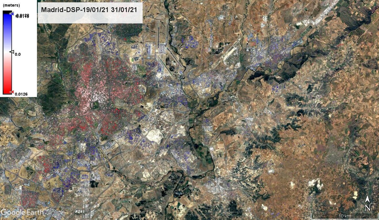
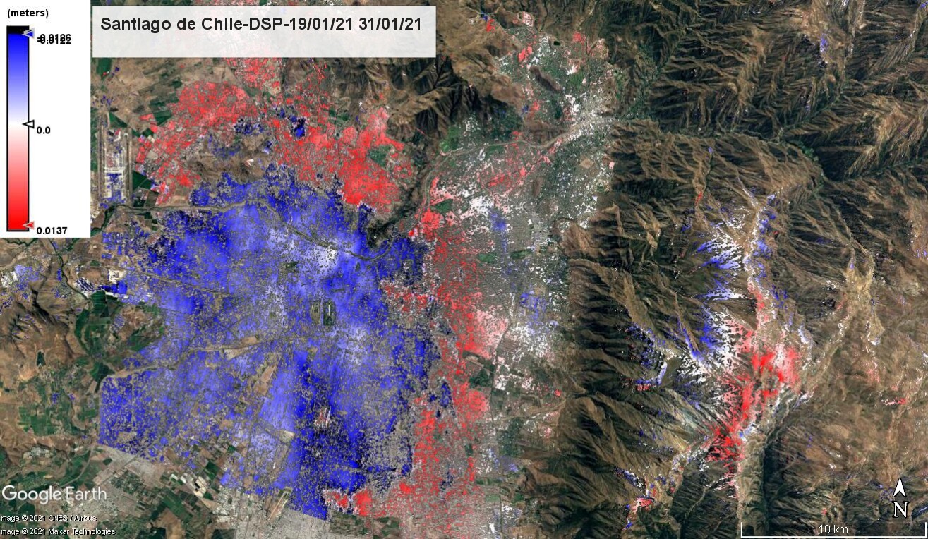
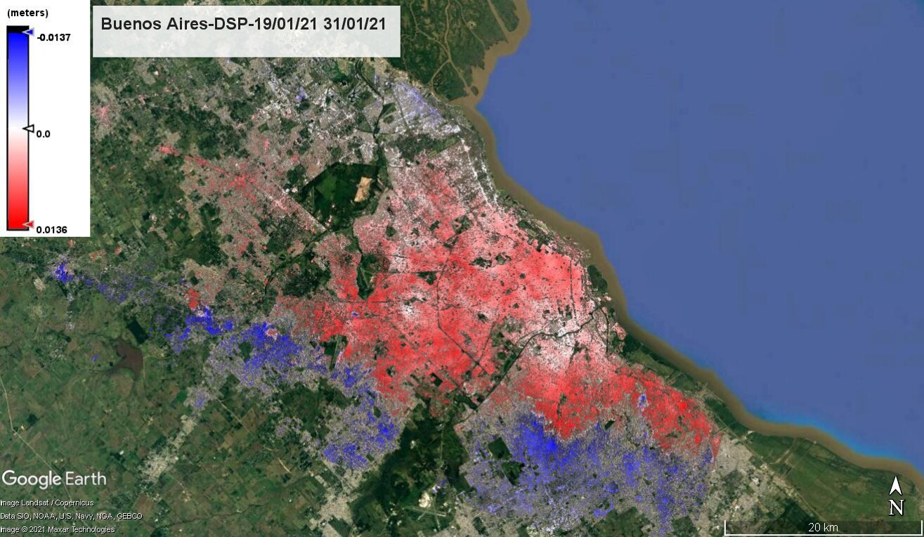
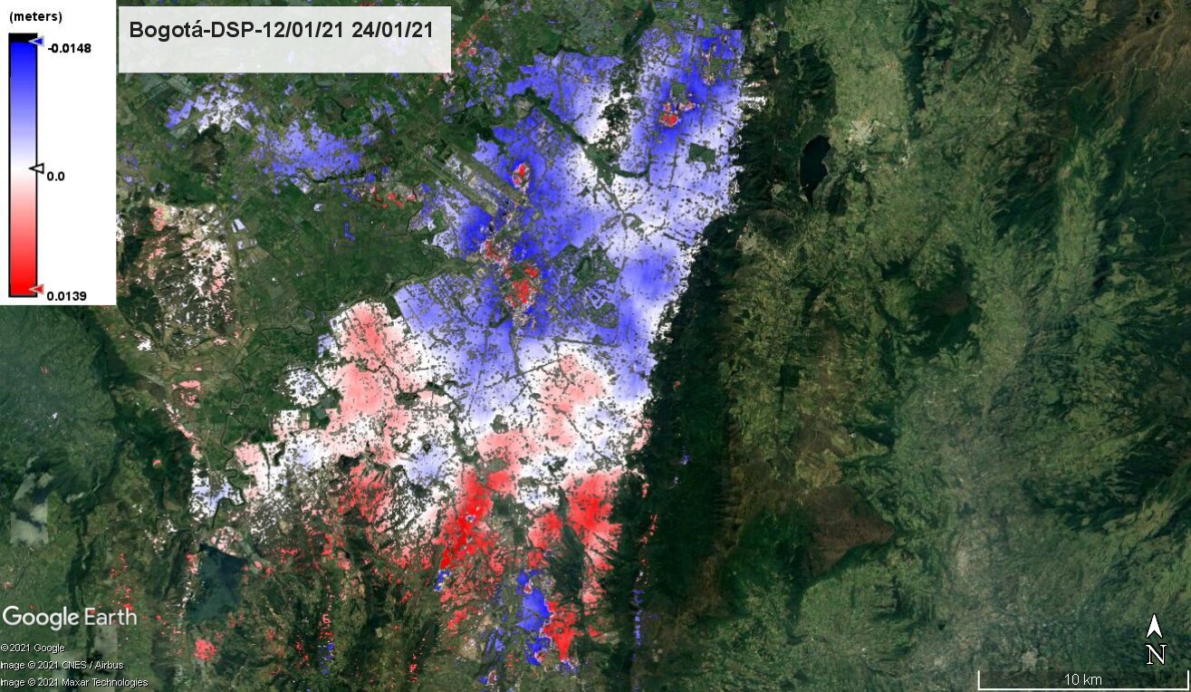
Hello everyone, I would like to share with you some testing results of the following workflow on sentinel 1 imagery (first image 19/01/2021, second image 31/01/2021):
Orb, Corregistration with ESD, Interferogram formation
with subtract topographic phase, Golstein phase filter, Deburst, Multilook, Snaphu export, Snaphu unwrapping, Snaphu import, Phase to displacement, finally the displacements shown are only for Coherence > 0.6.
From the results is possible to see that all displacements are between -1 and 1 centimeter, however I would expect not displacement in urban areas, at leats not for the same day in different places around the world. Should I assume that there is an associated error of +/- 1 cm for the DINSAR results? In that case, how could I perform a time series analysis and don’t confuse any real displacement with the associated error? In advance thanks for your reply.

especially on this point, please have a look at the following FAQ entry: I calculated displacement with DInSAR, but the resulting range of values is unrealistic
What causes the sharp jump from blue to red in Santiago de Chile and Buenos Aires for example? It’s as if the phase is still wrapped.