I’m working with sentinel 2, I’m wondering if it’s necessary reproject the images of type S2B_MSIL2A, being those, images that have correction atmosferic and they’re reprojected, according their specifications. Please help me with my doubt ![]()
![]()
The images are map projected to the UTM CRS, as you already said, so there is usually no need to reproject them again. Except you need the data in different CRS, e.g., WGS84, then you need to reproject them.
So, it depends on your use-case if a reprojection is necessary or not.
1 Like
Sentinel-2 images use WGS84 as CRS and are projected to the plane using the UTM system. Only if you would like to change the projection to other type, you do not need to do anything.
“For Level-1C and Level-2A, the granules, also called tiles, are 100x100 km2 ortho-images in UTM/WGS84 projection.”.
1 Like
Thanks for your reply!. I’m making a mosaic and the parameters that’s as the image show, well I think in this case I’d change the projection…from geographic to utm
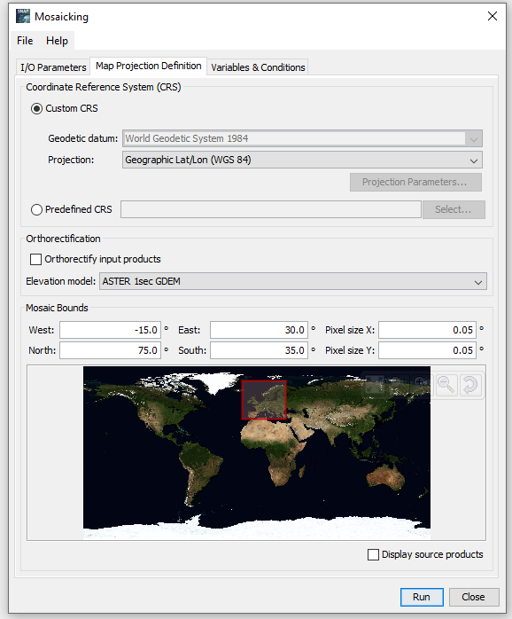
If you are mosaicking, you need to define the projection of the output. If the mosaic is very large, and you cannot define a UTM zone, maybe you can leave it as lat/lon. But if you want to put the results in a map form, I would recommend project into a plane using UTM (or whatever is typical in your country for maps). If you use UTM /WGS84, which is used in Europe, it will automatically assign the UTM zone. I guess this is up to you, If you are manipulating the data in a GIS and adding layers, it is recommended to use a map projection.
1 Like
That clarifies a lot of things for me. Txs very much ![]()