Is this a feature on SNAP? Or at least can SNAP transform the 2d interferogram into a 3d exaggerated displacement model, like the next image ? if so, could you please direct me to a tutorial ?

you can use SNAP to determine surface subsidence as shown in the interferograms
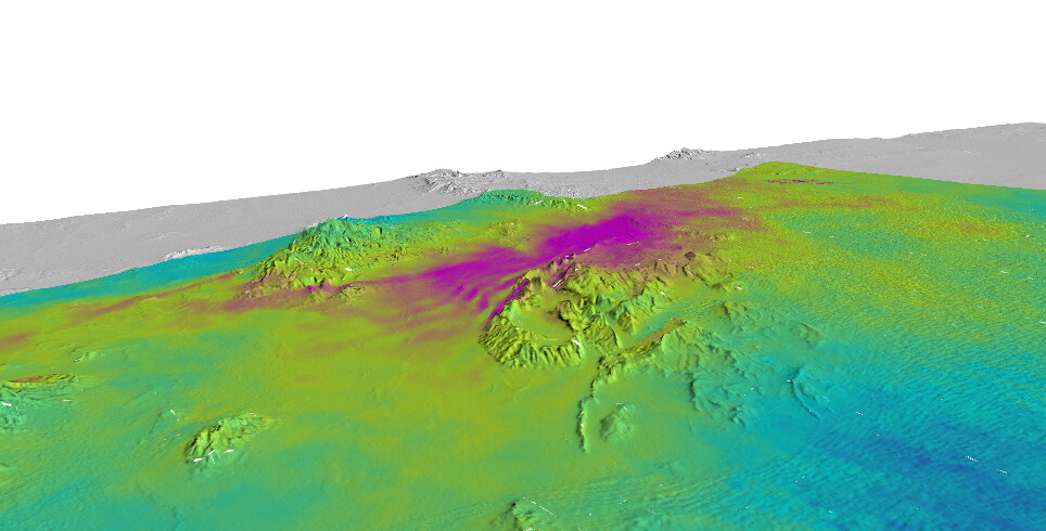
(Sentinel-1 TOPS interferometry, InSAR Displacement mapping with ERS data), but for 3D plots of the created results I would rather recommend QGIS (like in this example)
1 Like
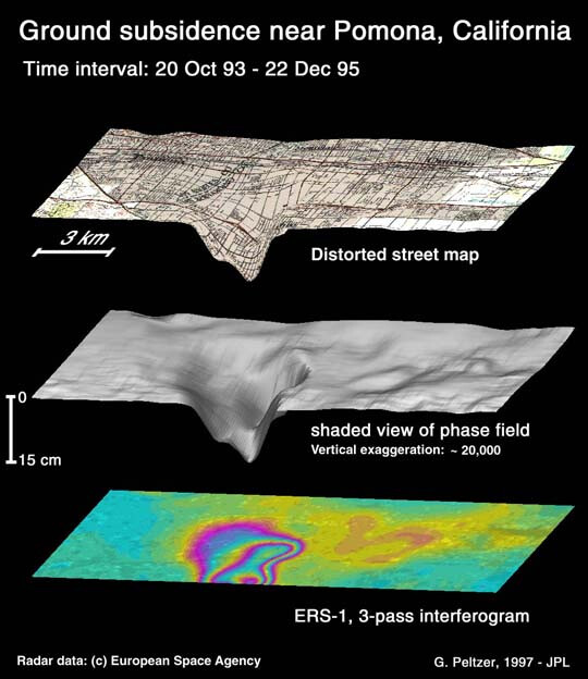
Quick test with an unwrapped interferogram from ASF and a 90m SRTM of the same area.
Not perfect, but works well.
2 Likes
Snap outputs a terrain corrected phase to displacement image and the unwrapped interferogram in (BEAM-DIMAP format), will this format be readable in QGIS? or should I make some conversion ? I would like to represent the amount displacement itself in a 3d layer instead of numbers. It’s like taking a displacement profile plot but over an area instead if a line.
yes, simply stick to the BEAM DIMAP format and use the img files inside in QGIS. This is explained here: Export of products from SNAP
The 3D view allows you to define which layer is used as heights (z value), so you can either use a DEM or the displacement itself (as in your example).
1 Like
I have tried to follow the example you’ve provided but unfortunately QGIS couldn’t establish a 3d displacement profile, looks like it only works for DEM
can you please show a screenshot of the map and the tool configuration?
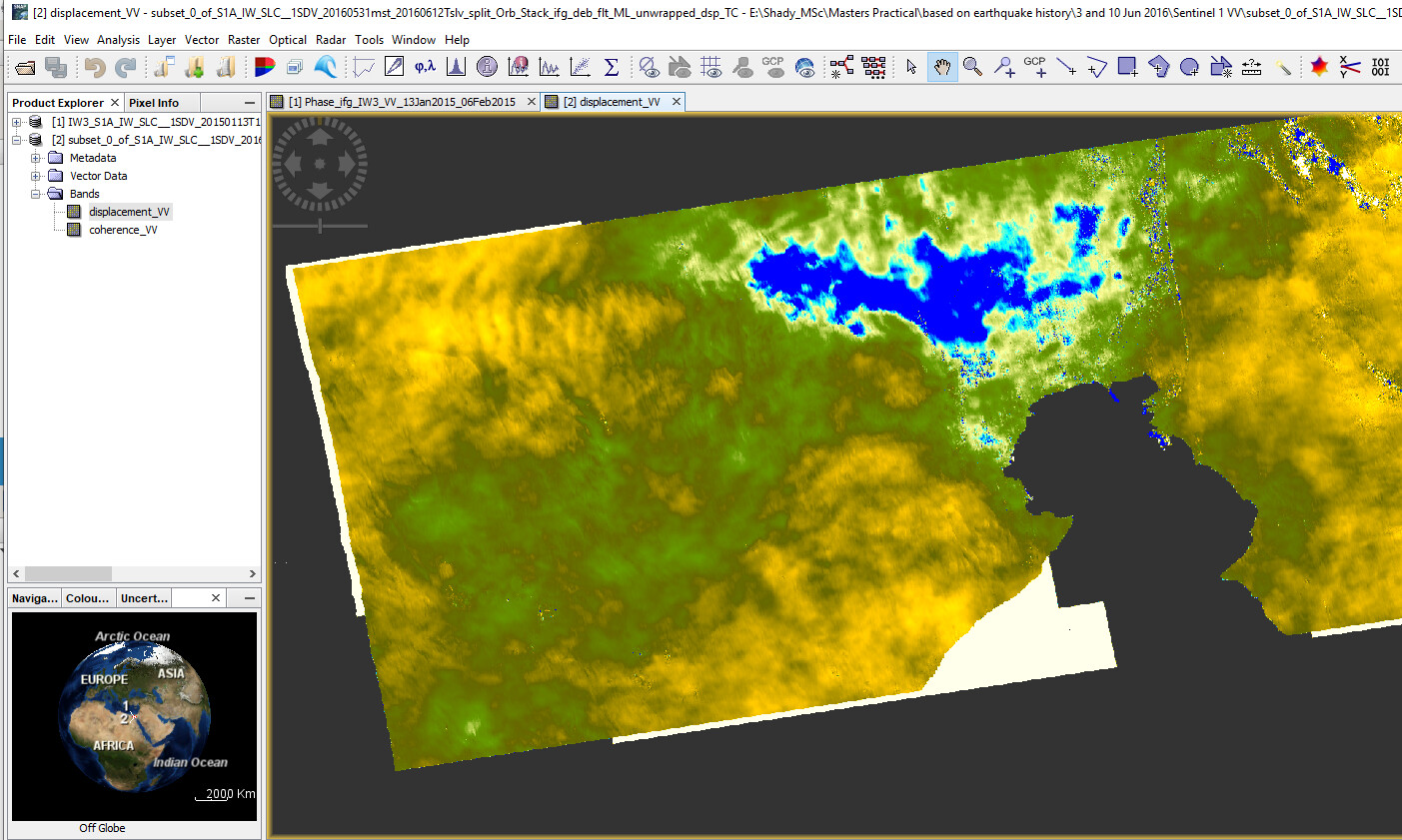
This is the phase to displacement image
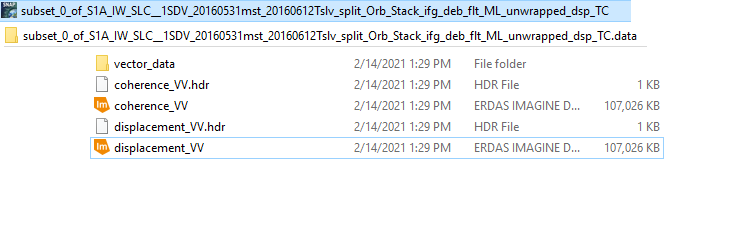
and these are the folder contents resulted from SNAP
and this is how the diplacement (img.) looks like on QGIS
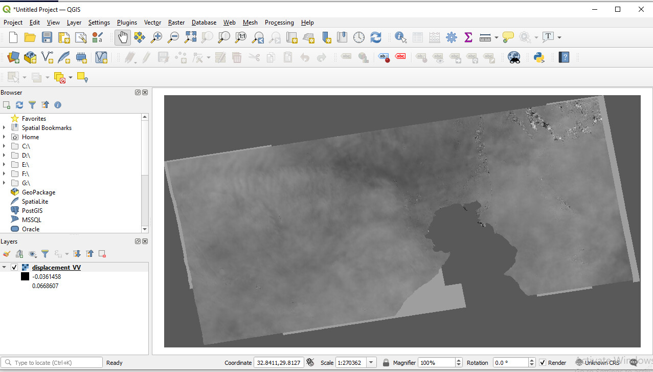
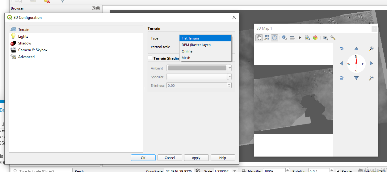
and in the #D view, it stays no matter which terrain type I choose
good, now you apply a color scheme to the image in the band properties and set 0 as the transparent value to remove the black data outside.
In the 3D Configuration you select DEM (Raster Layer) and then the displacement_VV raster. This allows you to refine the vertical scale (Standard is 1.0, but you might need to increase it to increase the terrain exaggeration).