Hello, I am a student new to GIS and SNAP software. I am trying to export Sentinel-1 radial velocity (RVL) bands from an OCN product in SNAP to a format usable in ArcMap. The OCN product is downloaded from Copernicus Open Access Hub.
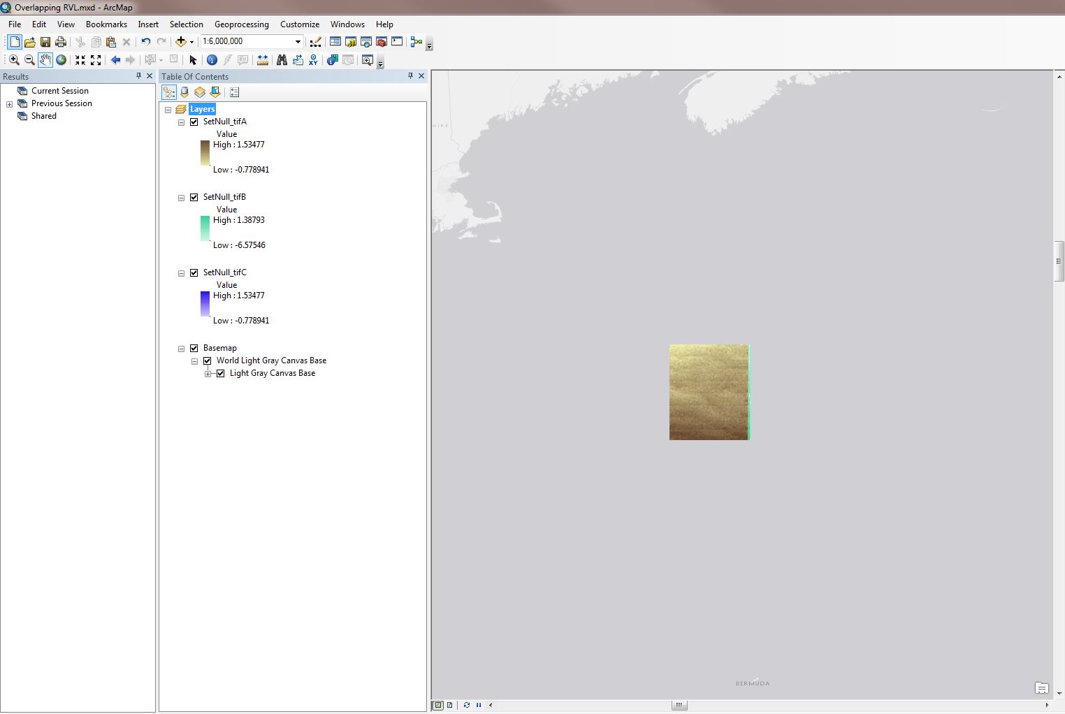
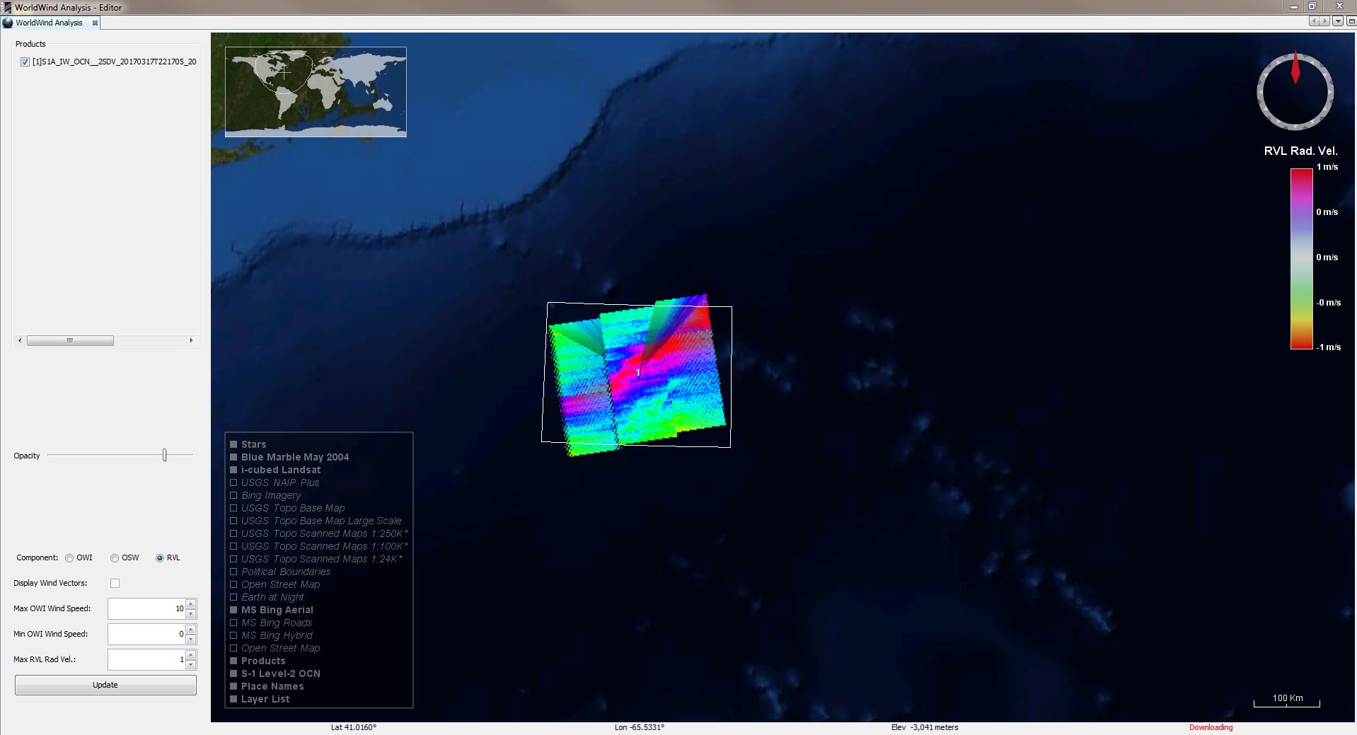
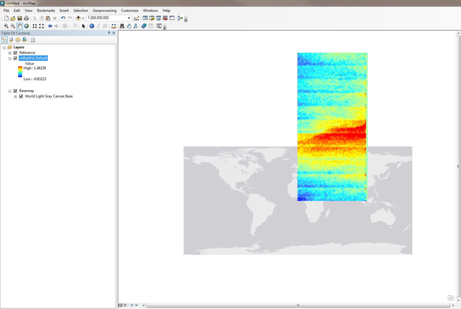
The issue that I am having is that the geotiffs I export from SNAP are in the approximately correct location, but overlap and appear to be poorly georeferenced (See image 1: the exported and corrected RVL Geotiffs in ArcMap, versus image 2: the RVL bands in WorldWind Analysis).
Background Information:
I am using SNAP version 6.0 on Windows 7, with 16GB RAM. I am using ArcMap version 10.4.1.
The name of one the product I use in this question is: “S1A_IW_OCN__2SDV_20170317T221705_20170317T221730_015738_019E85_FACA”
Mission: Sentinel-1 Instrument: SAR-C Sensing Date: 2017-03-17T22:18:45.478Z Size: 12.04 MB
The steps for my method are as follows:
-Download OCN product for 17-03-17
-Open product in SNAP.
-Attempt to take a Subset of the product (so that I can select the rvlRadVel bands I am interested in).
-Warning dialogue says that I must resample the product before selecting the subset of bands.
-Resample product (Raster > geometric operations > resampling) under the following parameters:
I/O Parameters left default.
Resampling parameters: (define size of resampled product > by target height and width).
This happens to be 257 width by 166 height. I do this because many bands have a small individual size, but combine to a larger size. For example, the “vv_001_IW1_rvlRadVel”, “vv_001_IW2_rvlRadVel”, and “vv_001_IW3_rvlRadVel” bands I am interested in form a single larger raster when displayed together (see image 2).
The rest of the Resampling parameters are left at their default (upsampling method: nearest, Downsampling method: first, Flag downsampling method: first, checked box for “Resample on pyramid levels for faster imaging).
-Run Resample
-From the resulting product, I take the subset of bands I am interested in (i.e. the three rvlRadVel bands).
-This forms another product, from which I then export the bands individually (File > Export > geoTIFF for each of the 3 bands).
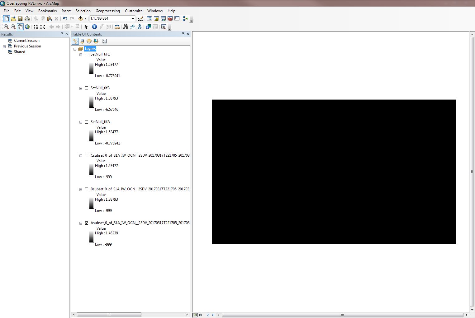
-This leaves me with 3 Tiff files to load into ArcMap, which appear black due to their stretched symbology trying to include the -999 null values as the low end of the color ramp (See image 3 below).
-I get around this by using the “Set Null” tool to get rid of the null values, leaving only the range of actual radial velocities (these are displayed, albeit overlapping, in image 1).
-To Set Null, I input the RVL raster as both the conditional and constant value rasters with the SQL expression set to “value = -999”.
This places the corrected raster in the approximately correct place geographically, but when I do this for each band, the rasters are all mapped to the exact same location on top of one another, what is more, they do not seem to have the correct orientation that they display when loaded in WorldWind analysis view in SNAP (see images 1 and 2). Their spatial reference is “GCS_WGS_1984”.
I spoke to my professor about this and he suggested that the Geotiff export might be missing tiff world files that determine the extra location, scale, and rotation parameters needed for them to display properly. However, I see no evidence of world files in SNAP and I was under the impression that Geotiff included all the necessary georeferencing information within itself.
I also wonder if, during the step where I take a subset of only the three RVL bands, I am excluding bands that somehow provide this extra information.
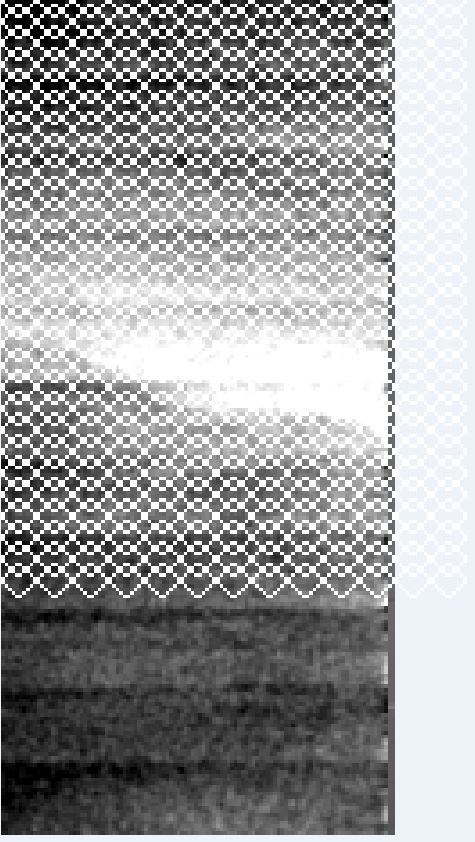
I have tried simply exporting individual RVL bands from the editor view (right click image > Export View as Image > Image Region: Full scene > save as Geotiff), but this produces images with strange cross-hatching artifacts (see image 4 below).
I have tried to calibrate the data (radiometric > calibrate), but an error message warns that I must input a SAR product. I know that RVL data is SAR derived so I am unsure if the data requires calibration, and if so, how it would be calibrated.
I have also tried extracting the NetCDF file directly from the zipped OCN product for use in ArcMap, but the RVL rasters appear to overlap there as well (see image 5 below). Additionally, the spatial reference is undefined and I am having trouble defining it properly (I have tried different variations of WGS1984 with no results).
If you have any ideas as to how I can fix this issue, streamline my process, or know of an easier method, they would be greatly appreciated.
Additionally, this is my first post on the SNAP forum, so if you have any advice on how I could improve my post or point out mistakes to avoid in the future, they would also be greatly appreciated.