Hello Everyone
I am trying to find out the inundated areas during a flood. The data used is SAR Data: Sentinel-1A_IW_GRDH_1SDV data. The steps followed were:
-
Creation of Subset
-
Calibration
-
Speckle Filter (Lee 3x3 window)
After Speckle filter, bands were converted from Linear to dB -
Radar-----> Geometric—>TerrainCorrection ----> Range Dopler Terrain Correction .
in step 4 the SRTM 1Sec HGT(Auto Download) DEM was used.
After Terrain correction, the bands were converted from Linear to dB, then it was converted band and saved to file.
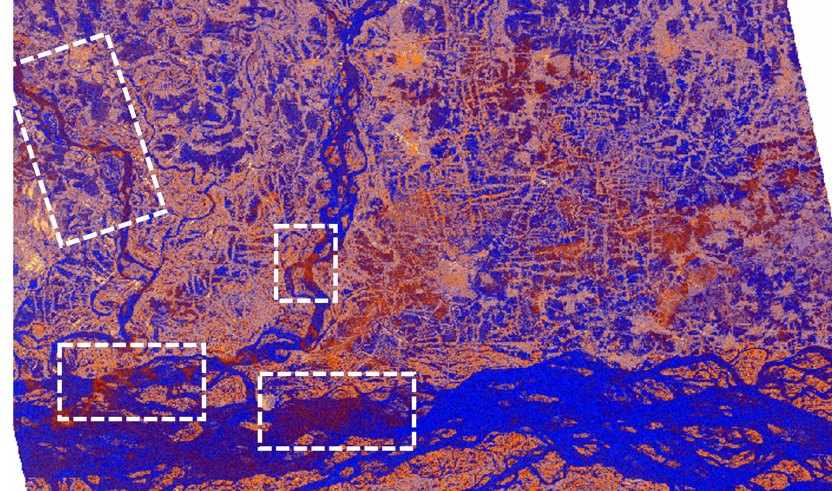
- Window—> Open RGB Image Window, here the RGB image channels were given as:
Profile: Dual pol Ratio Sigma0 VV+VH
Red= Sigma0_VV dB
Green = Sigma0_VH dB
Blue = Sigma0_VH dB - Sigma0_VV dB
When the RGB was generated, few patches (as marked in the attached picture ) are appearing as reddish brown in color , including a main river channel. As per my understanding, it appears in such color, only with highly moist soil.But in this flood scenario it is not possible to have a overflowing river channel exposed with moist soil. Do someone know why is it happening? Any suggestions to resolve this…
Thank you