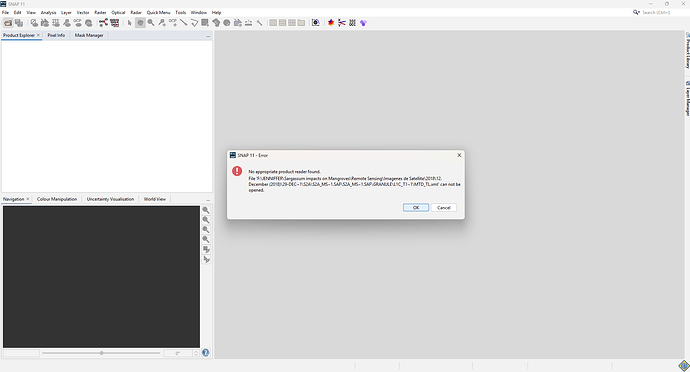
Hi all,
I recently became aware that Sentinel-2 data can now be downloaded through the Copernicus Data Space Ecosystem via the Copernicus Browser. I successfully downloaded a Sentinel-2 L1C image, and the file seems to have downloaded correctly.
However, when I try to open the MTD_MSIL1C.xml file (which I usually work with), I encounter an error. Interestingly, when I open the file in ArcGIS Pro, it works fine, and all the bands are displayed properly.
Does anyone have any recommendations for working with this data in SNAP? I know I can use ArcGIS Pro, but I’ve been working with SNAP for many years and would prefer to continue using it.
Thanks in advance for any suggestions!
