Hello all,
I posted smilar question about an month ago having gradient looking displacement and still having the exact same issue:Something is not right with my result :( - #7 by ArkLade
Some of you commented it may be because of long time interval (few years) so I re-did everything with fresh data (12 day interval):
S1A_IW_SLC__1SDV_20230316T000319_20230316T000346_047662_05B986_1A83.SAFE
S1A_IW_SLC__1SDV_20230328T000320_20230328T000347_047837_05BF6A_C649.SAFE
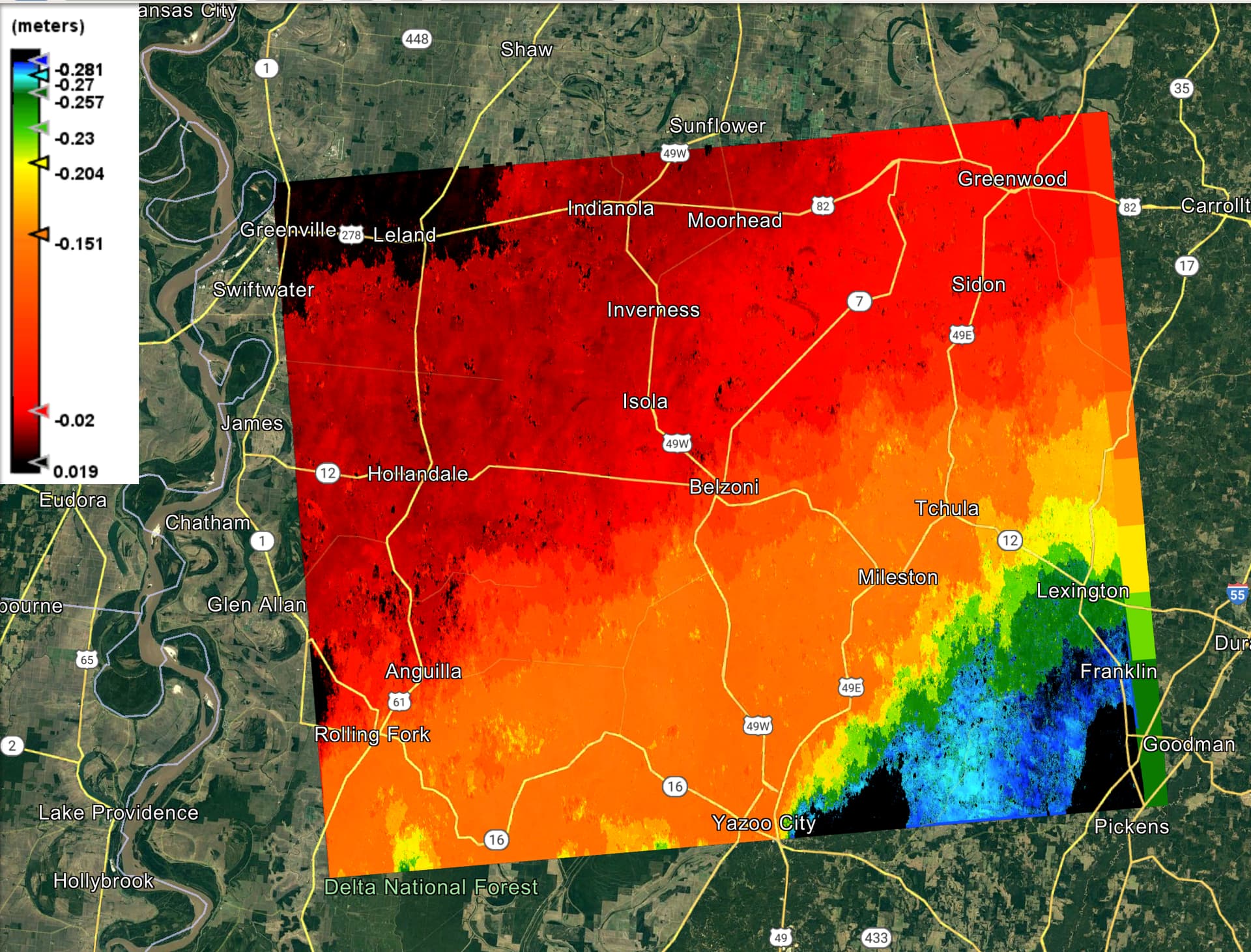
I am trying to see how well can InSAR pick up tornado damage. Many buildings were severly damaged and it was at Rolling Rork, MS, March 26, 2023. Below is updated workflow I did and some figures. Please help me what I might have done wrong.
I followed “TOPS Interferometry Tutorial” by Braun and Veci (2021) @ABraun to generate a surface displacement from a single image pair of SLC radar data.
Basic steps goes as follows:
- Download SLC pair
- Coregistration
- S1 TOPS Split
- Apply Orbit File
- S-1 Back Geocoding
- Interferogram Formation
- S-1 TOPS Deburst
- Goldstein Phase Filtering
- Subset
- Phase Unwrapping
- Export
- Unwarrping
- Import
- Phase to Displacement
- Range Doppler Terrain Correction
- Export as KMZ
I tried VV and VH on slighly different area.
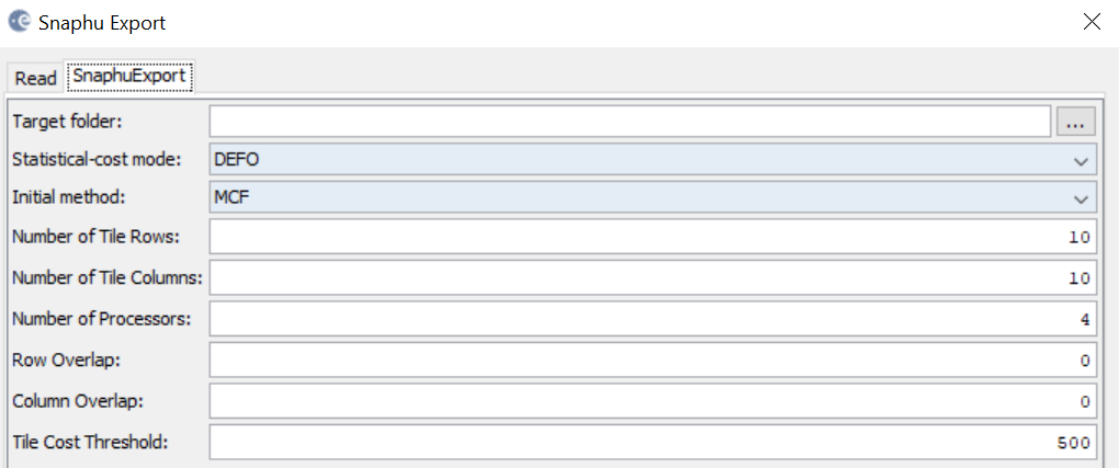
I used default setting for Snaphu Export
Everything worked out well without an error, but the end result is just not right.
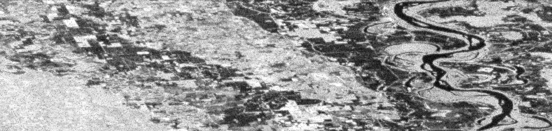
Intensity_VV
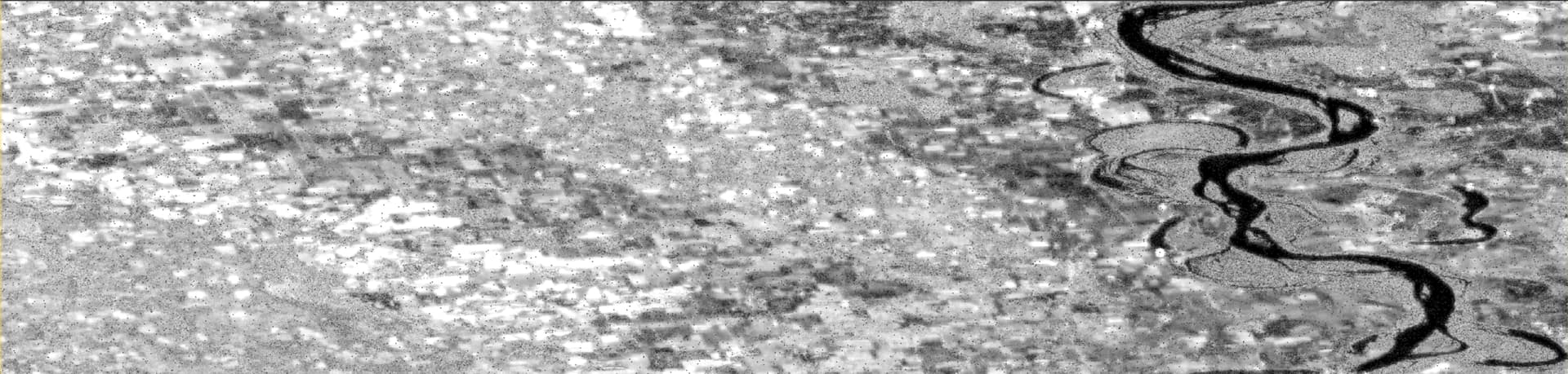
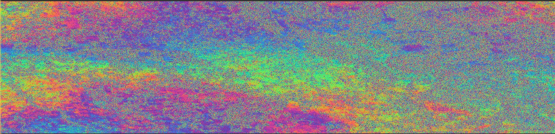
Phase_VV
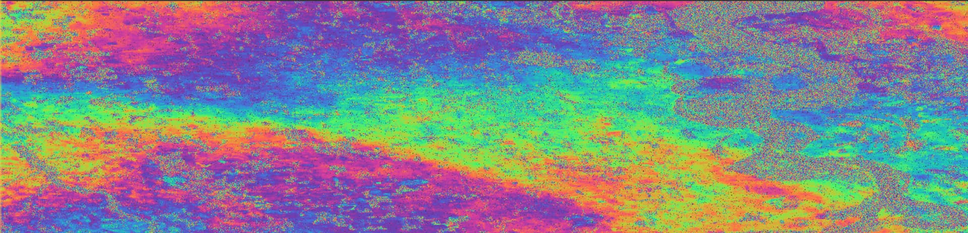
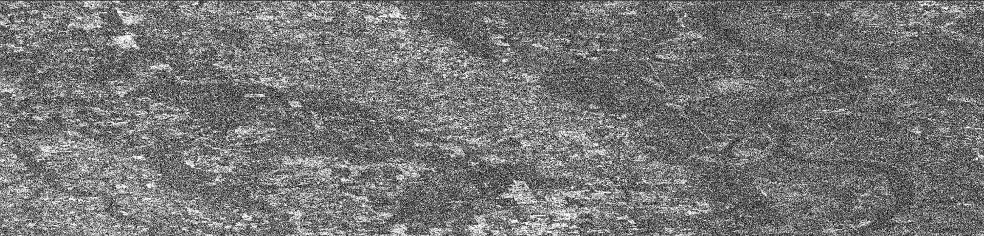
Coherence_VV
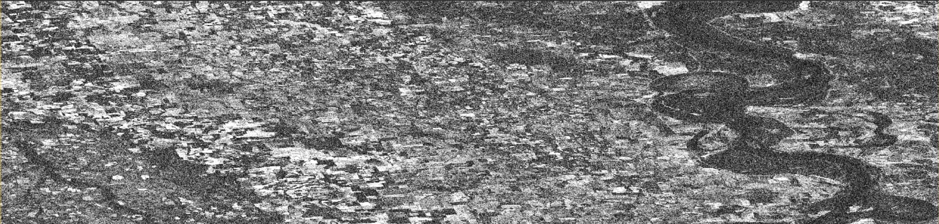
Intensity_VH
Phase_VH
Coherence_VH
Unwrapped Phase
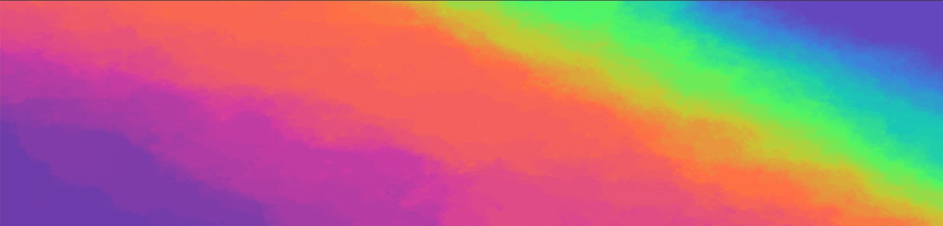
At the end, the both VV and VH displacement shows gradient pattern, which is just not right.
KMZ_VV
KMZ_VH
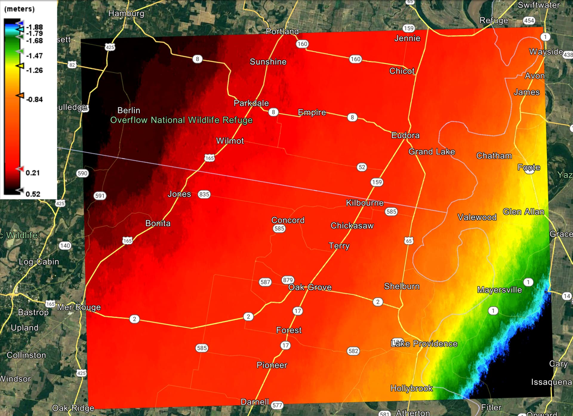
I was expecting to pick up some changes along the tornado path (vegitation and building damage ), but gradient looking displacement just don’t seem right.
Please help ![]()