Just tried with again, this time everything is a .tif and received an error -
java.lang.NullPointerException
at it.geosolutions.imageioimpl.plugins.tiff.TIFFLZWDecompressor.addStringToTable(TIFFLZWDecompressor.java:331)
at it.geosolutions.imageioimpl.plugins.tiff.TIFFLZWDecompressor.decode(TIFFLZWDecompressor.java:244)
at it.geosolutions.imageioimpl.plugins.tiff.TIFFLZWDecompressor.decodeRaw(TIFFLZWDecompressor.java:175)
at it.geosolutions.imageio.plugins.tiff.TIFFDecompressor.decodeRaw(TIFFDecompressor.java:2184)
at it.geosolutions.imageio.plugins.tiff.TIFFDecompressor.decode(TIFFDecompressor.java:2647)
at it.geosolutions.imageioimpl.plugins.tiff.TIFFImageReader.decodeTile(TIFFImageReader.java:1798)
at it.geosolutions.imageioimpl.plugins.tiff.TIFFImageReader.read(TIFFImageReader.java:2099)
at it.geosolutions.imageioimpl.plugins.tiff.TIFFRenderedImage.read(TIFFRenderedImage.java:300)
at it.geosolutions.imageioimpl.plugins.tiff.TIFFRenderedImage.getData(TIFFRenderedImage.java:284)
at it.geosolutions.imageioimpl.plugins.tiff.TIFFRenderedImage.getTile(TIFFRenderedImage.java:276)
at javax.media.jai.RenderedImageAdapter.getTile(Unknown Source)
at com.sun.media.jai.opimage.BandSelectOpImage.computeTile(Unknown Source)
at com.sun.media.jai.opimage.BandSelectOpImage.getTile(Unknown Source)
at javax.media.jai.PlanarImage.getData(Unknown Source)
at javax.media.jai.RenderedOp.getData(Unknown Source)
at com.bc.ceres.glevel.MultiLevelImage.getData(MultiLevelImage.java:64)
at org.esa.snap.core.gpf.internal.OperatorContext.getSourceTile(OperatorContext.java:449)
at org.esa.snap.core.gpf.internal.OperatorContext.getSourceTile(OperatorContext.java:435)
at org.esa.snap.core.gpf.Operator.getSourceTile(Operator.java:459)
at org.esa.snap.collocation.CollocateOp.collocateSourceBand(CollocateOp.java:668)
at org.esa.snap.collocation.CollocateOp.computeTile(CollocateOp.java:631)
at org.esa.snap.core.gpf.internal.OperatorImage.computeRect(OperatorImage.java:82)
at javax.media.jai.SourcelessOpImage.computeTile(Unknown Source)
Caused: org.esa.snap.core.gpf.OperatorException
at org.esa.snap.core.gpf.internal.OperatorExecutor$GPFImagingListener.errorOccurred(OperatorExecutor.java:381)
at com.sun.media.jai.util.SunTileScheduler.sendExceptionToListener(Unknown Source)
at com.sun.media.jai.util.SunTileScheduler.scheduleTile(Unknown Source)
at javax.media.jai.OpImage.getTile(Unknown Source)
at javax.media.jai.PlanarImage.getData(Unknown Source)
at com.bc.ceres.glevel.MultiLevelImage.getData(MultiLevelImage.java:64)
at org.esa.snap.core.gpf.internal.OperatorContext.getSourceTile(OperatorContext.java:449)
at org.esa.snap.core.gpf.internal.OperatorContext.getSourceTile(OperatorContext.java:435)
at org.esa.snap.core.gpf.internal.OperatorImage.computeRect(OperatorImage.java:75)
at javax.media.jai.SourcelessOpImage.computeTile(Unknown Source)
at com.sun.media.jai.util.SunTileScheduler.scheduleTile(Unknown Source)
at javax.media.jai.OpImage.getTile(Unknown Source)
at com.sun.media.jai.util.RequestJob.compute(Unknown Source)
[catch] at com.sun.media.jai.util.WorkerThread.run(Unknown Source)
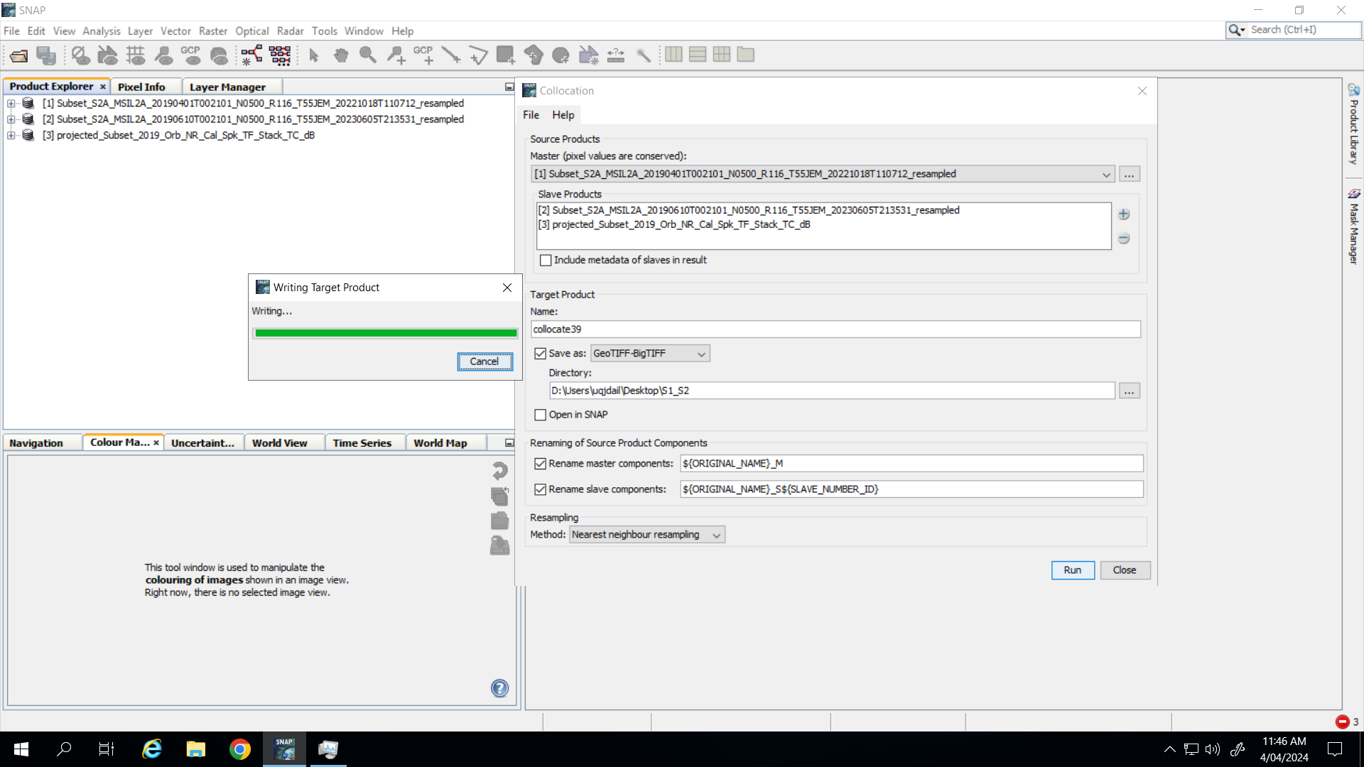
Apologiest for the delay, I wanted to try a few different scenarios. I completed pre-processing again on the S2 and S1 imagery. If I selected BEAM-DIMAP for the export type, it completes. If I select GeoTIFF-BigTIFF, it never completes.
Should I just collocate as BEAM-DIMAP and then open and export as GeoTIFF?
The same images that completed yesterday as BEAM-DIMAP (in roughly 3-4 hours) are almost at 24 hours now and no sign of finishing.
LOG file - I think I’ve reproduced the error, although I didn’t get the popup that is in my second post.
Traditionally SNAP-processing should always be done in the internal format, and exportes in a separate step. It seems that users are less aware of this than before - @TomBlock@diana_harosa what is the most recent recommendation and how to make users more aware?
Thanks for your response mengdahl. I was following the ARSET tutorial which stated to export the collocation product as a GeoTIFF.
So just to make sure I understand - I should collocate and save as BEAM-DIMAP, then export that product as a GEOTIFF (to use in a python script according to the tutorial). Is this correct?