I have a raster dataset with 81 band which I changed the band names and saved as beam dimap format. And now I wanted to convert my data from .dim to GeoTIFF-BigTiff format but It throws me an error like this:
java.io.FileNotFoundException: D:\S1S2stack_2020.data\collocationFlags_S2_2020_10.img (Sistem belirtilen dosyayı bulamıyor)
at java.io.RandomAccessFile.open0(Native Method)
at java.io.RandomAccessFile.open(RandomAccessFile.java:316)
at java.io.RandomAccessFile.(RandomAccessFile.java:243)
at javax.imageio.stream.FileImageInputStream.(FileImageInputStream.java:73)
at org.esa.snap.core.dataio.dimap.DimapProductReader.readBandRasterDataImpl(DimapProductReader.java:300)
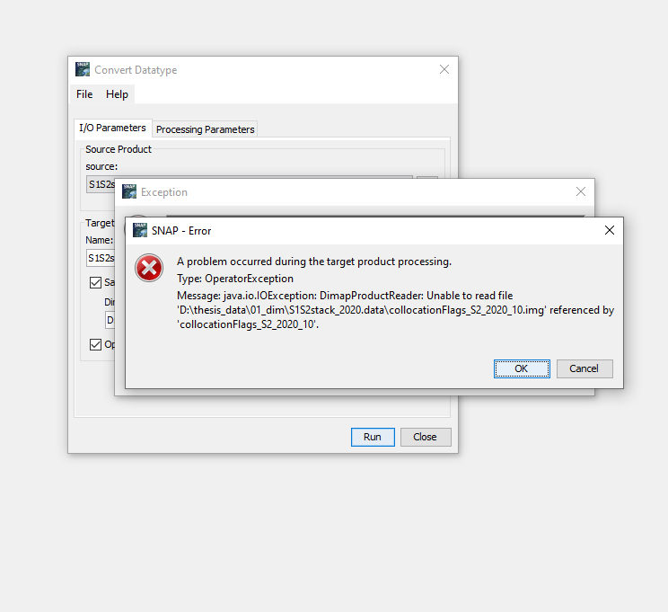
Caused: java.io.IOException: DimapProductReader: Unable to read file ‘D:\S1S2stack_2020.data\collocationFlags_S2_2020_10.img’ referenced by ‘collocationFlags_S2_2020_10’.
at org.esa.snap.core.dataio.dimap.DimapProductReader.readBandRasterDataImpl(DimapProductReader.java:318)
at org.esa.snap.core.dataio.AbstractProductReader.readBandRasterData(AbstractProductReader.java:277)
at org.esa.snap.core.image.BandOpImage.computeProductData(BandOpImage.java:68)
at org.esa.snap.core.image.RasterDataNodeOpImage.computeRect(RasterDataNodeOpImage.java:127)
Caused: java.lang.RuntimeException
at org.esa.snap.core.image.RasterDataNodeOpImage.computeRect(RasterDataNodeOpImage.java:129)
at javax.media.jai.SourcelessOpImage.computeTile(Unknown Source)
Caused: org.esa.snap.core.gpf.OperatorException: java.io.IOException: DimapProductReader: Unable to read file ‘D:\S1S2stack_2020.data\collocationFlags_S2_2020_10.img’ referenced by ‘collocationFlags_S2_2020_10’.
at org.esa.snap.core.gpf.internal.OperatorExecutor$GPFImagingListener.errorOccurred(OperatorExecutor.java:381)
at com.sun.media.jai.util.SunTileScheduler.sendExceptionToListener(Unknown Source)
at com.sun.media.jai.util.SunTileScheduler.scheduleTile(Unknown Source)
at javax.media.jai.OpImage.getTile(Unknown Source)
at javax.media.jai.PlanarImage.getData(Unknown Source)
at com.bc.ceres.glevel.MultiLevelImage.getData(MultiLevelImage.java:64)
at org.esa.snap.core.gpf.internal.OperatorContext.getSourceTile(OperatorContext.java:449)
at org.esa.snap.core.gpf.internal.OperatorContext.getSourceTile(OperatorContext.java:435)
at org.esa.snap.core.gpf.internal.OperatorImage.computeRect(OperatorImage.java:75)
at javax.media.jai.SourcelessOpImage.computeTile(Unknown Source)
at com.sun.media.jai.util.SunTileScheduler.scheduleTile(Unknown Source)
at javax.media.jai.OpImage.getTile(Unknown Source)
at com.sun.media.jai.util.RequestJob.compute(Unknown Source)
[catch] at com.sun.media.jai.util.WorkerThread.run(Unknown Source)