Hi everybody,
can I calculate LAI in the snap with pleidas sensor and ALOS-2 as well? how can I open pleidas in the snap?
ALOS-2 is a radar sensor and cannot deliver image products for direct LAI derivation.
Automatic LAI calculation is currently supported for Sentinel-2. I think Pléiades has not enough bands.
so, I have seen some papers about estimating LAI using radar,
http://ecologia.ib.usp.br/lepac/sensoriamento/BitencourtETAL2007.pdf
Both studies use field measurements of LAI.
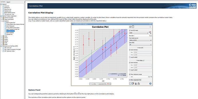
You can link any measurements to remote sensing data (or especially SAR backscatter) using the correlative plot view. Import the field data as a vector (CSV or shapefile) and this tool gives you a regression between your SAR data and your samples. Using this regression equation helps you to estimate the LAI for all raster cells. It is described quite well in the help section:
But there is no automatic way of doing it, e.g. directly reading LAI from radar data.
I see no radar data in the second study by the way.
I understood. Thank you so much.
