Hello everyone,
I tried applying the Land/Sea mask on a ROI, but it failed to nullify the pixel values depicting the area of a harbor. Thus, I tried creating a custom mask using the Mask Manager, but all it seemed to do was colorize the pixels corresponding to the function I used to create the mask, instead of nullifying them like the Land/Sea mask does.
What makes the mask applied from the Land/Sea Mask nullify the pixel values so visibly ?
Am I missing something at how the masks made with Mask Manager are actually applied ?
Thank you in advance for any input !
EDIT :
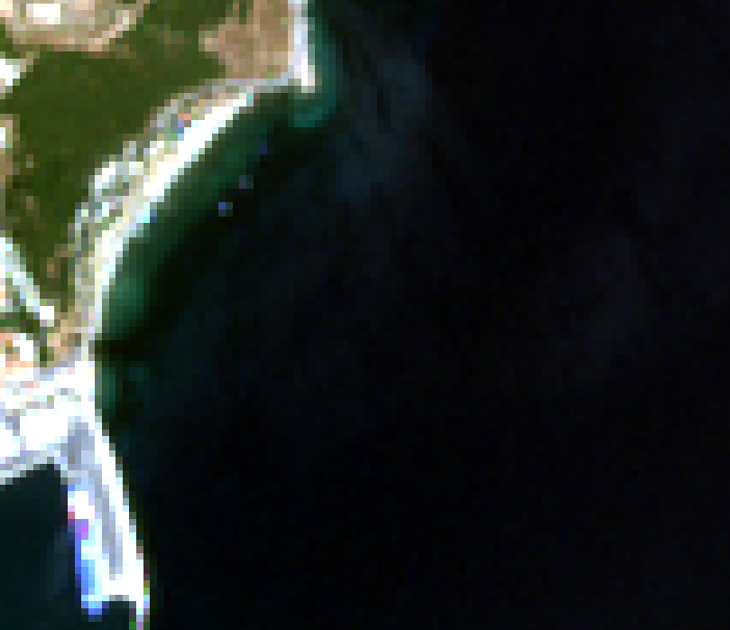
This is the RGB Natural Colors image of the subset I am using (an area of the Mitylene harbor). It is created from a Sentinel-2 L2A product, resampled to 10m. The elongated white shape on the lower left corner is the part of the harbor that was not processed by the Land/Sea mask as I expected.
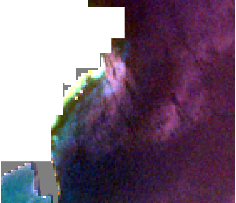
This is the same image after applying the Land/Sea mask. While most of the landmass has been masked out properly, the harbor area seems to have remained (Mr gnwiii mentioned below that it might be because of the resolution I am using)
The custom mask I am trying to apply is expressed as (B11>0.0375) and it covers the entirety of the pixels I would like masked out.
Original Image : S2A_MSIL2A_20180607T085601_N0208_R007_T35SMD_20180607T114919
My version is SNAP 8.0.9, Sentinel-2 Toolbox 8.0.7
I am running Windows 8 on the device I am using.
(Thanks to Mr gnwiii for pointing out the extreme lack of information on my original post)