Dear all,
I am trying to monitor a rapid landslide induced by heavy rainfall. I am stuck to determine which method of interferometry I should use. Kindly suggest
Regards,
Gokul
Dear all,
I am trying to monitor a rapid landslide induced by heavy rainfall. I am stuck to determine which method of interferometry I should use. Kindly suggest
Regards,
Gokul
Dear Gokul,
You should use the method of InSAR which will be matched with your purpose. As you said about a rapid landslide, I hope the SBAS is more comfortable for your case study.
Best regards,
Sayyed
I’m not sure interferometry will work as rain can destroy coherence outside the landslide, and the landslide itelf is likely to be decorrelated as well. Look at intensity images first and then try to see what the coherence is in a pair that spans the event (images nearest to the event in time).
Thanks for all the useful info. Could anyone suggest useful research publications for my case.?
By doing DInsar I am WKT which I used to subset is visible in my raster.I thought it will go away at final step but in google earth overlay also it is seen.Also, My final results doesn’t look promising. Kindly rectify where I have gone wrong
After applied it double click and delete it, it’ll be removed.
It can also be switched off in the layer manager.
It worked well and the box is removed. But my DInSAR output is not showing accurate results. I have taken master on 28july 2019 and slave on 21august 2019 with a Baseline of 58m.
How is the quality of your interferogram?
I am not seeing any changes on the placemark. But a landslide has occurred on Aug 10 at that placemark. How do I determine the quality of interferogram.?
does it look like this (good quality)?
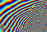
or does it look like this (bad quality)?
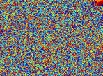
As mengdahl stated above: If the landslide was a non-coherent process, you cannot measure the displacement with DInSAR. Have a look at the coherence image over your landslide. If the values are low, decorrelation occured and you cannot reliably measure the displacement here.
Some reference on this:
#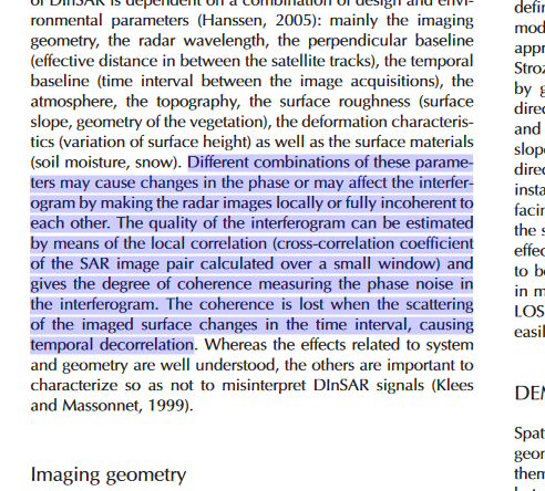
source: https://core.ac.uk/download/pdf/43658687.pdf
Also here:
The interferometric SAR signal will decorrelate when the displacement gradient between adjacent pixels is higherthan half the wavelength during the selected time interval(Massonnet and Feigl, 1998).
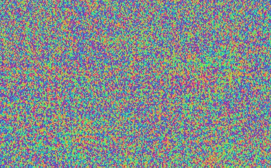
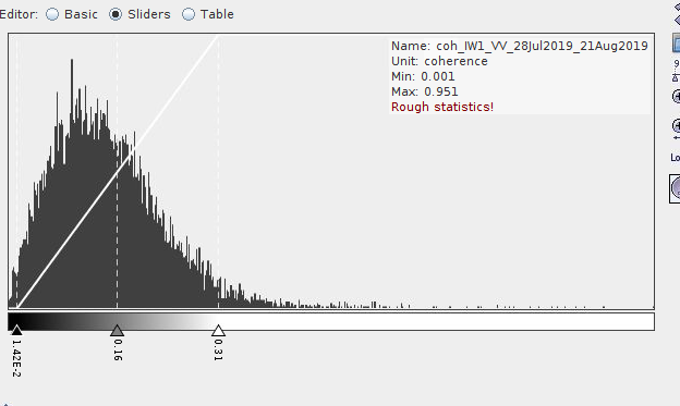
I don’t have those fringes in my interferogram. Now it is more obvious that I lack a good interferogram. Attaching the screenshots of ifg and coh of the subset.
what additionally matters is the looking direction of the sensor.
In an ideal case, the landslide moves along the range direction of the sensor. Maybe you can check if you find images with shorter temporal baselines (less temporal decorrelation) and a suitable imaging geometry.
Your coherence is very low so you have almost only noise and little signal. Try with a 12-day interferogram and see what the coherence is.
I have taken Descending orbit. Also, I proceeded with the master and slave obtained from Interferometry baseline calculator web tool. The tool is not showing any dataset with 12day interval. Is it ok if I manually choose the dataset? I am attaching the screenshot of the landslide from S2 FCC
if there is a pair with a higher suitablility (geometric, temporal, look direction), it is worth a try.
This study compares how the selection of pairs influences the quality of the interferogram of a landslide:
As you see, there can be considerable differences.
Hi, here is a recent study where they have done something similar. Check the references, I think there’s another conference paper by Mondini with more details on he pre-processing.
I haven’t tried myself yet, but hoping to soon. Let us know if you manage to get it working!
What does the coherence look like?