I don’t understand what is actually being done to my data when I click the box for “Save Layover Shadow Mask” in the SAR Simulation tool and in the Range Doppler Terrain Correction. Can someone describe the steps of the algorithm and/or please point me to the actual coding directives (in Github??) for the Layover Shadow Mask in SNAP? I also am not sure what my results are. What am I looking at, exactly? Thank you in advance for any insight!
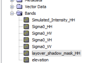
Thanks again for the follow up. I exported my mask layer as a Geotiff so I could analyse it more in ArcMap. When I open it I find that there are 7 bands of data. Logically it seems that these are the 7 bands of the file (see below image). I assume that Band 1 is Simulated_Intensity_HH, Band 2 is Sigma0_HH, etc. Does that make sense?
Is there any way that I can get a layover-shadow mask for the other polarizations besides HH? If so, how do I do that?
the shadow/layover effect is of purely geometric nature and exactly the same for all polarizations.
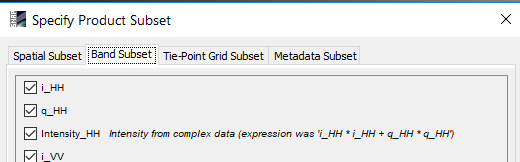
Try to export only the layover mask in the GeoTiff export by clicking subset and then switch to the band subset dialogue.
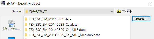
Here you can remove all bands besides of the mask.
But be aware that exporting to GeoTiff converts the values of your raster and the encoding above might no longer be the same.
Thanks! I’m working on this now…