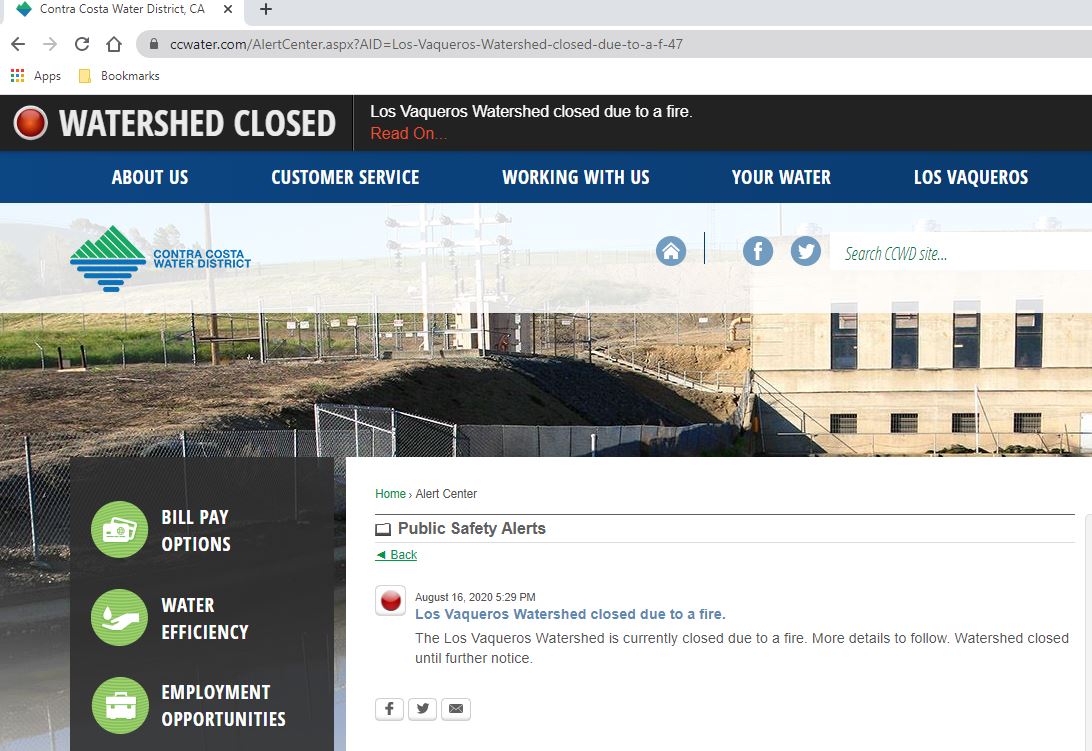
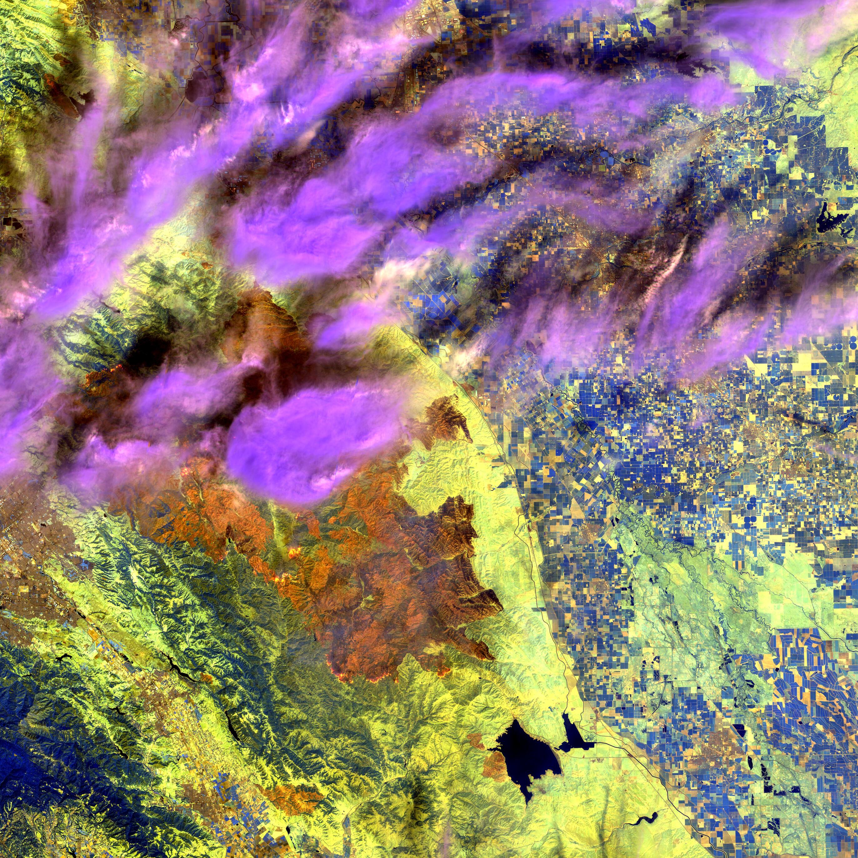
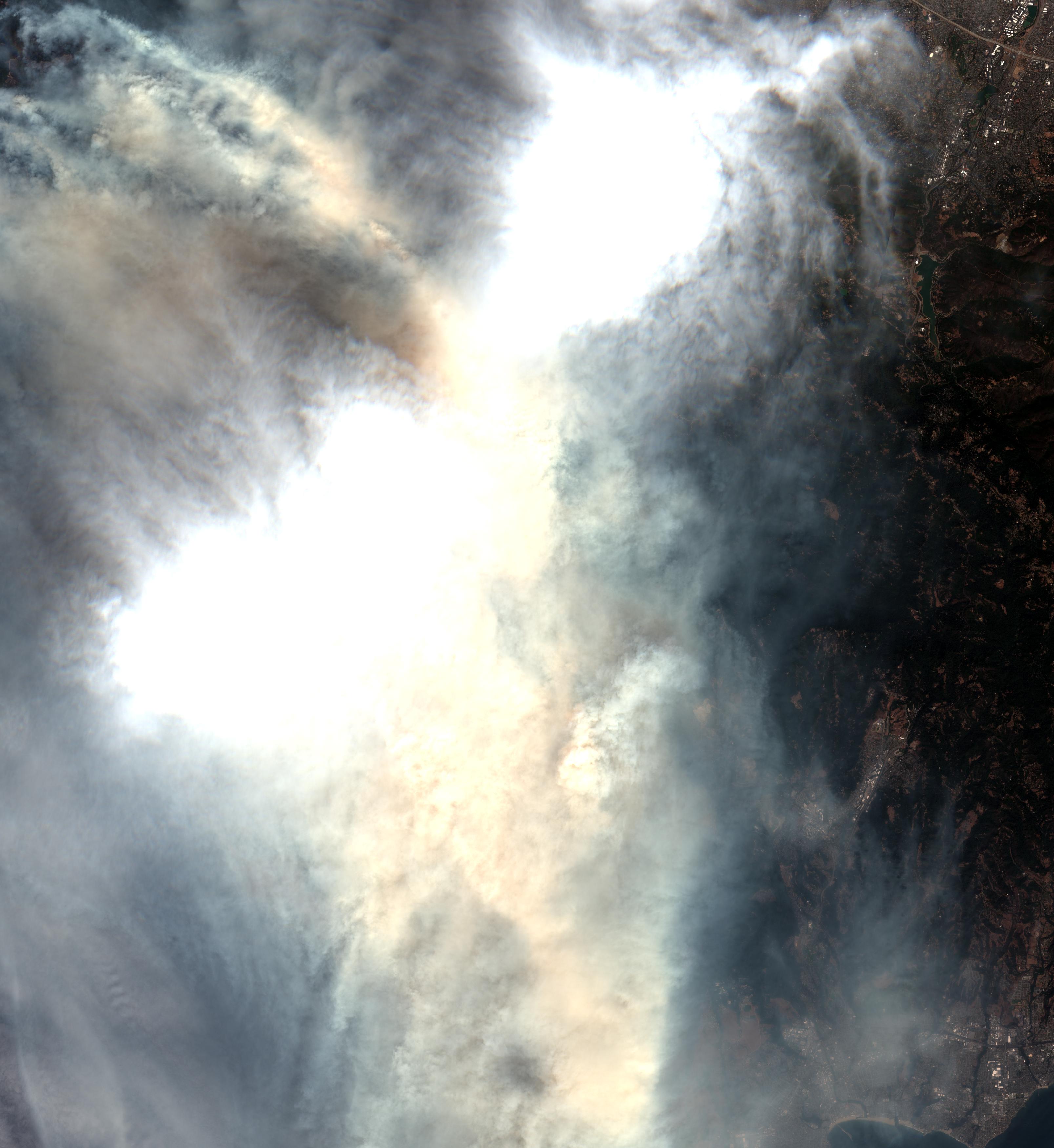
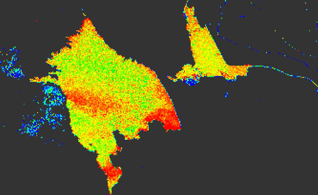
European Space Agency (ESA) Copernicus Sentinel 2 satellite image 17 Aug 2020 (18:49:19 Zulu) Los Vaqueros Reservoir California USA Watershed fire from lightning strike
I penetrated the smoke layer obscuring the visible spectrum by using the default atmospheric penetration mapping of colors and wavelengths in SNAP 7.0.4.
Color Band nano-meters
Red B12 2190
Green B11 1610
Blue B8A 865
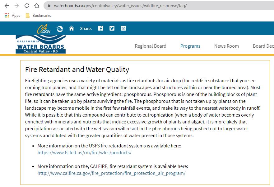
The satellite will be flying over us again Saturday morning. I will make a new image like this to see how much the fire has grown. If the wind clears the smoke I am interested in seeing in the visible spectrum the dye marked aerial drops of fire retardant in the watershed because it is high in phosphorus which is the key ingredient in CyanoBacterial Hazardous Algal Blooms (CyanoHABs). This reservoir has a known seasonal algal bloom and is used by my water district to deliver water to the tap in my home. I use the water to drink, cook, clean and bathe. I am posting this to the Sentinel Toolbox Exploitation (STEP) forum because ESA Copernicus is light years ahead of NASA LandSat under Trump and I am grateful ESA shares this technology with us and the world for free.
@marpet thank you for moving my work to the Show Room I am just an old retired guy who likes to build boats, swim, play fetch in the river with my Labradors, fish the Sacramento and Mokelumne rivers for Chinook salmon and trap Dungeness crabs at Bodega Bay. I really like that SNAP always has excellent default settings and parameters that are always a great starting point. Your tools are like a fine Mercedes, BMW or Italian sports car everything is well engineered and thought out and a pleasure to work with. Leland
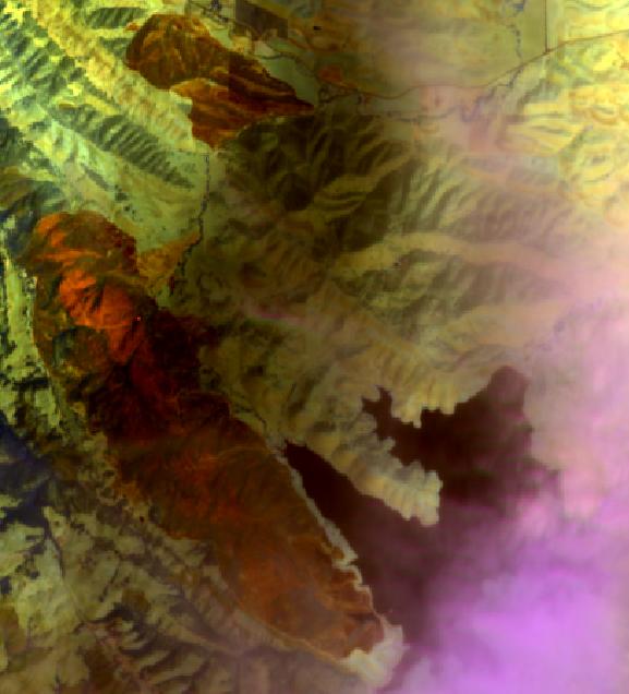
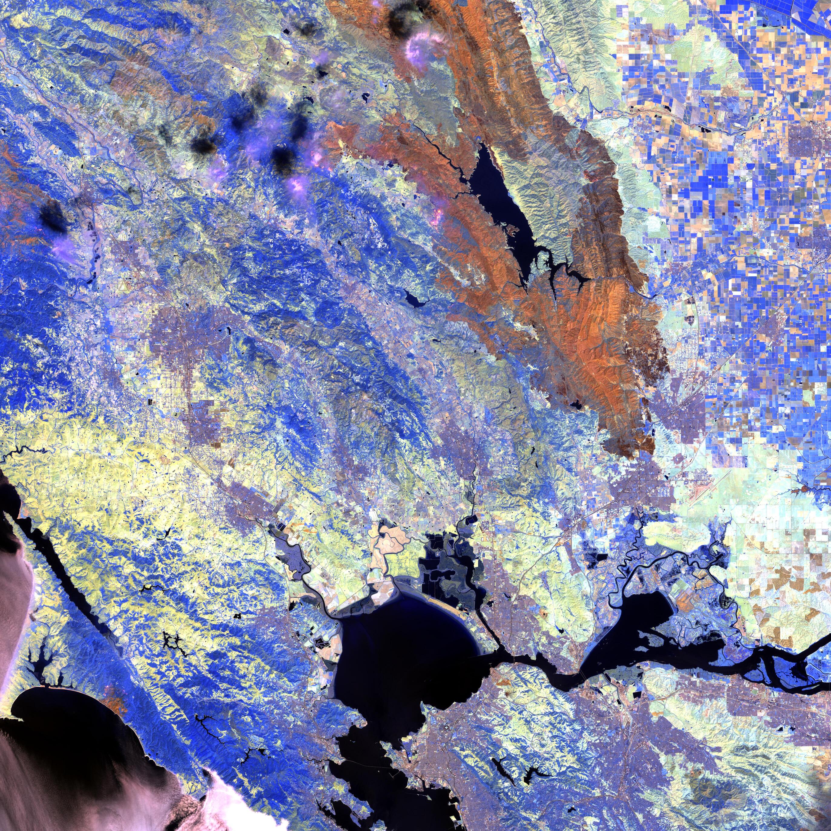
@ABraun thank you for your patience and help when I was learning how to use SNAP and ESA Copernicus Sentinel 2 images 18 months ago. I just downloaded these images, not much useful in the visible spectrum but the infrared atmospheric penetration bands are very revealing of fires near Los Vaqueros reservoir and approaching San Luis reservoir which is the water supply for California central valley farmers, Los Angeles and San Diego. I have shared these images with writers and reporters and asked they give ESA credit when they use them. I have also shared these images with California’s water policy makers, in my opinion we need to stop ruining aquifers with fracking, store water under ground not on the surface but change is hard and their are a lot of greedy interests. I am retired they cannot fire me. Leland
Jwr, a fisherman on the Coastside fishing forum, asked me to process an image of the Santa Cruz lightning strike fire near him, it came out really nice. First is infraread using atmospheric penetration Second is visible spectrum defaults, to much smoke cannot see through visible . Image from ESA Copernicus Sentinel 2 taken 22 Aug 2020 18:49:21 Zulu. My friend Ryan thinks this looks like art. Leland
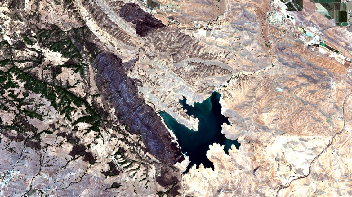
I can tell from the email thread I use to communicate with the California water policy wonks they are amazed also at the Sentinel 2 images but some are challenging my algal bloom concerns and we break off the thread and have a separate conversation. The USA Environmental Protection Agency has no drinking water standards for Cyanobacteria so regulatory agencies say they can’t do anything, Use to be Clear Lake in California was the poster child for algal blooms. This past week as you can see in this photo Lake Berryessa was completely encircled by fire and I would guess when we can see through the smoke a lot of red phosphorous rich fire retardant was dumped on its watershed so once we get some rains I expect Lake Berryessa to light up with chlorophyll absorption when I run Sentinel 2 images through the C2RCC processor that you turned me onto. I will be watching it. I am retired they cannot fire me. Leland
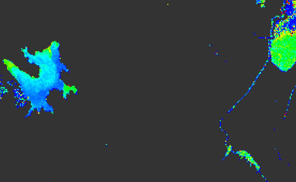
@ABraun the smoke cleared for Sentinel 2B’s multi spectral instrument to capture nice clear images in the visible range and allow me to put the C2RCC processor to work. I submitted a public comment to the California Water Commission Commissioners, Staff and Public for their 16 Sept 2020 meeting using Sentinel images and giving credit to ESA Copernicus. When they post that comment in their agenda I will post that link here so you can read my hell fire and brimstone sermon on climate change, wildfires and algal blooms. Hell fire and brimstone refers to an 18th century preacher in the American West I am not sure it translates to German. Here is the link to the time lapse video I made using Sentinel images and MovieMaker https://youtu.be/N0f8HtercTU Thank you for empowering me to have a science backed voice at the table with the policy wonks. Leland