Hi
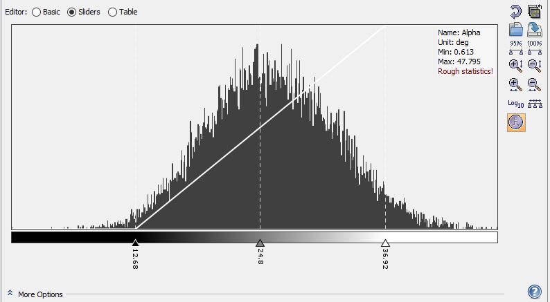
I am using Sentinel-1A dual pole VV,VH, SLC data acquired at IW mode for extracting alpha angle of different features. After carrying out the H-alpha decomposition for dual pole data using the sentinel-1 toolbox, I am getting very low values of alpha angle for features like building(23 to 26 Degrees) and vegetation(14 to 26 Degrees). Can anyone please tell me the reason for such low values? I am using Windows 10 and SNAP version: 8.0.8. The version of S1TBX is 8.0.5. Following are the steps followed for processing:-
1.TOPS SPLIT (I chose only the sub swath which corresponds to my study area )
2.Orbit File
3. Calibration (The output was saved as complex)
4. TOPS Deburst
5.Polarimetric Speckle Filtering (Default Parameters:Refined LEE; No of Looks:1;Windowsize 7x7)
6.Polarimetric Decomposition(H-alpha Dual Pole ; Window size 5)
7.Terrain Correction
PS: I am using a single data image to carry out the processing.
Why do you think these are low?
I just checked three randomly selected studies [1][2][3], and all of them have similar value ranges for the alpha angle.

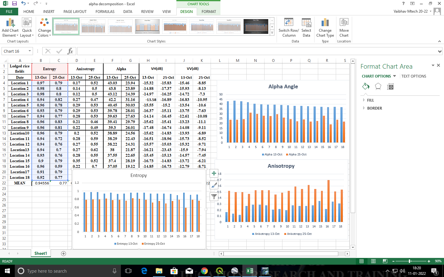
these are the observed alpha angle values over rice fields before lodging and post lodging as i have the Ground data GCP points
Sir, My study area consists of Mango Orchards which have previously shown high values of alpha angle(68 to 72) in the studies carried out by my colleagues. I am using the same date data and getting very low alpha values for the same orchards(14 to 26). That’s why I feel that I have made an error in processing the data even though I have followed same steps as my colleagues.
Do you use images of different look directions?
@Steena what Abraun sir have pointed out are you using same look directions you must use descending orbits images
We have used images of the same look direction.
@vaib Both of us have used data from ascending pass.
i am using images in descending orbit for my work
I performed H alpha decomposition in PolSAR-Pro Biomass version 6.0.3 and the range of values for alpha seem to be correct. I am now facing the issue of datum. The PolSAR-Pro software automatically assigns NAD 1927 UTM ZONE 30N to my data and I am not able to re project it to WGS 84 UTM zone 43N for my study area. Is there a way to prevent the software from assigning the datum or to re project the data for my study area?
After Changing the SNAP version from 8.0 to 6.0, I got the required alpha values for my data after performing the same steps.
Thank you for sharing this. Did you base both calculations on the same data? If so, something must have changed in the polarimetric tool - is it possible @jun_lu?
Yes Sir, I used the same steps on the same date image.