Dear All,
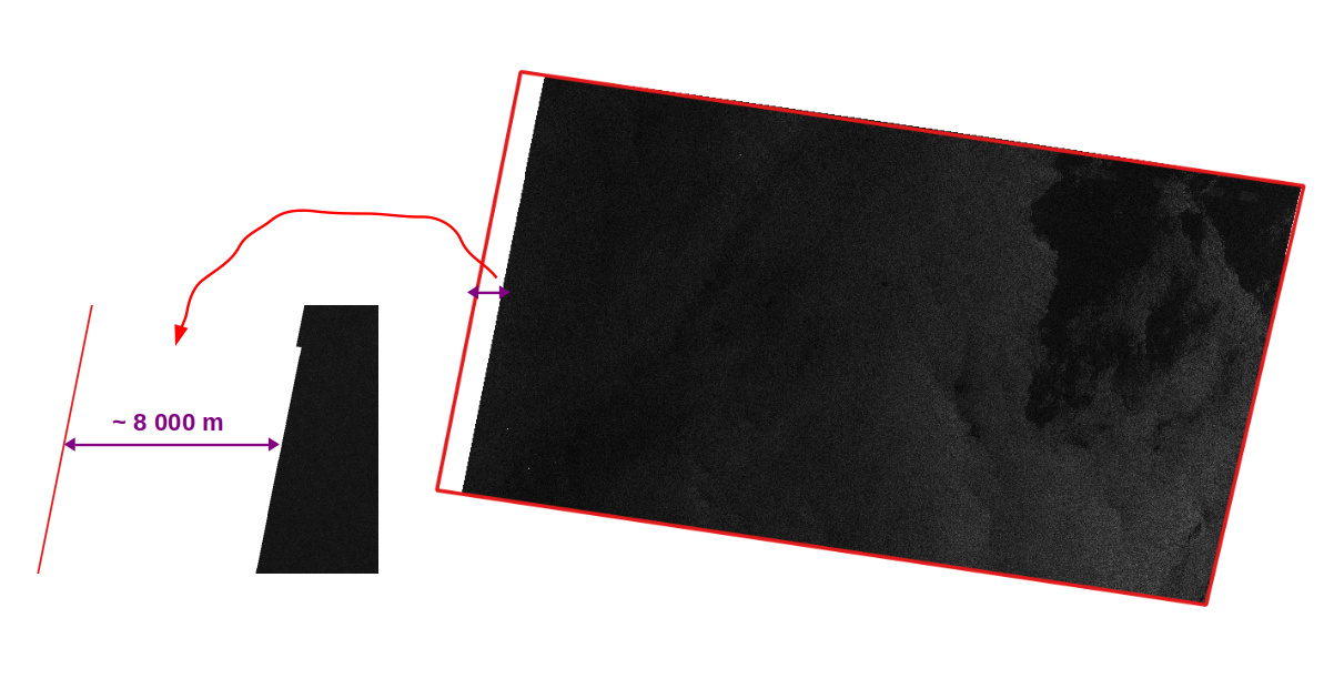
I wanted to understand why there is a white margin (without data) between the SAR image (S1, GRD, IW, VV) and its map-Overlay (see attachment)? I imported the two layers under QGIS and on the west side there is a white margin between these two layers of about 8 km? Is it a problem of projection of these two layers? Is there any idea to correct this? or it’s normal?
Thanks in advance!
Is there someone who offers me documents where I can find explanations on this subject?
Thank you
Not sure about that. But MAYBE, it is related to the tails present in the SLC data, which are cut in the GRD products. If you look SLC data, the borders of the image include “bad quality” signal. This is not present in the GRD product. Perhaps the map-overlay product is not updated after this “cut”.
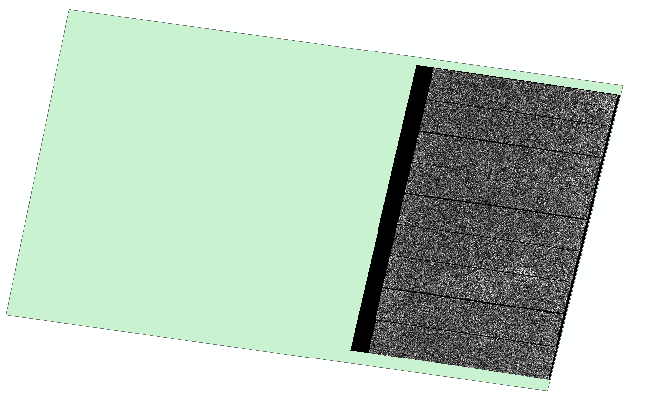
Thank you qglaude for your explanation. Out of curiosity, I uploaded an SLC image (S1A, IW, VV) (I have never worked with this product). I imported the SLC image and map-overlay under ARC GIS but the image (.tif) shows only a small part of the map overlay !! I don’t know if this is normal or there is a coordinate system problem!