Let’s start with your second demand, which is
It is possible to calculate the Radar Vegetation Index, RVI, this topic is quite discussed in here, and how could be modified the equation,
Also you could take a look at
Agricultural Applications with SAR Data
Also it is possible to classify S-1 images (GRD)
LAND COVER MAPPING USING SENTINEL-1 SAR DATA
DEFORESTATION MONITORING WITH SENTINEL-1 Case Study: Paraguay, 2018
Let’s comeback now to your first demand
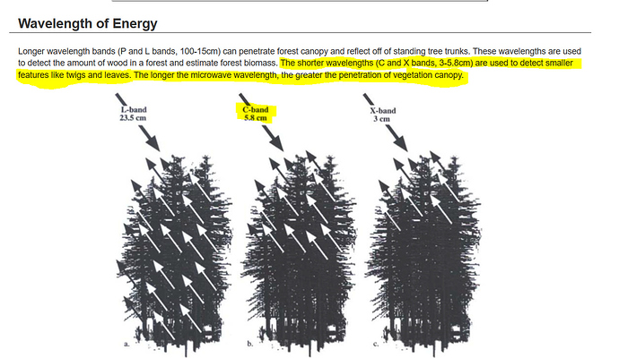
It is not possible to measure the tree heights using S-1 for a very simple reason that S-1 is C-band 5.8 cm wavelength
